The Army Photographed Everything It Drowned | Lake Cumberland, 1936-1958
In 1941 the Army Corps of Engineers began taking a Kentucky valley for Wolf Creek Dam - and photographed nearly all of it first: the farms parcel by parcel, the outhouses, the cornfields, the 900-gallon burgoo party the county threw for its own condemnation, the town of Burnside that refused to scatter, and the water that followed.
Transcript
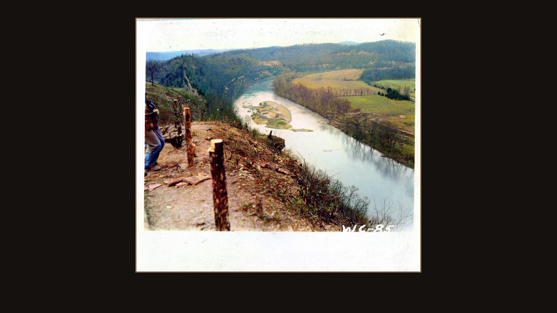
R13 4" x 4.5"
U.S. Army Corps of Engineers, Nashville District · undated · USACE Digital Library · AI-colorized. View the original.
In January of eighteen seventy-four, a farmer named James Warriner and his wife Mourning gave a corner of their land away — on one condition. The deed says the land is theirs again if it ever stops holding a school or a church. Sixty-seven years later, the United States government took the land, and a federal judge had to decide whether that promise still counted.
The promise
It didn't. The court ruled the government's seizure erased the condition. The family got nothing, the school board got fourteen hundred and twelve dollars, and the land became part of the biggest thing the federal government ever built in Kentucky.
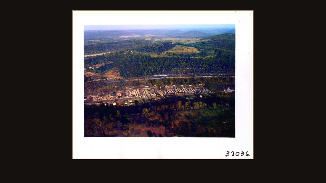
R44 Wolf Creek Reservoir relocations. Nov. 1949. View of Burnside, KY
U.S. Army Corps of Engineers, Nashville District · November 1949 · USACE Digital Library · AI-colorized. View the original.
This is the story of Lake Cumberland — told in the government's own photographs, because the Army Corps of Engineers photographed nearly everything it drowned.
The colors are guesses
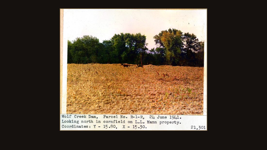
R19 Wolf Creek Dam, parcel no. R-1-R, 24 June 1941. Looking north in cornfield on L.L. Mann property. Coordinates: Y - 15.80, X - 15.30. 21,301
U.S. Army Corps of Engineers, Nashville District · June 1941 · USACE Digital Library · AI-colorized. View the original.
Two honest warnings before we start. These photographs were shot in black and white. The color was added by a computer this year, and the colors are guesses — good guesses, but guesses.
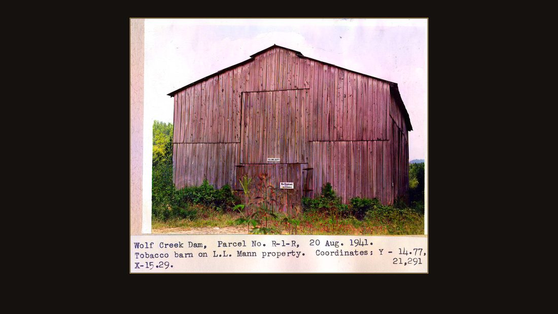
R21 Wolf Creek Dam, Parcel No. R-1-R, 20 Aug. 1941. Tobacco barn on L.L. Mann property. Coordinates: Y - 14.77, X - 15.29. 21,291
U.S. Army Corps of Engineers, Nashville District · August 1941 · USACE Digital Library · AI-colorized. View the original.
Every original is free at the Army Corps' digital library, uncolored and uncropped. The link is in the description. If the machine painted your grandmother's barn the wrong red, tell me in the comments.
The river
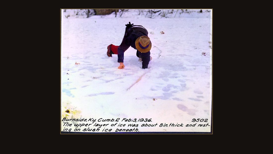
R01 Burnside, Ky. Feb 3, 1936. 9502. The upper layer of ice was about 8 in. thick and resting on slush ice beneath.
U.S. Army Corps of Engineers, Nashville District · February 1936 · USACE Digital Library · AI-colorized. View the original.
The Cumberland River made the case for the dam itself. February, nineteen thirty-six: a Corps man crouches on the frozen river at Burnside, Kentucky. The caption on the print says the upper layer of ice was about eight inches thick, resting on slush ice beneath.
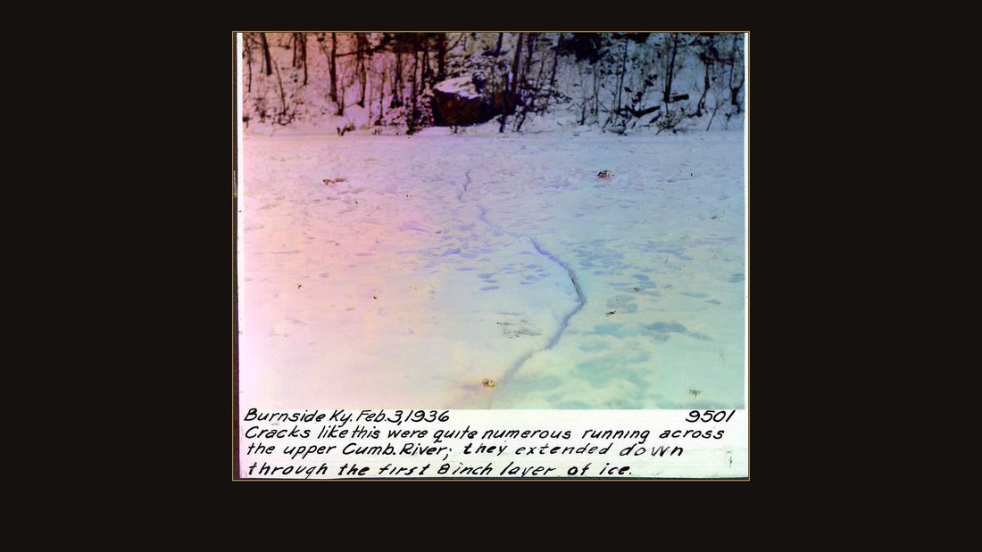
R02 Burnside, Ky. Feb. 3, 1936. 9501. Cracks like this were quite numerous running across the upper Cumb. River; they extended down through the first 8 inch layer of ice.
U.S. Army Corps of Engineers, Nashville District · February 1936 · USACE Digital Library · AI-colorized. View the original.
Cracks like this one ran clear across the river. The Corps was watching the ice because when it broke, it went downstream like a battering ram.
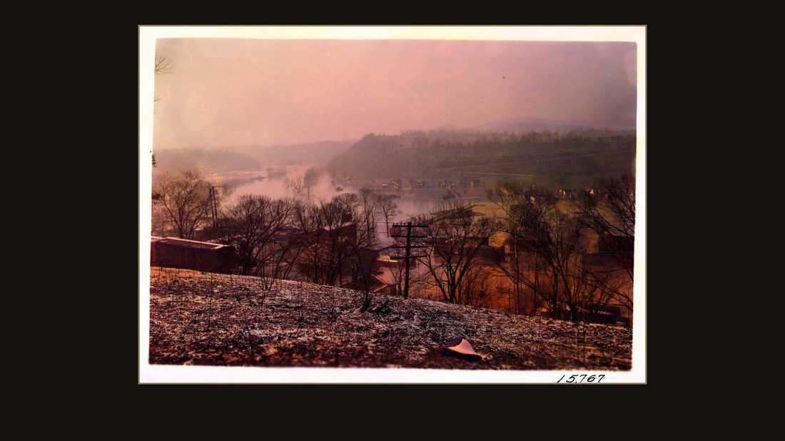
R03 Burnside, Ky., Cumberland River, Feb. 4, 1939. Views of flood at 63.2 ft. stage. Crest of 65.5 ft. was reached on Feb. 3, 1939. No negatives.
U.S. Army Corps of Engineers, Nashville District · February 1939 · USACE Digital Library · AI-colorized. View the original.
Three years later the river showed what it could really do. February fourth, nineteen thirty-nine. Burnside, Kentucky, from the hillside — the town is in the river.
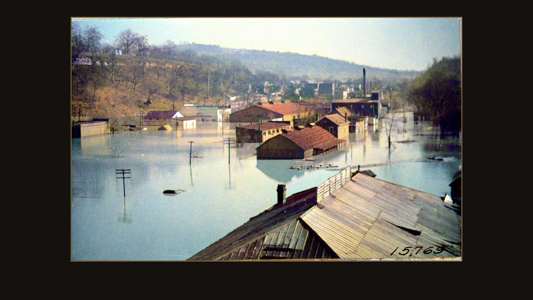
R04 Burnside, Ky., Cumberland River, Feb. 4, 1939. Views of flood at 63.2 ft. stage. Crest of 65.5 ft. was reached on Feb. 3, 1939. No negatives.
U.S. Army Corps of Engineers, Nashville District · February 1939 · USACE Digital Library · AI-colorized. View the original.
The Corps photographer logged it with an engineer's calm: flood at sixty-three point two feet. The crest, the day before, had reached sixty-five and a half.
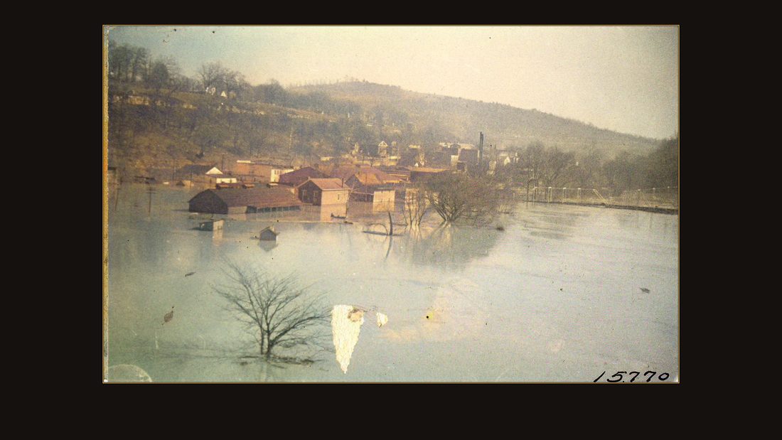
R05 Burnside, Ky., Cumberland River, Feb. 4, 1939. Views of flood at 63.2 ft. stage. Crest of 65.5 ft. was reached on Feb. 3, 1939. No negatives.
U.S. Army Corps of Engineers, Nashville District · February 1939 · USACE Digital Library · AI-colorized. View the original.
Rooftops and chimneys, roads gone.
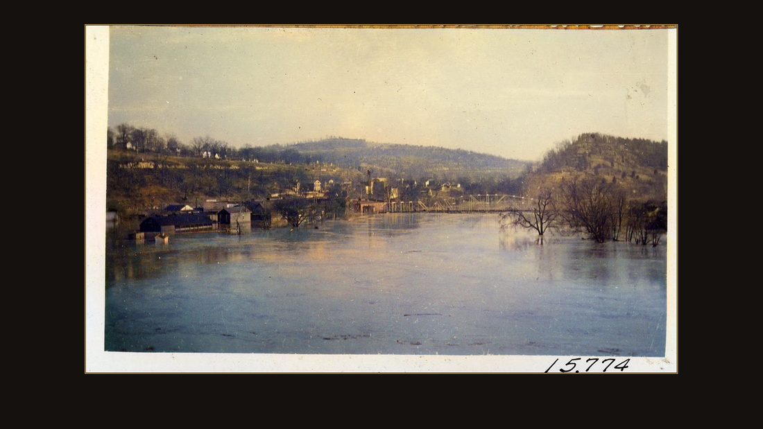
R06 Burnside, Ky., Cumberland River, Feb. 4, 1939. Views of flood at 63.2 ft. stage. Crest of 65.5 ft. was reached on Feb. 3, 1939. No negatives.
U.S. Army Corps of Engineers, Nashville District · February 1939 · USACE Digital Library · AI-colorized. View the original.
Whole blocks standing in backwater.
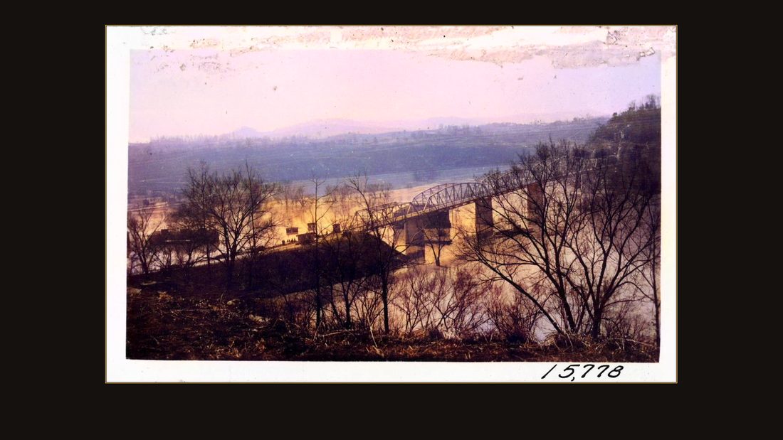
R07 Burnside, Ky., Cumberland River, Feb. 4, 1939. Views of flood at 63.2 ft. stage. Crest of 65.5 ft. was reached on Feb. 3, 1939. No negatives. Capton on photo: 15,778.
U.S. Army Corps of Engineers, Nashville District · February 1939 · USACE Digital Library · AI-colorized. View the original.
The highway bridge held. The town below it did not.
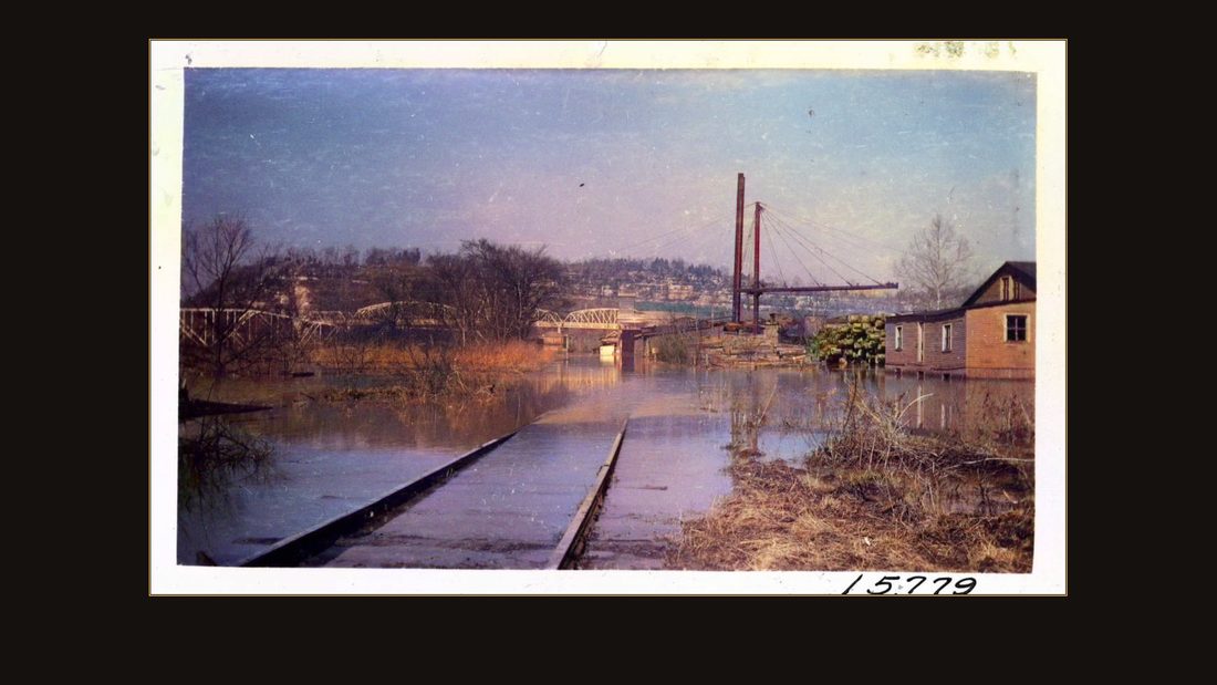
R08 Burnside, Ky., Cumberland River, Feb. 4, 1939. Views of flood at 63.2 ft. stage. Crest of 65.5 ft. was reached on Feb. 3, 1939. No negatives. Capton on photo: 15,779.
U.S. Army Corps of Engineers, Nashville District · February 1939 · USACE Digital Library · AI-colorized. View the original.
The railroad ran straight into the river and kept going.
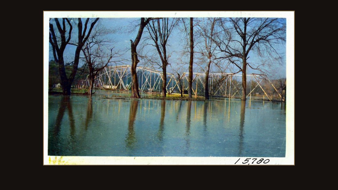
R09 Burnside, Ky., Cumberland River, Feb. 4, 1939. Views of flood at 63.2 ft. stage. Crest of 65.5 ft. was reached on Feb. 3, 1939. No negatives. Capton on photo: 15,780.
U.S. Army Corps of Engineers, Nashville District · February 1939 · USACE Digital Library · AI-colorized. View the original.
Burnside — old Point Isabel — had been an important steamboat port on the upper Cumberland in the eighteen hundreds. By the nineteen thirties it was a flood plain with a post office.
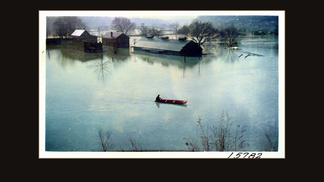
R10 Burnside, Ky., Cumberland River, Feb. 4, 1939. Views of flood at 63.2 ft. stage. Crest of 65.5 ft. was reached on Feb. 3 1939. No negatives. Caption on photo: 15,782.
U.S. Army Corps of Engineers, Nashville District · February 1939 · USACE Digital Library · AI-colorized. View the original.
A man crosses main street by canoe.
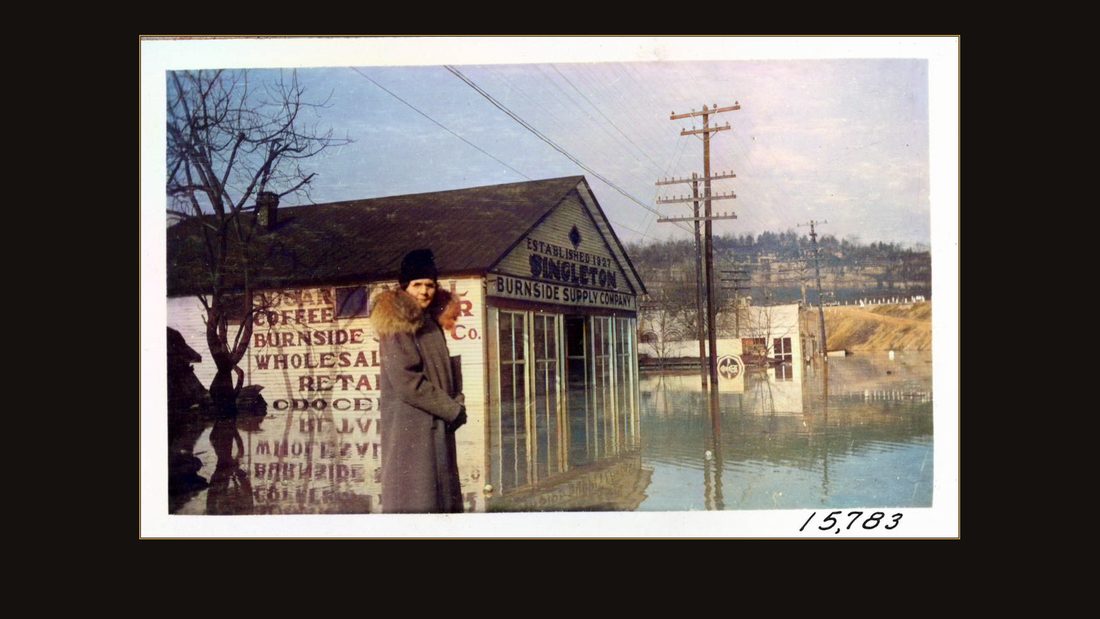
R11 Burnside, Ky., Cumberland River, Feb. 4, 1939. Views of flood at 63.2 ft. stage. Crest of 65.5 ft. was reached on Feb. 3 1939. No negatives. Caption on photo: 15,783.
U.S. Army Corps of Engineers, Nashville District · February 1939 · USACE Digital Library · AI-colorized. View the original.
A woman stands outside the Burnside wholesale grocery, the water just off the porch. This was not a hundred-year flood. This was the river's habit.
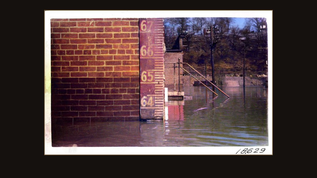
R12 Burnside, Ky., Cumberland River, Feb. 4, 1939. Views of flood at 63.2 ft. stage. Crest of 65.5 ft. was reached on Feb. 3 1939. No negatives. Caption on photo: 18,629.
U.S. Army Corps of Engineers, Nashville District · February 1939 · USACE Digital Library · AI-colorized. View the original.
The Corps nailed a gauge to a brick wall and photographed the number: sixty-four feet and climbing. Numbers like this one built the dam.
R13 4" x 4.5"
U.S. Army Corps of Engineers, Nashville District · undated · USACE Digital Library · AI-colorized. View the original.
Congress had authorized a study after the great floods of nineteen thirty-seven. The Corps looked at six reservoir sites in the Cumberland basin and picked this one: Wolf Creek, river mile four-sixty, Russell County, Kentucky.
The farms
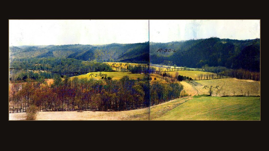
R14 Wolf Creek Dam, parcel no. R-2-R, 2 April 1940. View looking south showing portion of L.C. Humble property in lower half of photograph. 19,758B & 19,758C
U.S. Army Corps of Engineers, Nashville District · April 1940 · USACE Digital Library · AI-colorized. View the original.
But before the government could build the dam, it had to buy the valley. And the Corps documented every parcel it condemned — field by field, building by building, with survey coordinates typed under each print.
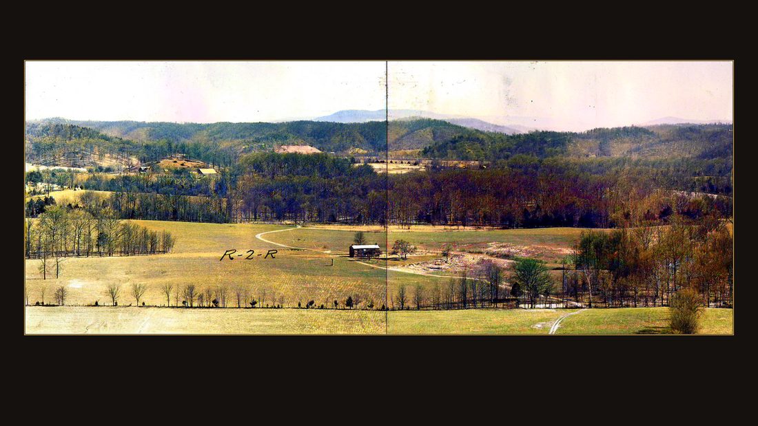
R15 Wolf Creek Dam, parcel no. R-2-R, 2 April 1940. View looking southeast showing portion of L.C. Humble property in lower half of photograph. 19,758 & 19,758A
U.S. Army Corps of Engineers, Nashville District · April 1940 · USACE Digital Library · AI-colorized. View the original.
April, nineteen forty. Parcel R-2-R: the farm of L.C. Humble.
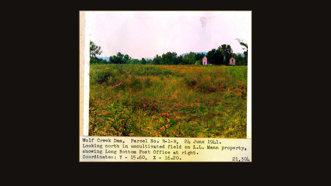
R16 Wolf Creek, Dam, parcel no. R-1-R, 24 June 1941. Looking north in uncultivated field on L.L. Mann property, showing Long Bottom Post Office at right. Coordinates: Y - 15.60, X - 16.20. 21,304
U.S. Army Corps of Engineers, Nashville District · June 1941 · USACE Digital Library · AI-colorized. View the original.
June, nineteen forty-one. Parcel R-1-R: the farm of L.L. Mann. In the corner of the frame, the building with the porch is the Long Bottom Post Office.
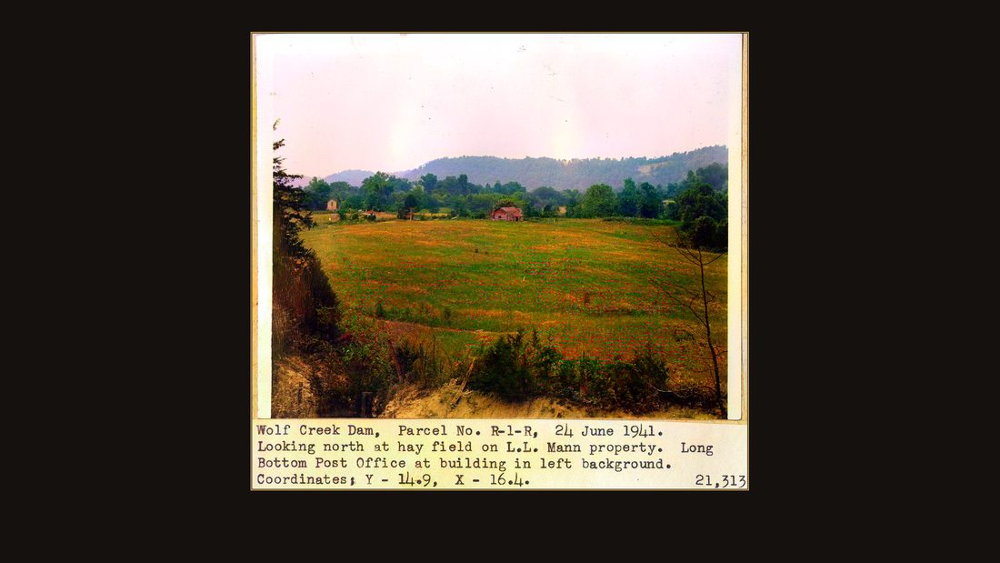
R17 Wolf Creek Dam, Parcel No. R-1-R, 24 June 1941. Looking north at hay field on L.L. Mann property. Long Bottom Post Office at building in left background. Coordinates: Y-14.9, X-16.4. 21,313
U.S. Army Corps of Engineers, Nashville District · June 1941 · USACE Digital Library · AI-colorized. View the original.
The Mann hay field, mid-summer, with the post office beyond it. Everything in this frame is condemned.
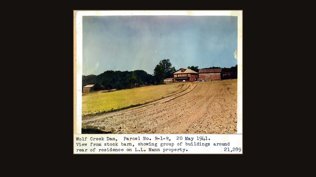
R18 Wolf Creek Dam, parcel no R-1-R, 20 May 1941. View from stock barn, showing group of buildings around rear of residence on L.L. Mann property. 21,289
U.S. Army Corps of Engineers, Nashville District · May 1941 · USACE Digital Library · AI-colorized. View the original.
The view from the stock barn: the house, the outbuildings, the fence lines.
R19 Wolf Creek Dam, parcel no. R-1-R, 24 June 1941. Looking north in cornfield on L.L. Mann property. Coordinates: Y - 15.80, X - 15.30. 21,301
U.S. Army Corps of Engineers, Nashville District · June 1941 · USACE Digital Library · AI-colorized. View the original.
The corn was still planted. The government photographed the corn.
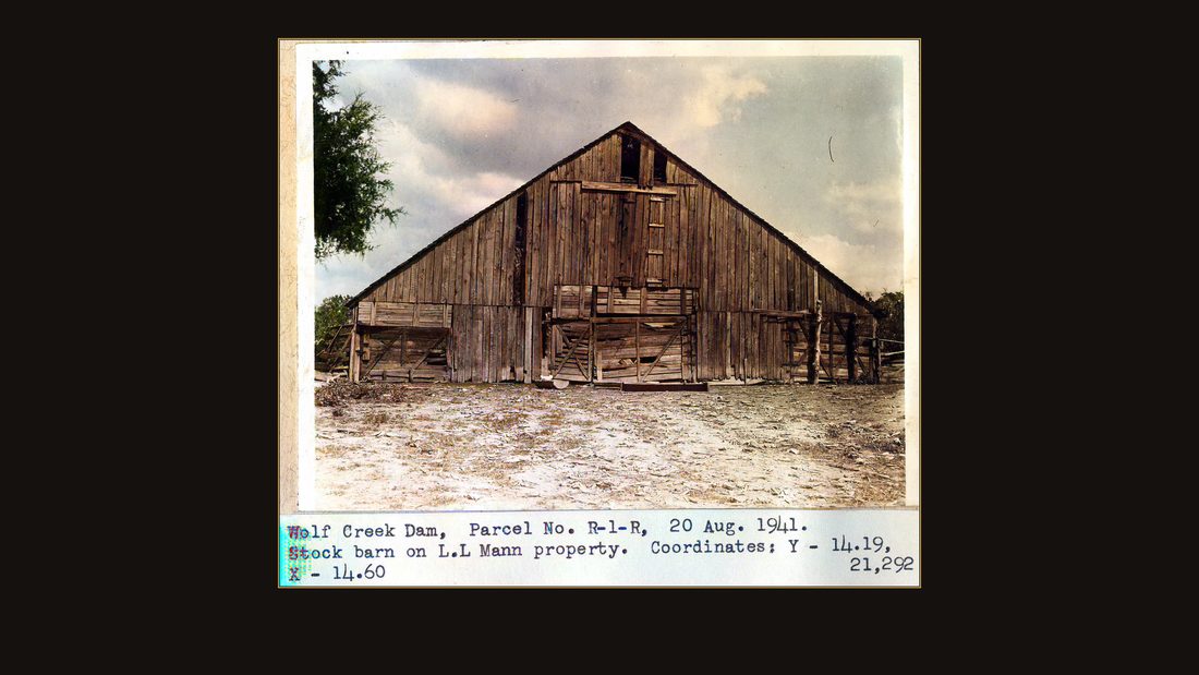
R20 Wolf Creek Dam, Parcel No. R-1-R, 20 Aug. 1941. Stock barn on L.L. Mann property. Coordinates: Y - 14.19, X - 14.60. 21,292
U.S. Army Corps of Engineers, Nashville District · August 1941 · USACE Digital Library · AI-colorized. View the original.
The stock barn, parcel R-1-R, coordinates typed on the print.
R21 Wolf Creek Dam, Parcel No. R-1-R, 20 Aug. 1941. Tobacco barn on L.L. Mann property. Coordinates: Y - 14.77, X - 15.29. 21,291
U.S. Army Corps of Engineers, Nashville District · August 1941 · USACE Digital Library · AI-colorized. View the original.
The tobacco barn.
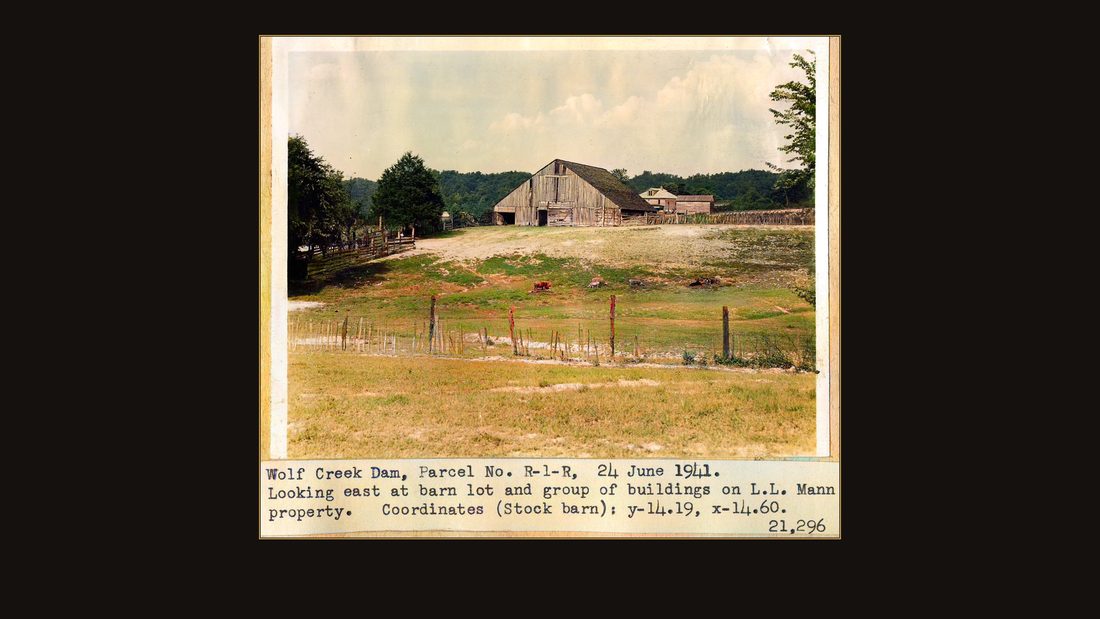
R22 Wolf Creek Dam, parcel no. R-1-R, 24 June 1941. Looking east at barn lot and group of buildings on L.L. Mann property. Coordinates (stock barn): Y - 14.19, X - 14.60, 21,296
U.S. Army Corps of Engineers, Nashville District · June 1941 · USACE Digital Library · AI-colorized. View the original.
The barn lot, looking east.
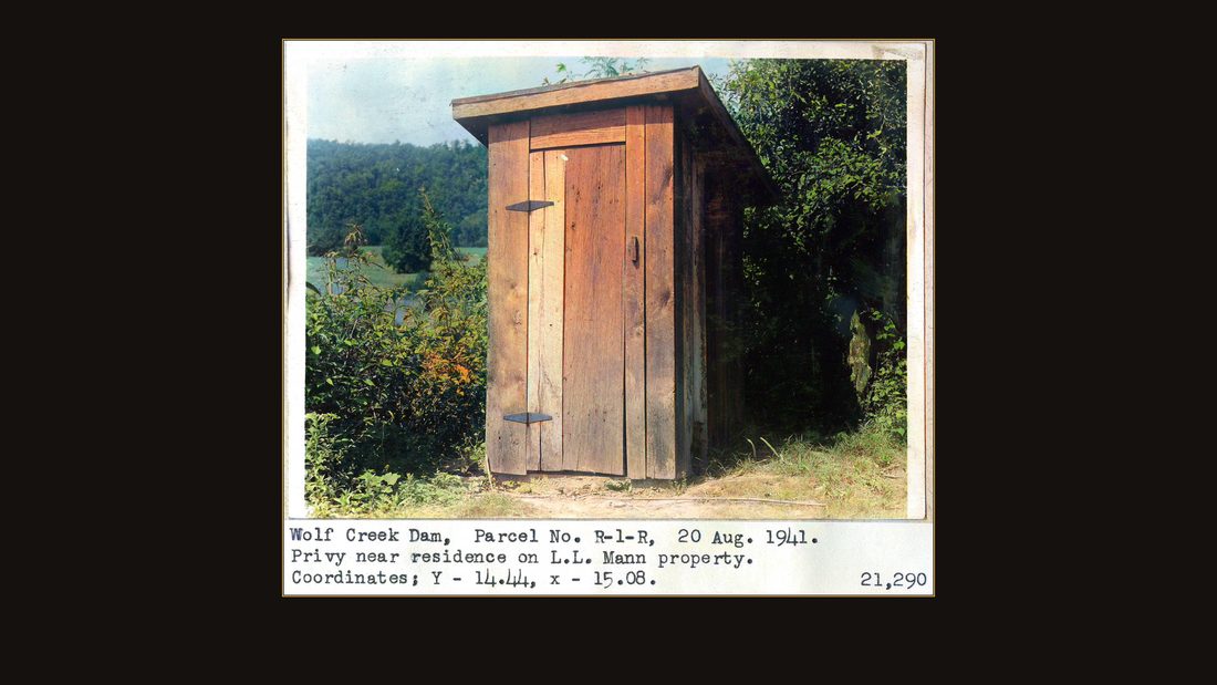
R23 Wolf Creek Dam, parcel no R-1-R, 20 August 1941. Privy near residence on L.L. Mann property. Coordinates; Y - 14.44, x - 15.08. 21,290
U.S. Army Corps of Engineers, Nashville District · August 1941 · USACE Digital Library · AI-colorized. View the original.
The privy near the residence. The federal government of the United States photographed, catalogued, and assigned coordinates to an outhouse. That is what taking a farm honestly looks like on paper.
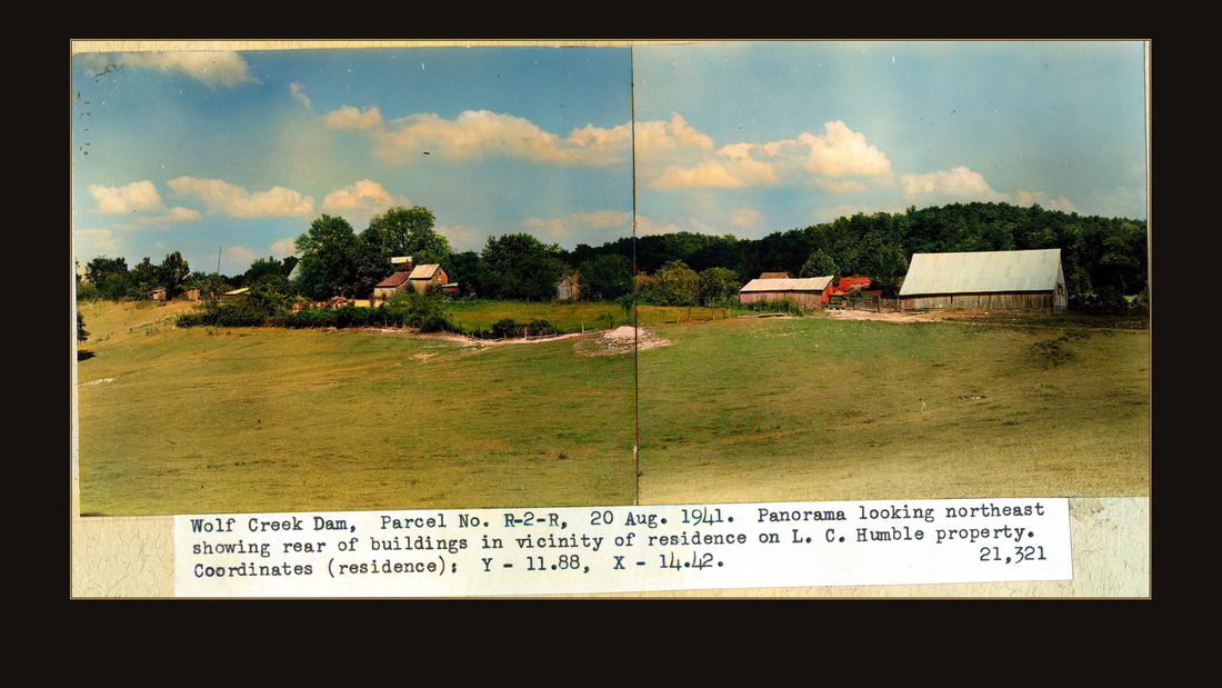
R24 Wolf Creek Dam, parcel No. R-2-R, 20 Aug. 1941. Panorama looking northeast showing rear of buildings in vicinity of residence on L. C. Humble property. Coordinates (residence): Y - 11.88, X - 14.42. 21,321
U.S. Army Corps of Engineers, Nashville District · August 1941 · USACE Digital Library · AI-colorized. View the original.
The Humble place, in panorama, from the rear of the residence.
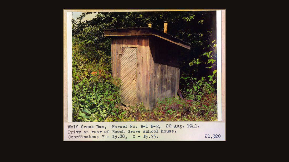
R25 Wolf Creek Dam, parcel No. R-1 B-R, 20 Aug. 1941. Privy at rear of Beech Grove school house. Coordinates: Y - 13.88, X - 15.73. 21,320
U.S. Army Corps of Engineers, Nashville District · August 1941 · USACE Digital Library · AI-colorized. View the original.
And parcel R-1-B-R: the privy behind the Beech Grove school house. Remember the Warriner deed — a school lot in this same county, taken this same summer, was the one the judge said no longer belonged to the family that gave it.
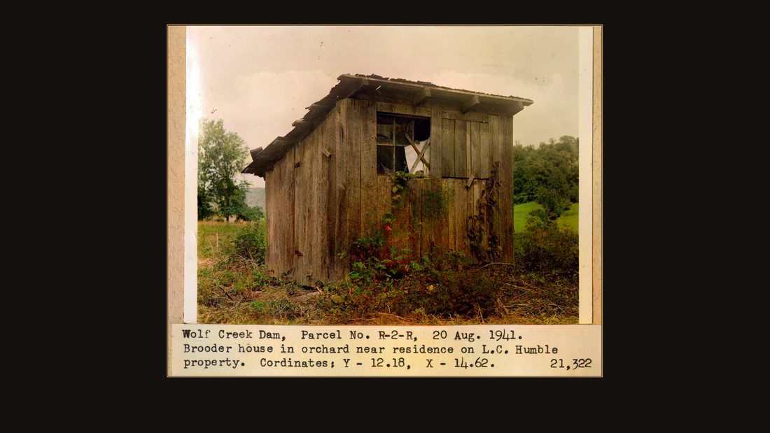
R26 Wolf Creek Dam, Parcel No. R-2-R, 20 Aug. 1941. Brooder house in orchard near residence on L.C. humble property. Coordinates: Y - 12.18, X - 14.62. 21,322.
U.S. Army Corps of Engineers, Nashville District · August 1941 · USACE Digital Library · AI-colorized. View the original.
A brooder house in the Humble orchard. The apples came in that fall either way.
The party
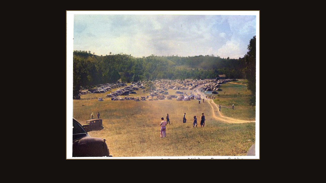
R27 Wolf Creek Dam Celebration, 1 Sept. 1941. One of the parking areas for automobiles which brought people from many points in Kentucky and Tennessee. 24,980
U.S. Army Corps of Engineers, Nashville District · September 1941 · USACE Digital Library · AI-colorized. View the original.
And then, with the valley bought and the war one season away, Russell County threw a party.
September first, nineteen forty-one. The parking field, in the Corps' words, held automobiles from many points in Kentucky and Tennessee.
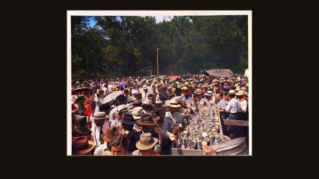
R28 Wolf Creek Dam Celebration, 1 Sept. 1941. Cups of hot "burgoo" and bread are given free to the crowd which attended the celebration. 24,983
U.S. Army Corps of Engineers, Nashville District · September 1941 · USACE Digital Library · AI-colorized. View the original.
Cups of hot burgoo and bread, free to the crowd.

R29 Wolf Creek Dam Celebration, 1 Sept. 1941. "Soups on." Man at left in white cap was the Chief Cook and considered the "Burgoo King." 24,984
U.S. Army Corps of Engineers, Nashville District · September 1941 · USACE Digital Library · AI-colorized. View the original.
The man in the white cap, the caption says, was the chief cook — considered the Burgoo King.
![Wolf Creek Dam Celebration, 1 Sept. 1941. Men stirring "burgo" [sic] with boat oars. 900 gal. of "burgoo" were made, using - 650 lb. beef, 88 hens, 8 bushels on](img/R30.jpg)
R30 Wolf Creek Dam Celebration, 1 Sept. 1941. Men stirring "burgo" [sic] with boat oars. 900 gal. of "burgoo" were made, using - 650 lb. beef, 88 hens, 8 bushels onions, 16 bushels potatoes, 80 dozen ears corn. This was eaten with 50 cases of bread. 24,982
U.S. Army Corps of Engineers, Nashville District · September 1941 · USACE Digital Library · AI-colorized. View the original.
They stirred it with boat oars. Nine hundred gallons: six hundred fifty pounds of beef, eighty-eight hens, eight bushels of onions, sixteen bushels of potatoes, eighty dozen ears of corn, and fifty cases of bread to eat it with. Every number is from the Corps' own caption.

R31 Wolf Creek Dam Celebation, 1 Sept. 1941. First lady to be served in "burgoo" line is shown at right. 24,985
U.S. Army Corps of Engineers, Nashville District · September 1941 · USACE Digital Library · AI-colorized. View the original.
The first lady served in the burgoo line.
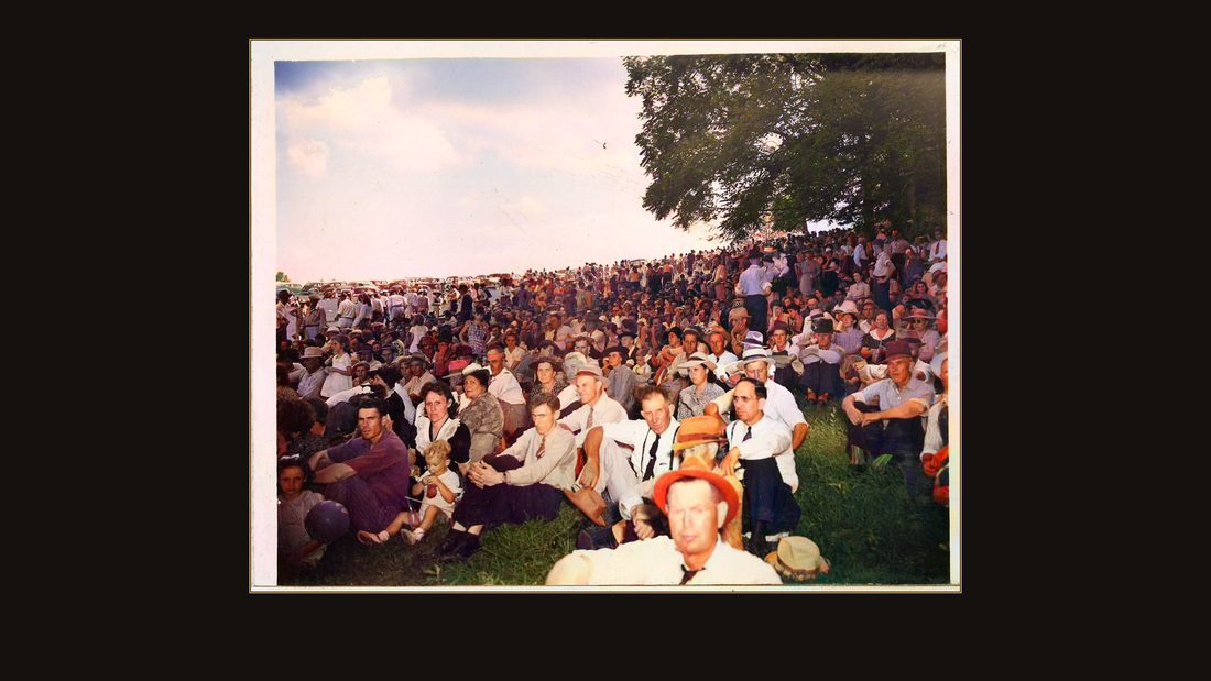
R32 Wolf Creek Dam Celebration, 1 Sept. 1941. Portion of crowd which heard speakers following the free lunch. 24,987
U.S. Army Corps of Engineers, Nashville District · September 1941 · USACE Digital Library · AI-colorized. View the original.
After lunch came the speeches.
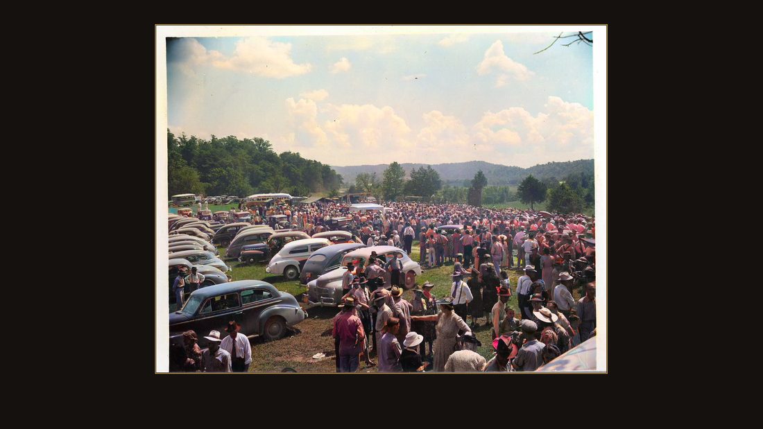
R33 Wolf Creek Dam Celebration, 1 Sept. 1941. Portion of the crowd was estimated to number between 6,000 & 7,000. 24,981
U.S. Army Corps of Engineers, Nashville District · September 1941 · USACE Digital Library · AI-colorized. View the original.
The Corps put the crowd at six to seven thousand people — in a county seat of a few hundred, at the end of a gravel road.
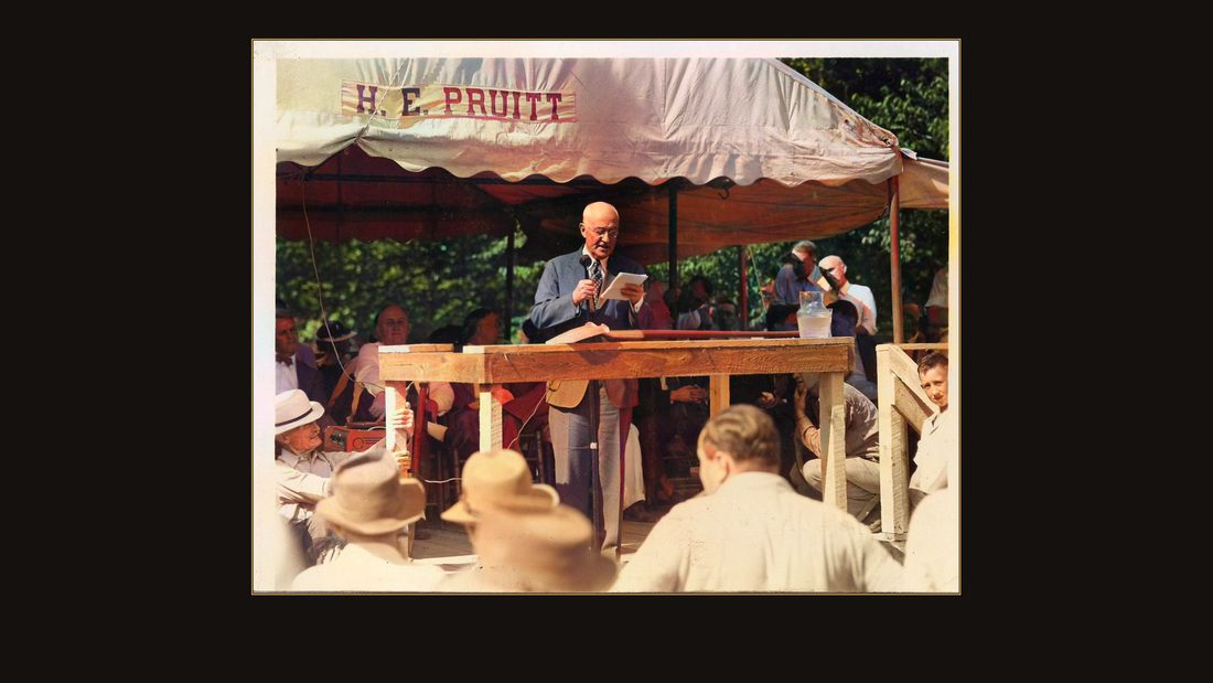
R34
U.S. Army Corps of Engineers, Nashville District · September 1941 · USACE Digital Library · AI-colorized. View the original.
Under the tent, the dignitaries took their turns.
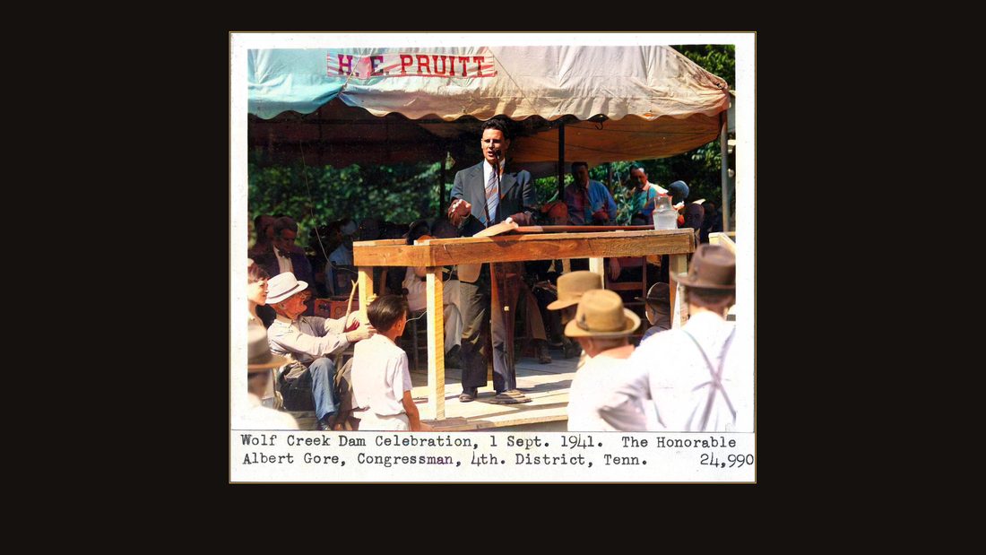
R35 Wolf Creek Dam celebration, 1 Sept. 1941. The Honorable Albert Gore, Congressman, 4th. District, Tenn. 24,990
U.S. Army Corps of Engineers, Nashville District · September 1941 · USACE Digital Library · AI-colorized. View the original.
Congressman Albert Gore of Tennessee — the father of the vice president — spoke.
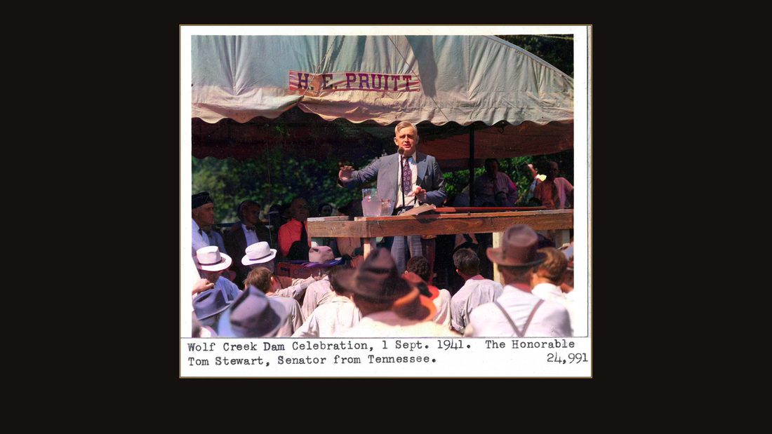
R36 Wolf Creek Dam celebratio, 1 Sept. 1941. The Honorable Tom Stewart, Senator from Tennessee. 24,991
U.S. Army Corps of Engineers, Nashville District · September 1941 · USACE Digital Library · AI-colorized. View the original.
So did Senator Tom Stewart.
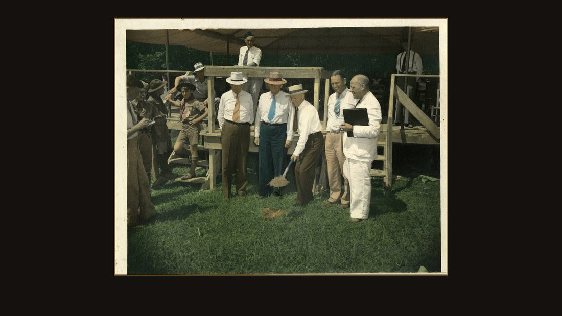
R37 Wolf Creek Dam Site, Cumberland River, Mile 460.9, Sept. 1, 1941. Major General Julian F. Schley moving first spadeful of dirt at ground breaking ceremony, which was attended by 6,000 or 7,000 people. In group with Major General Schley are, from left to right: Lt. Colonel O. E. Walsh, District Engineer, Nashville District; Colonel C. L. Hall, Division Engineer, Ohio River Division; Major General Schley, Chief of Engineers, U. S. Army; Fred Pace, Director, Upper Cumberland Chamber of Commerce; and Hugh Goodpasture, Secretary, Upper Cumberland Chamber of Commerce. U. S. Engineer Office, Nashville, Tenn. No. 21,657
U.S. Army Corps of Engineers, Nashville District · September 1941 · USACE Digital Library · hand-tinted print. View the original.
And then Major General Julian Schley turned the first spadeful of dirt. Look at this photograph. It is in color — real color, not the computer's. Someone at the Nashville District hand-tinted this print in nineteen forty-one: painted the ties blue and orange, the grass green, the Boy Scout's neckerchief red. Human color guesses, eighty-five years before the machine's.
The clearing
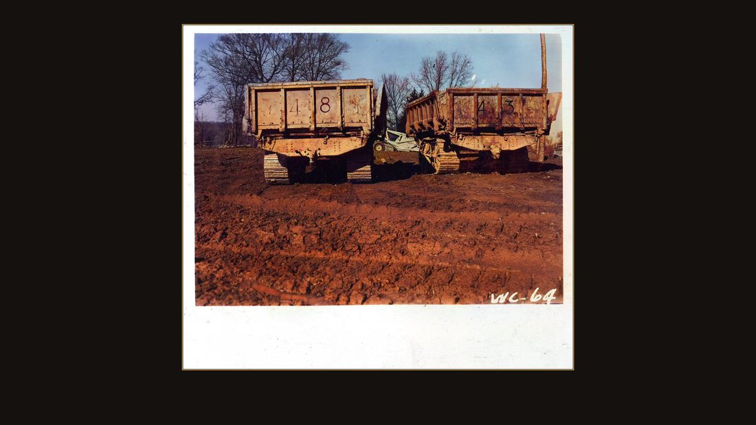
R38 4" x 4.5"
U.S. Army Corps of Engineers, Nashville District · undated · USACE Digital Library · AI-colorized. View the original.
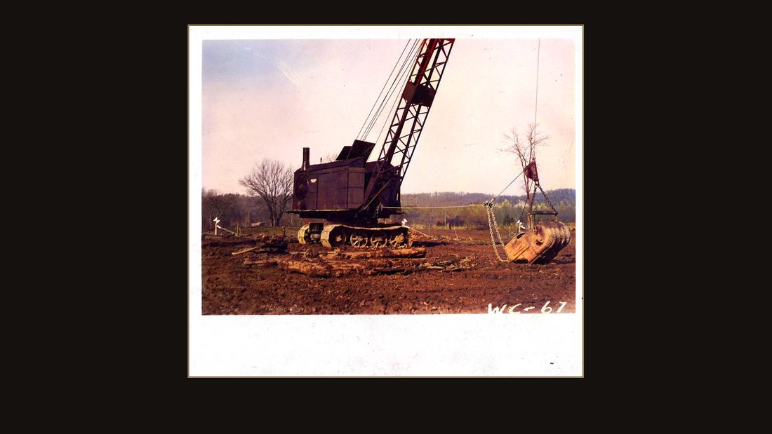
The machines moved in that fall.
R39 4" x 4.5"
U.S. Army Corps of Engineers, Nashville District · undated · USACE Digital Library · AI-colorized. View the original.
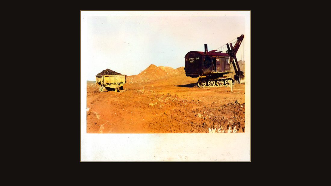
Draglines stripped the bottomland down to clay.
R40 4" x 4.5"
U.S. Army Corps of Engineers, Nashville District · undated · USACE Digital Library · AI-colorized. View the original.
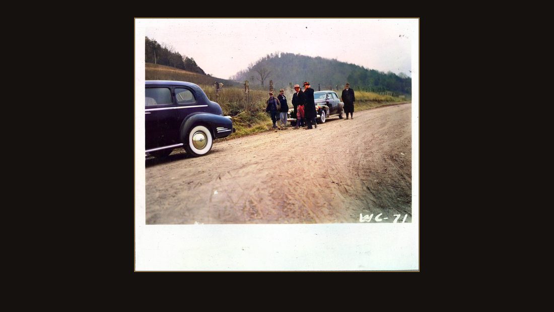
A steam shovel loaded spoil wagons where the corn had been.
R41 4" x 4.5"
U.S. Army Corps of Engineers, Nashville District · undated · USACE Digital Library · AI-colorized. View the original.
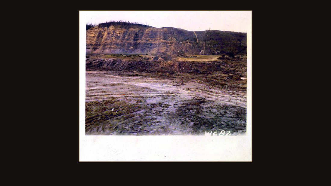
Families drove out to watch the valley being unmade.
R42 4" x 4.5"
U.S. Army Corps of Engineers, Nashville District · undated · USACE Digital Library · AI-colorized. View the original.
Then, three months in, Pearl Harbor. Washington first ordered the dam rushed — power for war industries. Then it ordered it stopped. At roughly three percent complete, Wolf Creek sat out the war.
The town
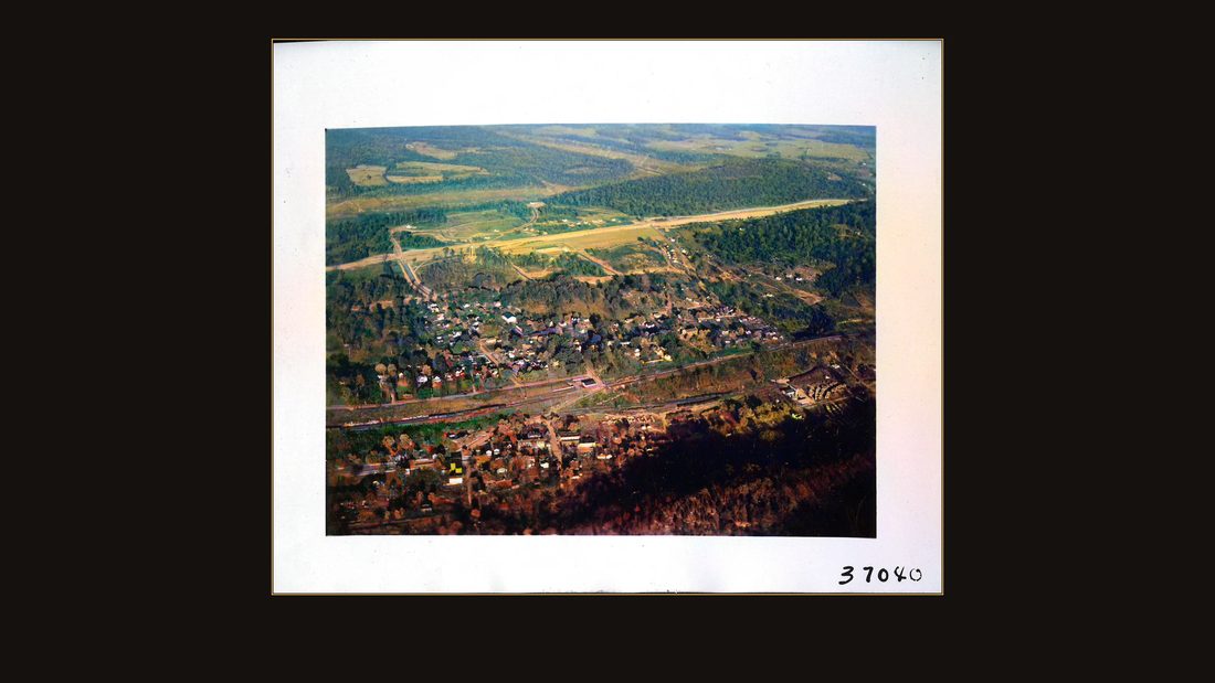
R43 Wolf Creek Reservoir relocations. Nov. 1949. View of Burnside, KY
U.S. Army Corps of Engineers, Nashville District · November 1949 · USACE Digital Library · AI-colorized. View the original.
After the war, construction resumed — and the Corps soon faced what its own history calls its first large-scale relocation problem. This is why. November, nineteen forty-nine: Burnside, Kentucky, from the air — the flood town of ten years before, now sitting on the bottom of a planned lake.
R44 Wolf Creek Reservoir relocations. Nov. 1949. View of Burnside, KY
U.S. Army Corps of Engineers, Nashville District · November 1949 · USACE Digital Library · AI-colorized. View the original.
The Corps' plan was to scatter the residents into other towns and be done with it.
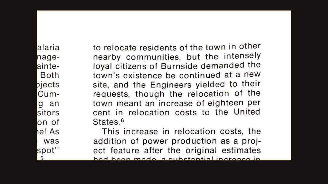
S1
Engineers on the Twin Rivers, USACE Nashville District · p. 216.
Burnside refused. The district history says it plainly: the intensely loyal citizens of Burnside demanded the town's existence be continued at a new site — and the Engineers yielded, though it raised relocation costs eighteen percent.
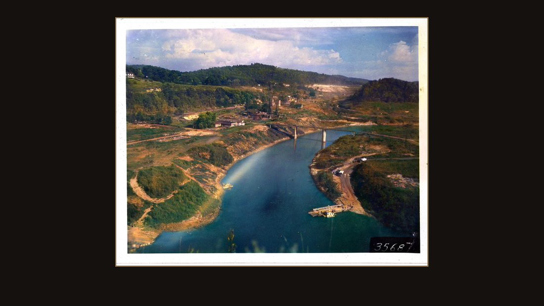
R46 Wolf Creek Reservoir relocations. 20 Sept. 1950. View of Burnside relocated area
U.S. Army Corps of Engineers, Nashville District · September 1950 · USACE Digital Library · AI-colorized. View the original.
So the town moved up the hill, whole. September, nineteen fifty: the relocated area, graded and waiting.
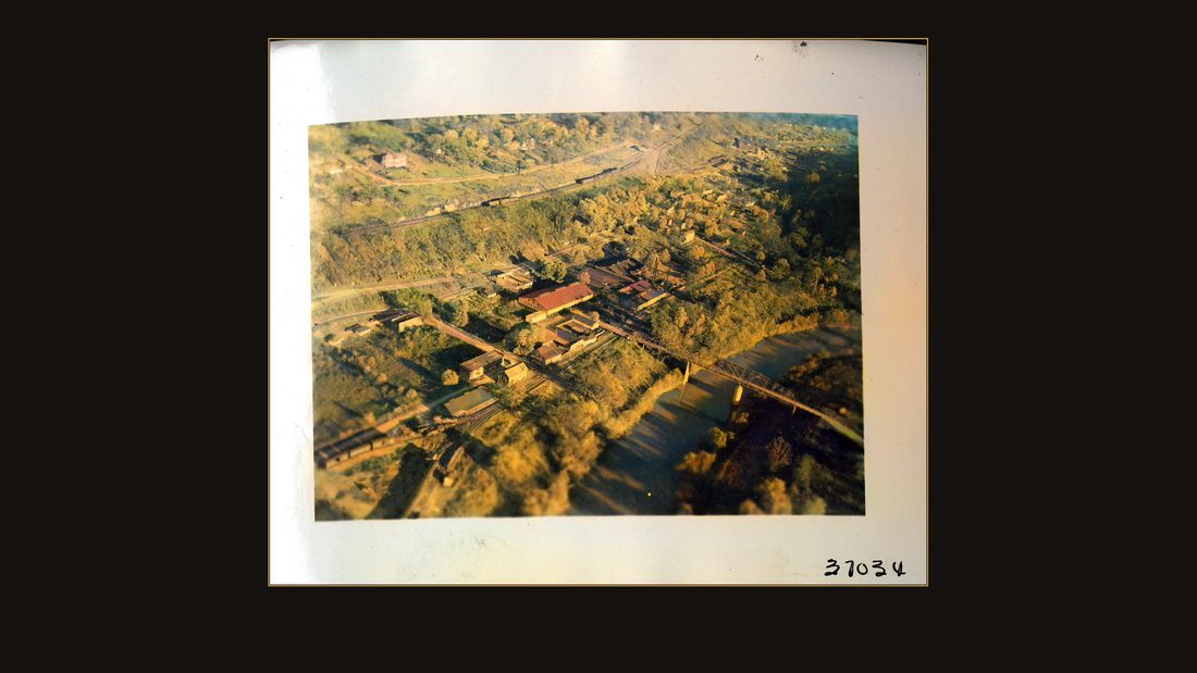
R45 Wolf Creek Reservoir relocations. Nov. 1949. View of Burnside, KY
U.S. Army Corps of Engineers, Nashville District · November 1949 · USACE Digital Library · AI-colorized. View the original.
The old town stayed where it was. The Corps didn't burn it or bulldoze it for the newsreels. They emptied it, and the water did the rest.
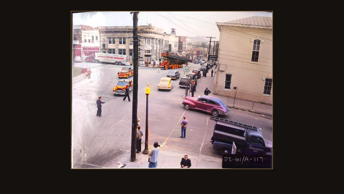
R47 Wolf Creek power plant, 15 November 1950. Girder load approaching square in Somerset, Ky. Q2-61/A-117
U.S. Army Corps of Engineers, Nashville District · November 1950 · USACE Digital Library · AI-colorized. View the original.
The dam's hardware came through the region's towns on trucks. November, nineteen fifty: a powerhouse girder crosses the public square in Somerset, and the whole town comes out to watch it turn.
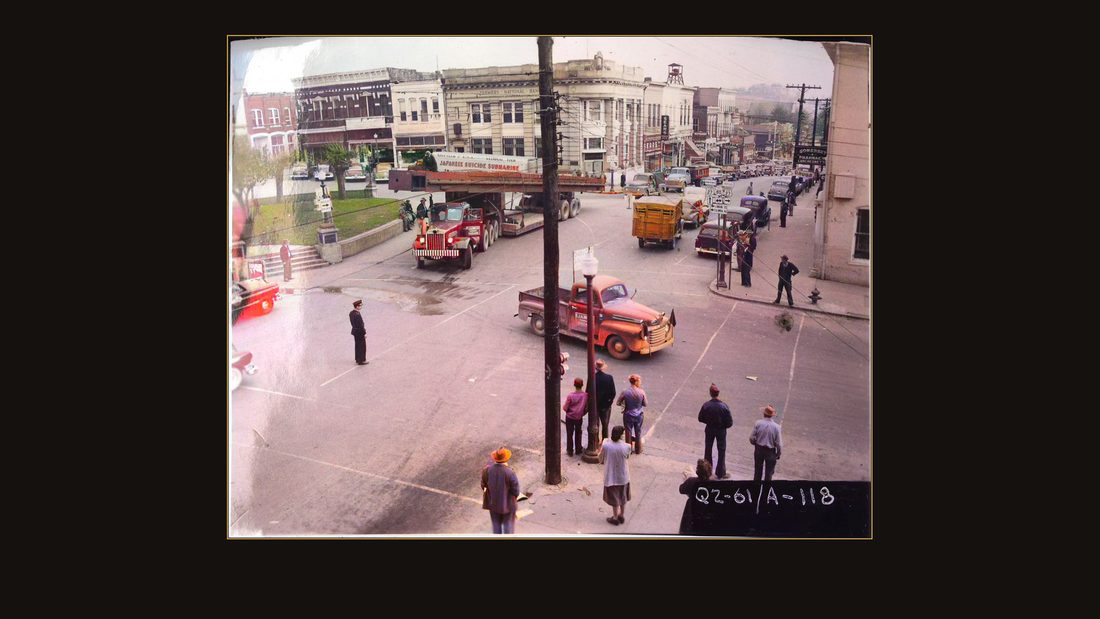
R48 Wolf Creek power plant, 15 November 1950. Girder load approaching turn into West Kentucky West Kentucky Highway #80, Somerset, Ky. Q2-61/A-118
U.S. Army Corps of Engineers, Nashville District · November 1950 · USACE Digital Library · AI-colorized. View the original.
The truck is longer than the courthouse block.
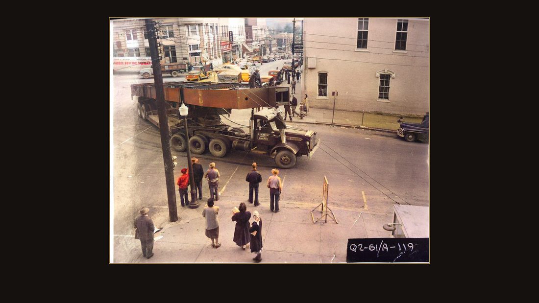
R49 Wolf Creek power plant, 15 November 1950. Girder load making turn into West Kentucky West Kentucky Highway #80, Somerset, Ky. Q2-61/A-119
U.S. Army Corps of Engineers, Nashville District · November 1950 · USACE Digital Library · AI-colorized. View the original.
Making the turn onto Highway 80, one parked car at a time.
The water
R45 Wolf Creek Reservoir relocations. Nov. 1949. View of Burnside, KY
U.S. Army Corps of Engineers, Nashville District · November 1949 · USACE Digital Library · AI-colorized. View the original.
December first, nineteen fifty — that's the taking date the Court of Claims later used, the day the flooding began. The water walked up a hundred and one miles of valley toward the empty streets of old Burnside. The Mann and Humble farms were already gone a different way — their parcels are labeled, in the Corps' own files, "Wolf Creek Dam."
Not everything drowned was on the surface. A family that had owned mineral rights under twenty-eight hundred acres since the eighteen sixties sued for compensation. Their problem: the deeds proving where their minerals were had burned with the Clinton County courthouse — in eighteen sixty-four.
They spent a decade in the Court of Claims proving title from Civil War ashes. They asked for four hundred thirty-one thousand dollars. In nineteen sixty, the court awarded them eight thousand two hundred twenty-five.
The powerhouse
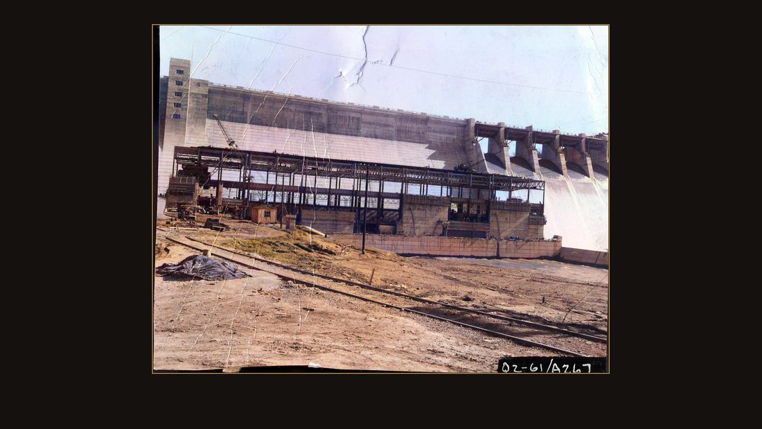
R50 Wolf Creek power plant, 4 April 1951. Power house from E.J. Albrecht mixer plant. Q2-61/A-267
U.S. Army Corps of Engineers, Nashville District · April 1951 · USACE Digital Library · AI-colorized. View the original.
Meanwhile the powerhouse went up. April, nineteen fifty-one.
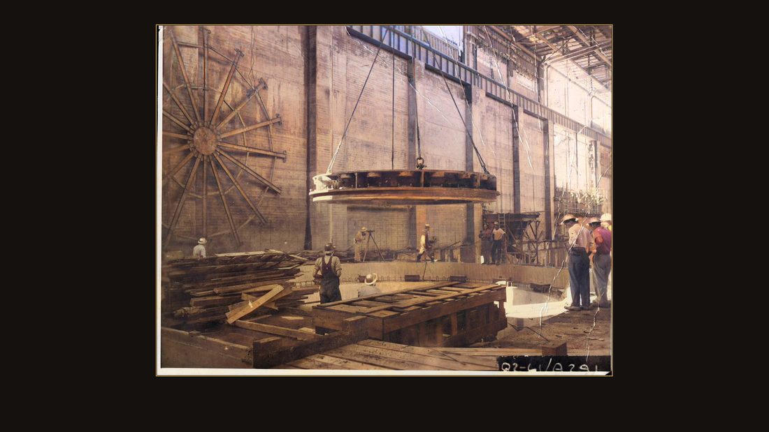
R51 Wolf Creek power plant, 12 May 1951. Lower head cover with overhead crane, Unit 6. Q2-61/A-291
U.S. Army Corps of Engineers, Nashville District · May 1951 · USACE Digital Library · AI-colorized. View the original.
A turbine's lower head cover, with men for scale.
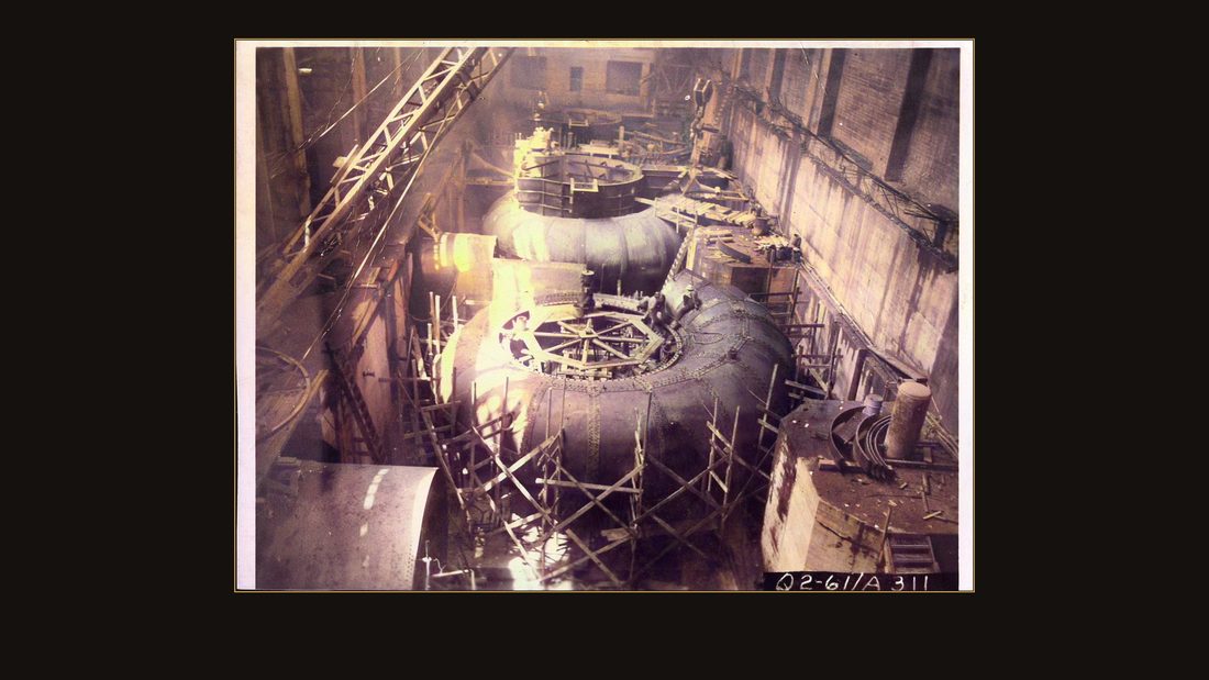
R52 Wolf Creek power plant, 11 July 1951. From erection platform. Q2-61/A-311
U.S. Army Corps of Engineers, Nashville District · July 1951 · USACE Digital Library · AI-colorized. View the original.
From the erection platform, July nineteen fifty-one.
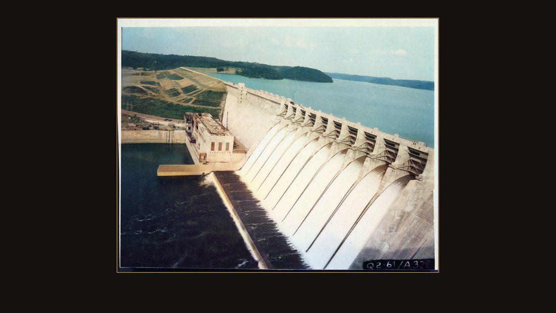
R53 Wolf Creek power plant, 7 July 1951. Powerhouse from high side. Q2-61/A-322
U.S. Army Corps of Engineers, Nashville District · July 1951 · USACE Digital Library · AI-colorized. View the original.
The powerhouse from the high side, the lake already forming behind the dam.
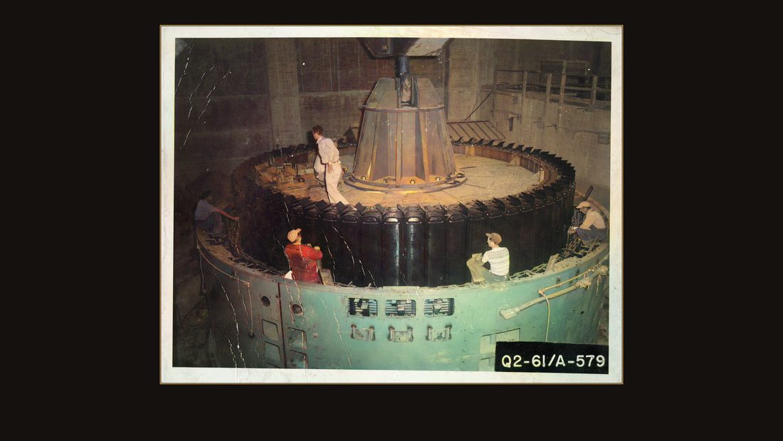
R54 Wolf Creek Dam, 10 June 1952. Unit 1 rotor being lowered onto shaft. Q2-61/A-579
U.S. Army Corps of Engineers, Nashville District · June 1952 · USACE Digital Library · AI-colorized. View the original.
June, nineteen fifty-two: Unit One's rotor is lowered onto its shaft.
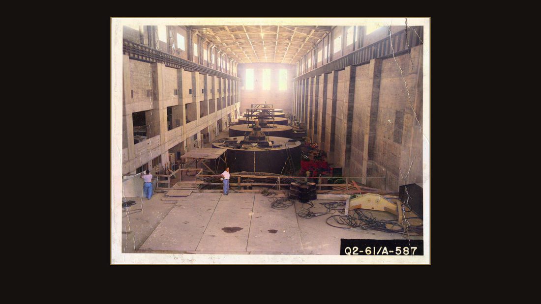
R55 Wolf Creek Dam, 17 June 1952. Generators from observation balcony. Q2-61/A-587.
U.S. Army Corps of Engineers, Nashville District · June 1952 · USACE Digital Library · AI-colorized. View the original.
The generator hall, from the observation balcony. Two hundred seventy thousand kilowatts, in a valley that had been kerosene lamps and ice floes twenty years before.
The dedication
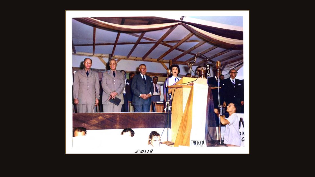
R56 4" x 5"
U.S. Army Corps of Engineers, Nashville District · September 1951 · USACE Digital Library · AI-colorized. View the original.
September first, nineteen fifty-one — ten years to the day after the burgoo — they dedicated the dam.
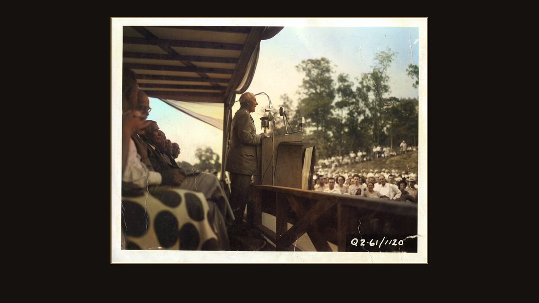
R57 Wolf Creek Dam, 1 September 1951. General Pick speaks at Wolf Creek Dam dedication. Chief of Engineers. Q2-61/1120.
U.S. Army Corps of Engineers, Nashville District · September 1951 · USACE Digital Library · AI-colorized. View the original.
General Lewis Pick, Chief of Engineers, spoke.
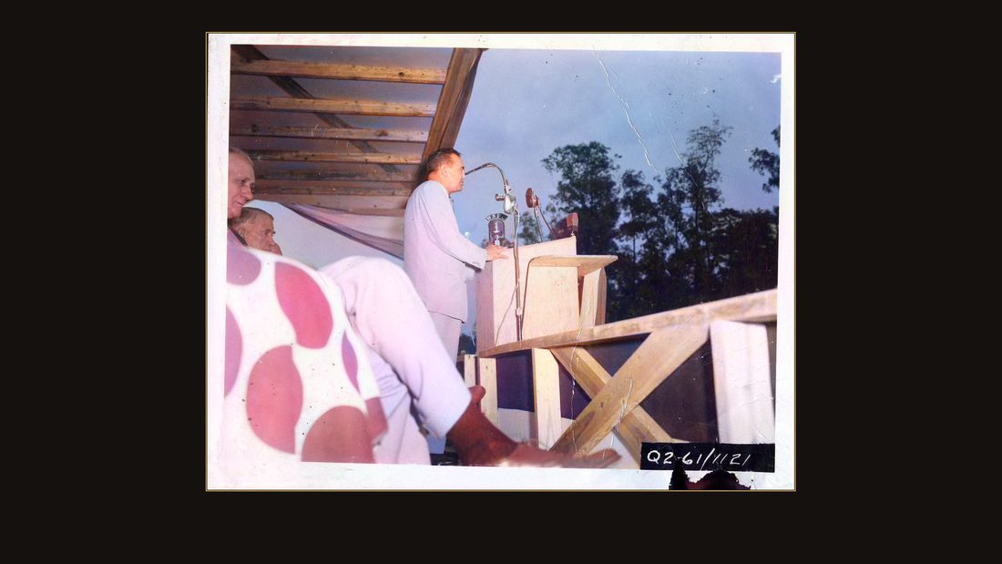
R58 Wolf Creek Dam, 1 September 1951. Governor Wetherby speaks at Wolf Creek Dam dedication. Q2-61/1121.
U.S. Army Corps of Engineers, Nashville District · September 1951 · USACE Digital Library · AI-colorized. View the original.
So did Governor Lawrence Wetherby.
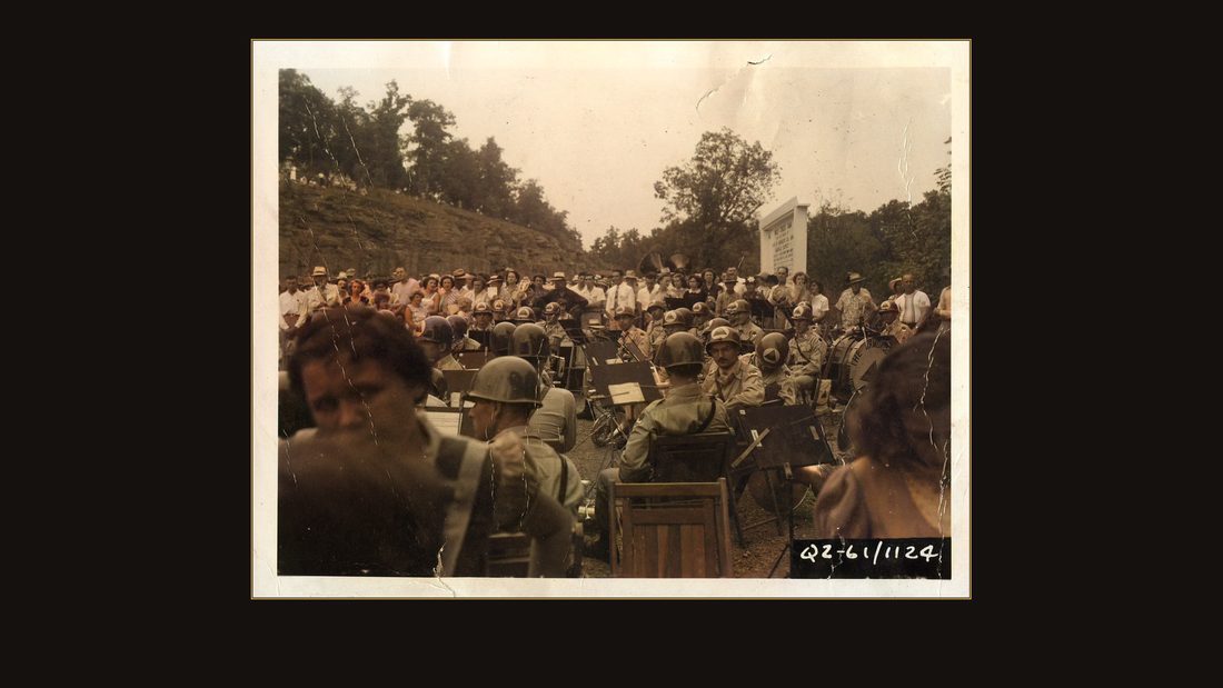
R59 Wolf Creek Dam, 1 September 1951. Army Band plays at Wolf Creek Dam dedication. Q2-61/1120.
U.S. Army Corps of Engineers, Nashville District · September 1951 · USACE Digital Library · AI-colorized. View the original.
The Army band played.
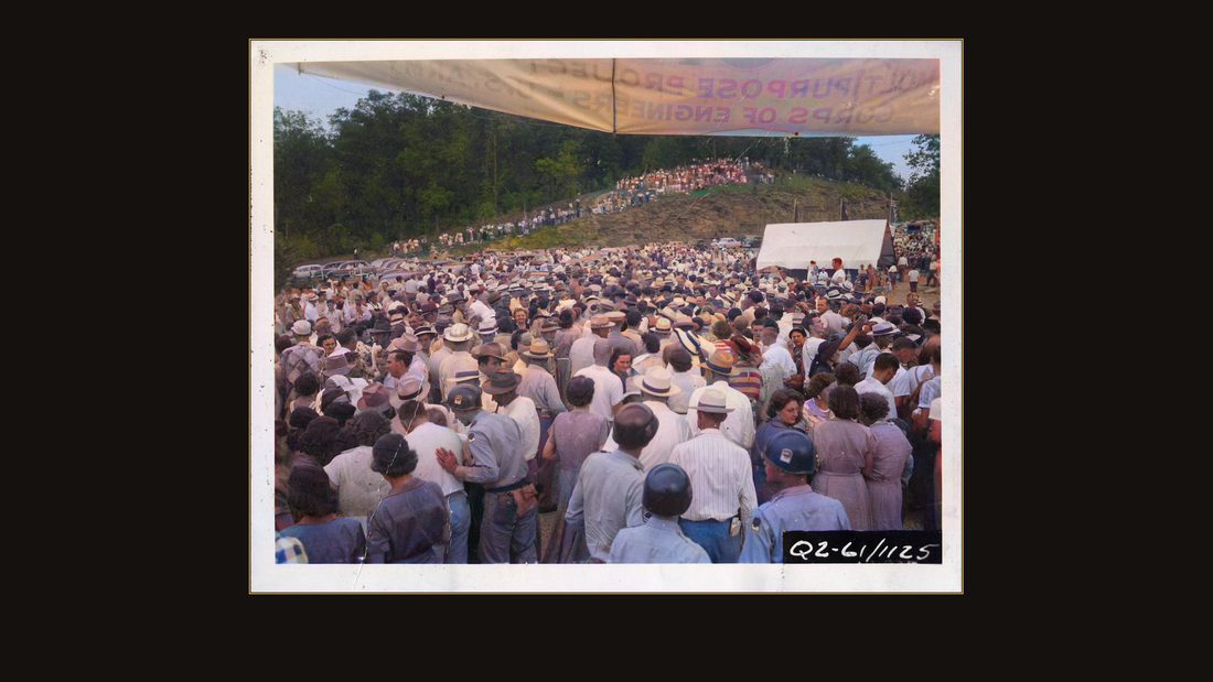
R60 Wolf Creek Dam, 1 September 1951. Approximately 2,000 people at Wolf Creek Dam dedication. Q2-61/1125.
U.S. Army Corps of Engineers, Nashville District · September 1951 · USACE Digital Library · AI-colorized. View the original.
The Corps counted the crowd again: approximately two thousand. Ten years earlier, seven thousand people had come to watch a shovel of dirt. The party for the promise was three times the size of the party for the thing itself.
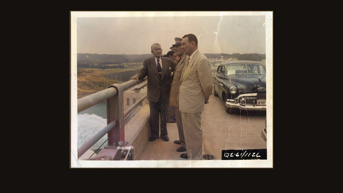
R61 Wolf Creek Dam, 1 September 1951. Vice-President Barkley, General Pick and Governor Wetherby inspects dam. Q2-61/1126.
U.S. Army Corps of Engineers, Nashville District · September 1951 · USACE Digital Library · AI-colorized. View the original.
Vice President Alben Barkley — Kentucky's own — gave the dedication. Almost noiselessly, he said, the clear waters impounded here will surge through the giant turbines, pouring forth an endless stream of electric power.
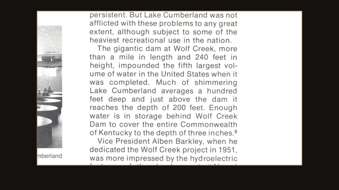
S2
Engineers on the Twin Rivers, USACE Nashville District · p. 217.
The visitors stood on the overlook and watched the water. That's the district history's own page: the dam more than a mile long, two hundred forty feet high — and enough water stored behind it to cover the entire Commonwealth of Kentucky three inches deep.
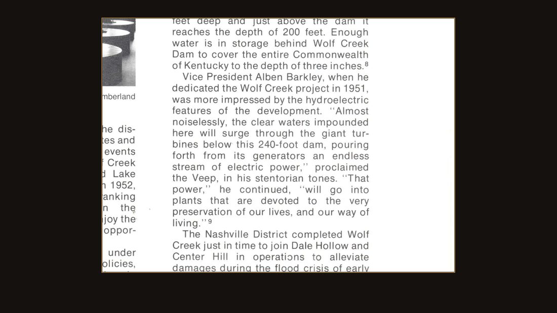
S3
Engineers on the Twin Rivers, USACE Nashville District · p. 217.
Congress made the name official in nineteen fifty-two: Lake Cumberland.
The lake
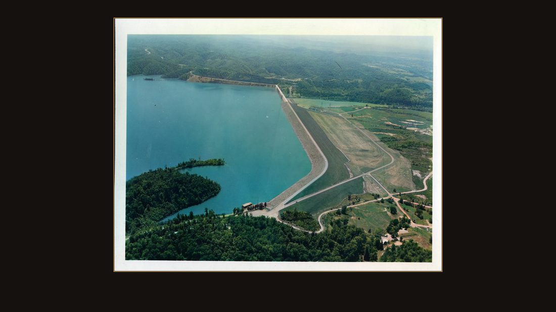
R63 Wolf Creek Dam, 28 May 1958. Aerial view of embankment section of Wolf Creek dam. Q2-61/1128.
U.S. Army Corps of Engineers, Nashville District · May 1958 · USACE Digital Library · AI-colorized. View the original.
Here it is in May, nineteen fifty-eight.
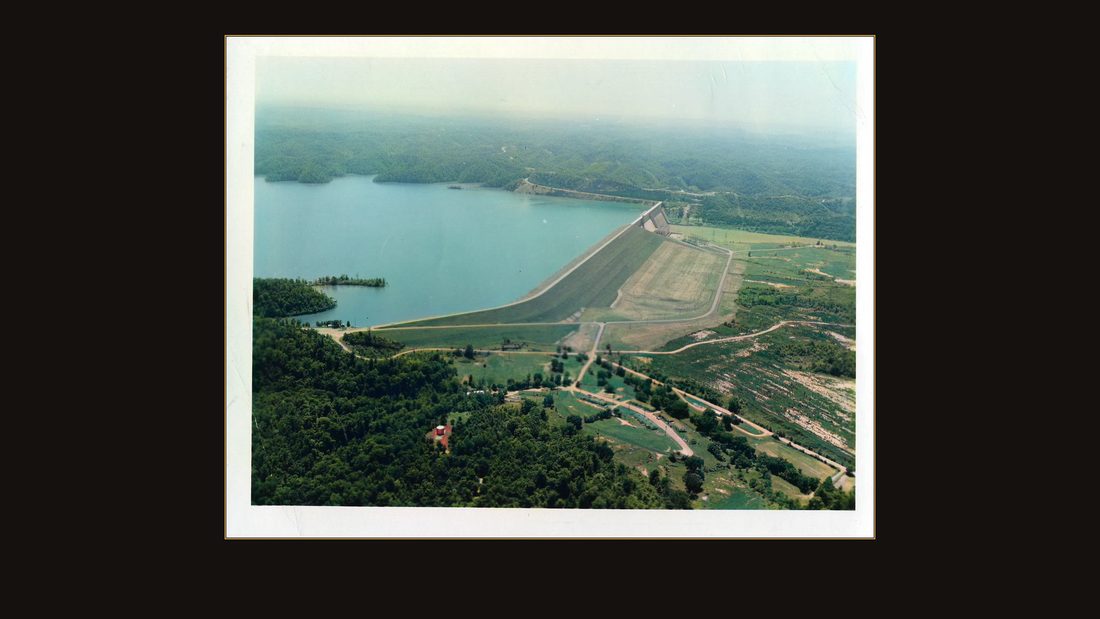
R64 Wolf Creek Dam, 28 May 1958. Aerial view of embankment section of Wolf Creek dam. Q2-61/1129.
U.S. Army Corps of Engineers, Nashville District · May 1958 · USACE Digital Library · AI-colorized. View the original.
A hundred and one miles of river became lake. Much of it averages a hundred feet deep.
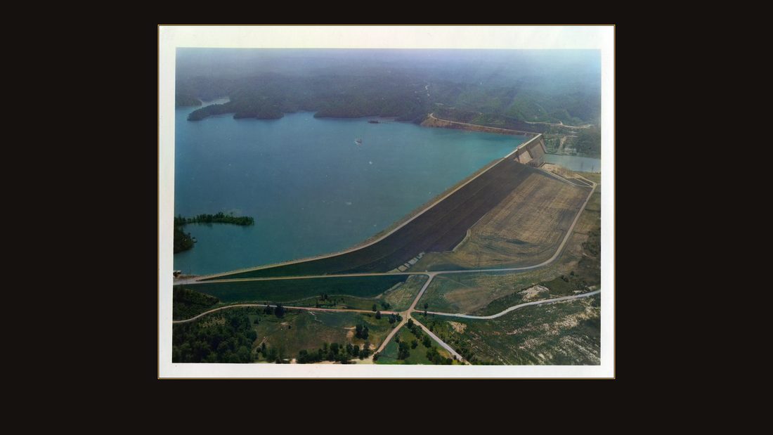
R65 Wolf Creek Dam, 28 May 1958. Aerial view of embankment section of Wolf Creek dam. Q2-61/1130.
U.S. Army Corps of Engineers, Nashville District · May 1958 · USACE Digital Library · AI-colorized. View the original.
Under the water and under the works: a post office, two farms photographed down to their outhouses, a schoolhouse lot with a broken promise attached, and the streets of a steamboat town.
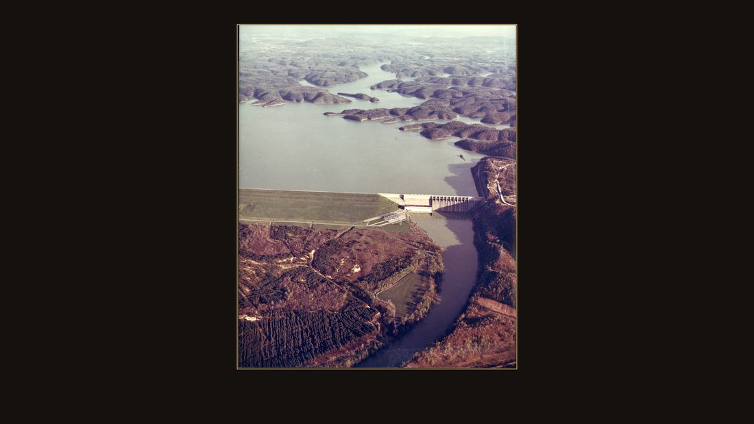
R66 Wolf Creek Project, Cumberland River. The project is located at river mile 460.9 on the cumberland river, about 10 miles southwest of Jamestown, Kentucky. The project is 5,736 feet long with a maximum height of 258 feet. Its primary functions are flood control and hydro-power. The installed capacity of 270,000 kilwatts and an average annual energy output of 867,00,000 kilowatt hours. Wolf Creek is one of the largest hydroelectric plants in the eastern United States. The reservoir provides excellent recreational opportunities for sportsmen.
U.S. Army Corps of Engineers, Nashville District · undated · USACE Digital Library · color print. View the original.
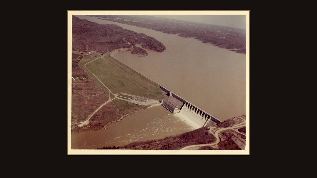
The Corps' later color print states the final figures: five thousand seven hundred thirty-six feet long, two hundred fifty-eight feet at its maximum height, ten miles southwest of Jamestown.
R67 8" x 10"
U.S. Army Corps of Engineers, Nashville District · undated · USACE Digital Library · color print. View the original.
In nineteen fifty-one, the dam helped cut a flood crest by thirty feet at Celina and eleven feet at Nashville. Burnside has not been in the river since. The lake it sits beside became, in the Corps' own words, one of its top-ranking reservoirs in visitors. Whether the trade was worth it is not the government's question to answer. The government just kept the receipts — and the photographs.
R66 Wolf Creek Project, Cumberland River. The project is located at river mile 460.9 on the cumberland river, about 10 miles southwest of Jamestown, Kentucky. The project is 5,736 feet long with a maximum height of 258 feet. Its primary functions are flood control and hydro-power. The installed capacity of 270,000 kilwatts and an average annual energy output of 867,00,000 kilowatt hours. Wolf Creek is one of the largest hydroelectric plants in the eastern United States. The reservoir provides excellent recreational opportunities for sportsmen.
U.S. Army Corps of Engineers, Nashville District · undated · USACE Digital Library · color print. View the original.
Sources
- All photographs: U.S. Army Corps of Engineers, Nashville District — USACE Digital Library, collection "Photographs" (usace.contentdm.oclc.org, collection p15141coll5). Federal works, public domain. Each frame's catalog record is linked in the exhibit registry; originals are free to view and download, uncolored.
- Color in the photographs was added in 2026 with an AI colorization model (DDColor) except three frames: the September 1, 1941 groundbreaking print, hand-tinted by the Corps in the period, and two later Corps color prints of the finished dam. Colors in the AI-colorized frames are estimates, not records.
- United States v. 1846.77 Acres of Land, More or Less, 48 F. Supp. 721 (W.D. Ky., Sept. 8, 1942) — the Warriner deed of Jan. 5, 1874, the school parcel taken June 1941, and the ruling that federal seizure rendered the reversion clause inoperative. Read via CourtListener (opinion cluster 8881504).
- Wally v. United States, 148 Ct. Cl. 371 (Jan. 20, 1960) — mineral rights under 2,875.24 acres in Russell and Clinton counties; the 1864 Clinton County courthouse fire; the December 1, 1950 taking date; $431,286 claimed, $8,225 awarded. Read via CourtListener (opinion cluster 8613557).
- Leland R. Johnson, "Engineers on the Twin Rivers: A History of the Nashville District, Corps of Engineers" (USACE Nashville District) — authorization after the 1937 floods; six candidate reservoir sites; wartime rush order and suspension at about three percent complete; Burnside (old Point Isabel) relocation and the eighteen-percent cost increase; dam dimensions; storage equal to covering Kentucky three inches deep; renaming to Lake Cumberland by act of Congress, 1952; Barkley dedication quotation; 1951 flood-crest reductions. USACE Digital Library, collection p16021coll4, item 109 (pp. 216–217 and ch. on the Cumberland projects).
- Crowd counts, the burgoo recipe, flood stages, parcel numbers, and photograph dates are quoted from the Corps' own typed captions and catalog records for each print.