The Town at the Bottom of the Lake | East Tennessee in Color, 1935-1943
In 1936 the Tennessee Valley Authority closed the gates of its first dam and a Union County town called Loyston went under Norris Lake. TVA's own project report counts the cost in one sentence: nearly 150,000 acres purchased, 3,000 families moved, 5,000 graves.
Transcript
Two small towns
S1
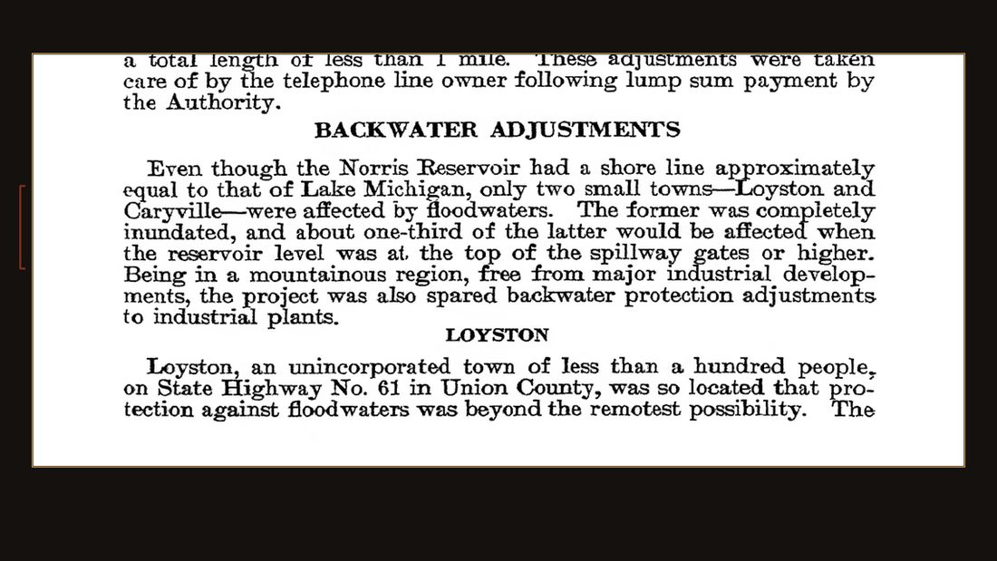
TVA · The Norris Project · Tech. Report No. 1 (1940) · p. 531.
Page five thirty-one of a federal engineering report. Even though the reservoir had a shoreline approximately equal to that of Lake Michigan, only two small towns were affected. One of them was completely inundated. Its name was Loyston.
S2
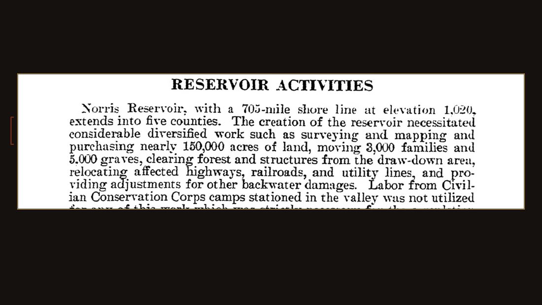
TVA · The Norris Project · Tech. Report No. 1 (1940) · p. 485.
The same report adds up what it took to make the lake: nearly one hundred fifty thousand acres purchased. Three thousand families moved. Five thousand graves.
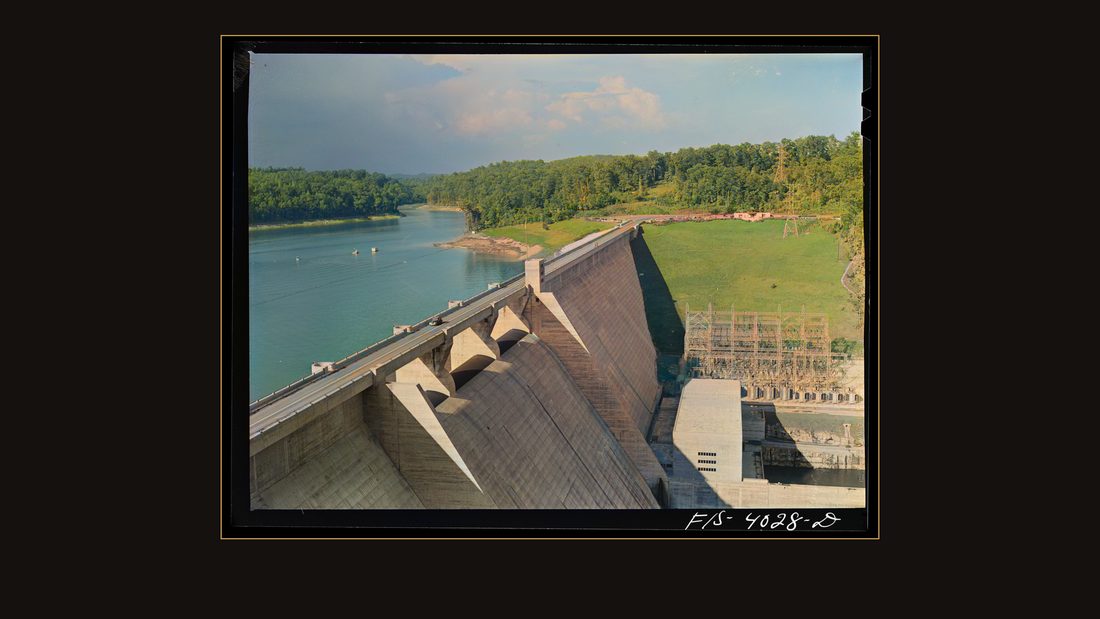
R37 Norris Dam, Tennessee (Tennessee Valley Authority (TVA)). Norris Dam pushes back the Tennessee River seventy-two miles to form Norris Lake
Arthur Rothstein · June 1942 · Library of Congress · FSA/OWI · AI-colorized. View the original.
And through all of it — the drowning, the building, the war that followed — photographers on the federal payroll kept passing through East Tennessee. Their negatives have sat in Washington ever since, in black and white.
The colors are guesses
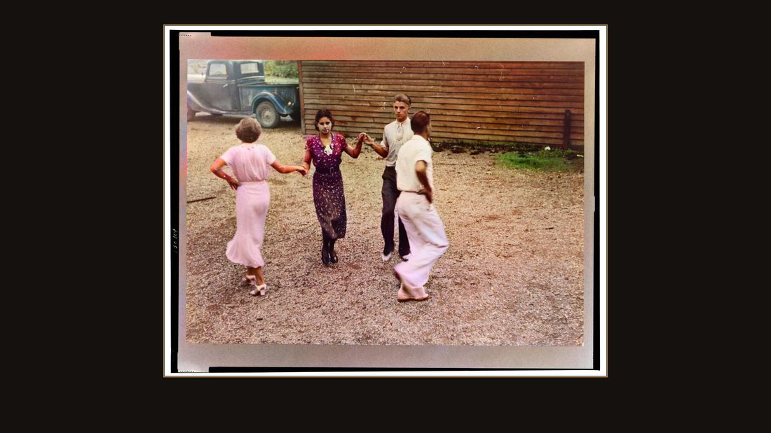
R22 Dancers taught by Leonard Kirk, Cumberland Homesteads, Crossville, Tennessee
Ben Shahn · 1937 · Library of Congress · FSA/OWI · AI-colorized. View the original.
So let's be straight about what you're watching. Every color in this film is a guess — made this year, by a machine, from the gray values on those negatives.
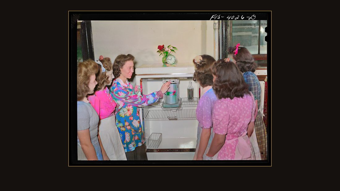
R40 Knox County, Tennessee (Tennessee Valley Authority (TVA)). Girls are shown how to operate an electric refrigerator at the Farragut Agricultural School
Arthur Rothstein · June 1942 · Library of Congress · FSA/OWI · AI-colorized. View the original.
The faces, the light, the framing — those belong to the photographers, untouched. The colors are estimates, and every original is free at the Library of Congress, linked below. That's the deal. Keep it in mind and these pictures won't lie to you.
Five months before the water
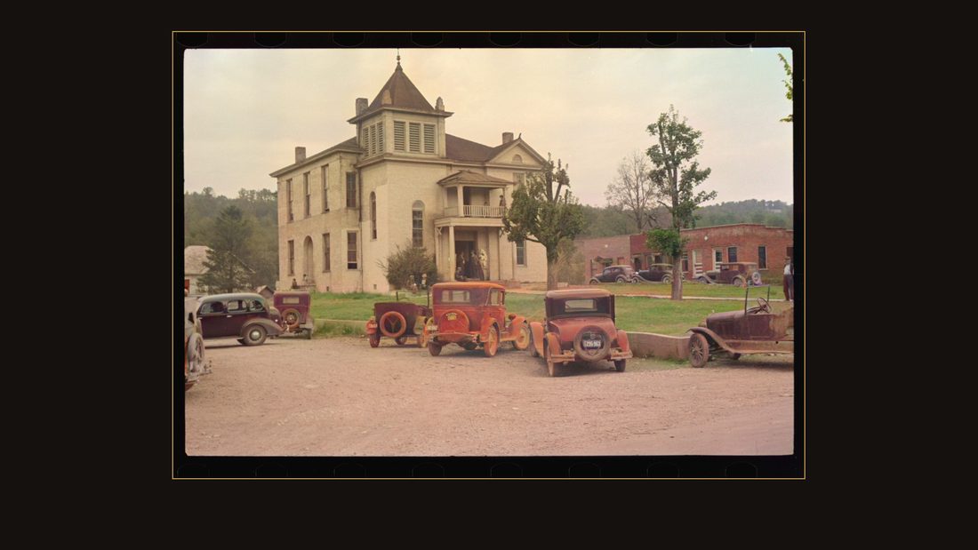
R01 County courthouse in Maynardville, Tennessee
Ben Shahn · October 1935 · Library of Congress · FSA/OWI · AI-colorized. View the original.
October, nineteen thirty-five. Ben Shahn — a painter carrying a thirty-five millimeter camera for the Resettlement Administration — stopped in Maynardville, the seat of Union County. This is the courthouse.
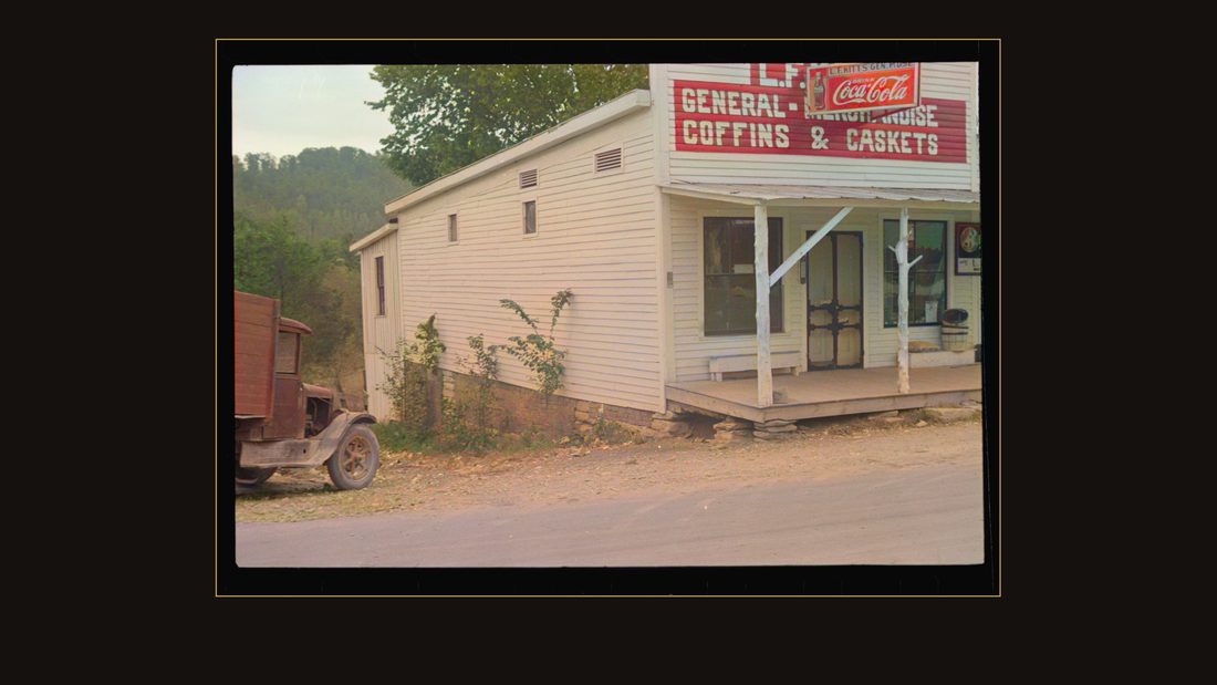
R02 Maynardville, Tennessee
Ben Shahn · October 1935 · Library of Congress · FSA/OWI · AI-colorized. View the original.
Union County is where Loyston stood — a town of fewer than a hundred people, down on Highway sixty-one, that the government had already bought outright. Store by store, church by church.
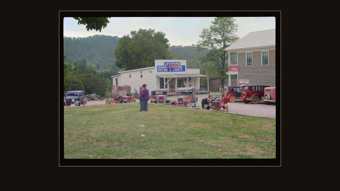
R03 Maynardville, Tennessee
Ben Shahn · October 1935 · Library of Congress · FSA/OWI · AI-colorized. View the original.
The dam that would drown it had been under construction for two years. The gates closed five months after Shahn left — March fourth, nineteen thirty-six.
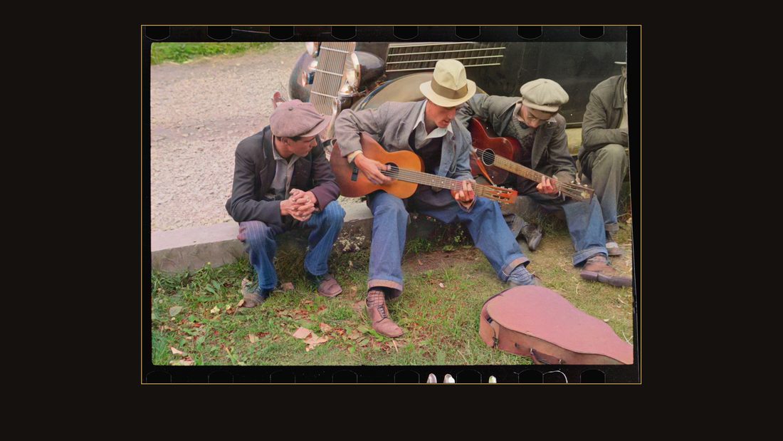
R05 Street musicians, Maynardville, Tennessee
Ben Shahn · October 1935 · Library of Congress · FSA/OWI · AI-colorized. View the original.
He didn't photograph the dam. He photographed a street corner. His caption says: street musicians, Maynardville, Tennessee.
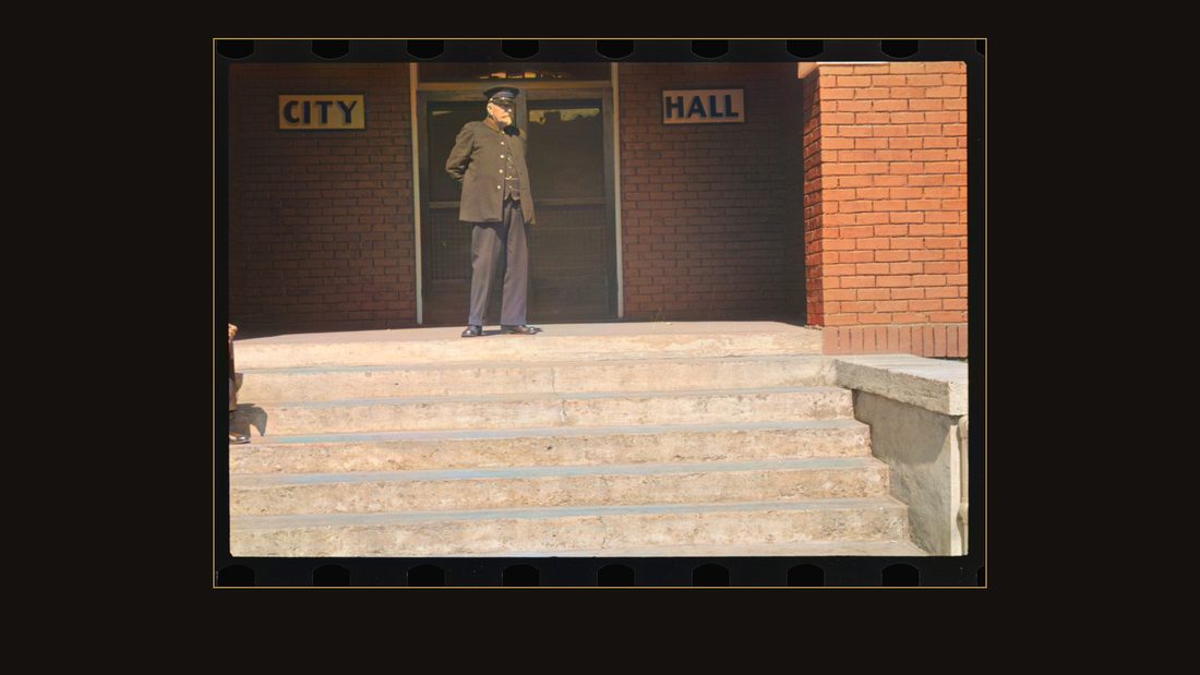
R06 Old fireman in front of city hall, Maynardville, Tennessee
Ben Shahn · October 1935 · Library of Congress · FSA/OWI · AI-colorized. View the original.
An old fireman, posted in front of city hall.
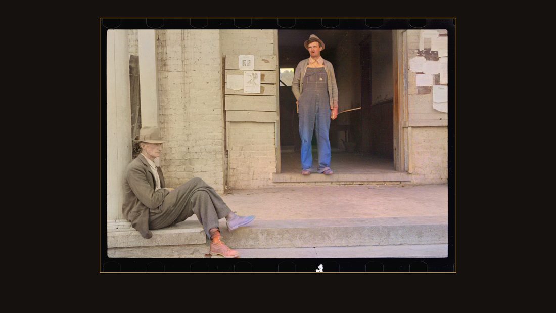
R04 A street scene, Maynardville, Tennessee
Ben Shahn · October 1935 · Library of Congress · FSA/OWI · AI-colorized. View the original.
Most of Loyston's people moved four miles south on the same highway and started over. They called the new place New Loyston. The engineering report records all of it, in one paragraph.
The stone farms
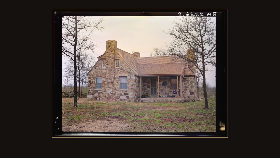
R16 Cumberland Homesteads. Crossville, Tennessee
Carl Mydans · March 1936 · Library of Congress · FSA/OWI · AI-colorized. View the original.
That same fall, sixty miles west on the Cumberland Plateau, the government was building the opposite of a drowned town — a brand-new one.
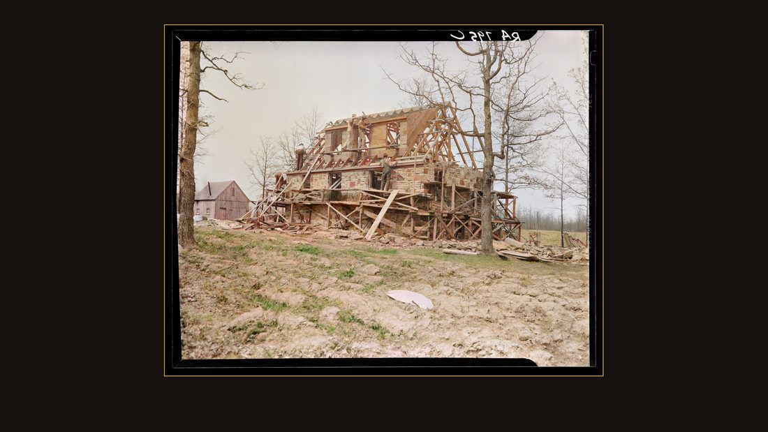
R10 Construction at Cumberland Homesteads. Crossville, Tennessee
Carl Mydans · November 1935 · Library of Congress · FSA/OWI · AI-colorized. View the original.
Cumberland Homesteads, outside Crossville. Eleven thousand six hundred acres, bought from a coal company at seven dollars and seventy-six cents an acre, to settle miners and timber workers whose industries had collapsed under them.
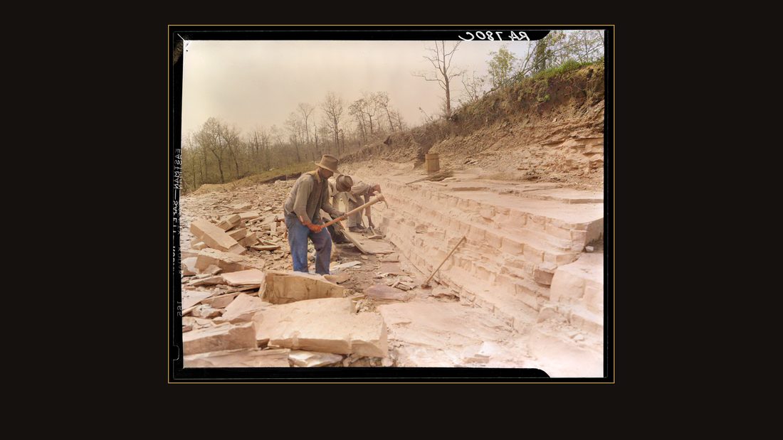
R07 Rock quarry used in construction of Cumberland Homesteads. Crossville, Tennessee
Carl Mydans · November 1935 · Library of Congress · FSA/OWI · AI-colorized. View the original.
Carl Mydans photographed the rock quarry. The houses were cut from the plateau's own Crab Orchard sandstone.
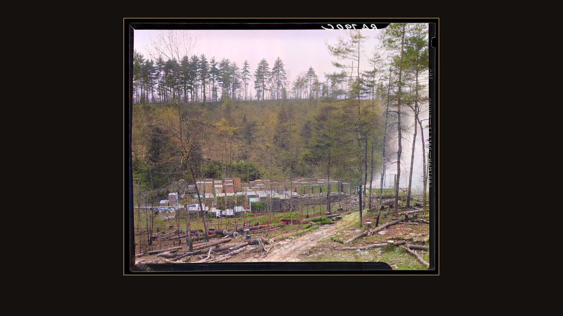
R09 Sawmill. Crossville, Tennessee
Carl Mydans · November 1935 · Library of Congress · FSA/OWI · AI-colorized. View the original.
The sawmill.
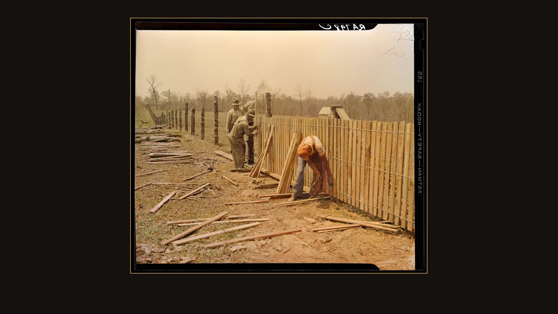
R11 Erecting a fence at Cumberland Homesteads. Crossville, Tennessee
Carl Mydans · November 1935 · Library of Congress · FSA/OWI · AI-colorized. View the original.
The homesteaders built the houses themselves — forty-five hours a week, cash for fifteen, the rest credited against the house. A dollar an hour for skilled work.
S3
NPS · NRHP Nomination 88001593 · Cumberland Homesteads (1988) · §8 p. 6.
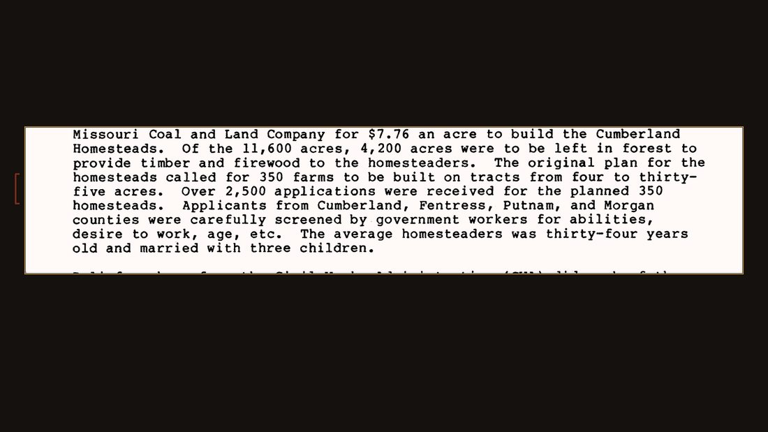
Three hundred fifty farms were planned. Over twenty-five hundred families applied. The screeners' file says the average homesteader was thirty-four years old, married, three children.
S5
NPS · NRHP Nomination 88001593 · Cumberland Homesteads (1988) · §8 p. 6.
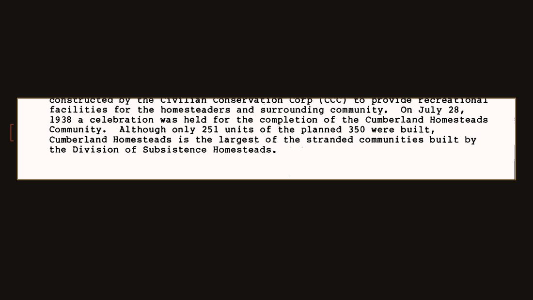
While the houses went up, families lived in the barns. The plan called it a family barn, and it came first.
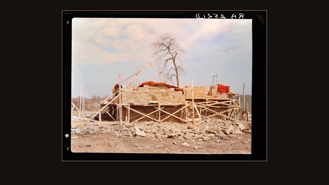
R12 Close up of the stone house which is being built by the farmer at Crossville, Tennessee. Cumberland Homesteads
Carl Mydans · March 1936 · Library of Congress · FSA/OWI · AI-colorized. View the original.
A farmer's stone house going up. Mydans's caption notes he was building it himself.
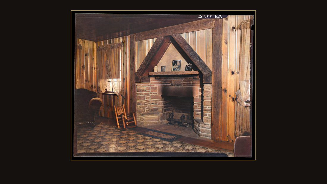
R13 Interior of house at Crossville, Tennessee. Cumberland Homesteads
Carl Mydans · November 1935 · Library of Congress · FSA/OWI · AI-colorized. View the original.
And inside a finished one — plaster walls, board floors, a sandstone fireplace.
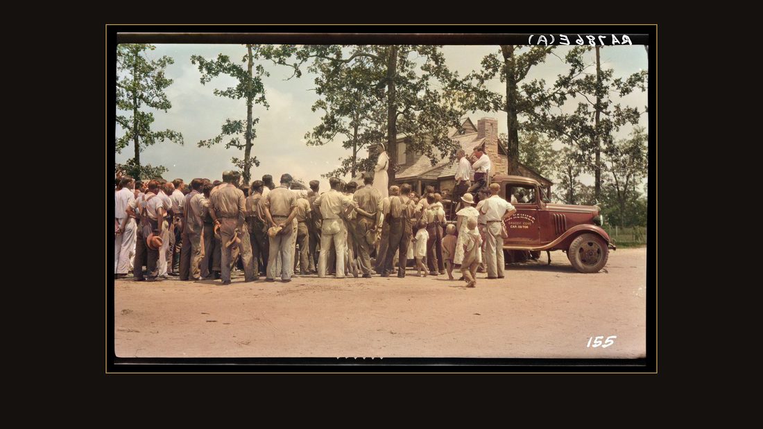
R08 Mrs. Roosevelt addressing group at Cumberland Homesteads. Crossville, Tennessee
Carl Mydans · Fall 1935 · Library of Congress · FSA/OWI · AI-colorized. View the original.
In Mydans's file from that fall there is one frame of a visitor on a platform. His caption: Mrs. Roosevelt, addressing group at Cumberland Homesteads.
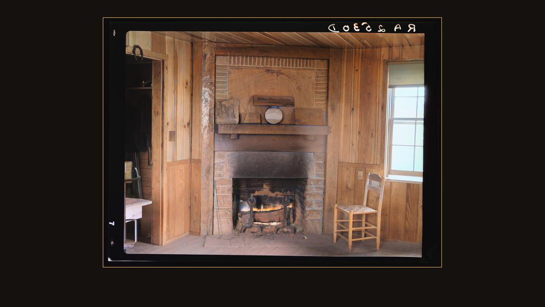
R14 Fireplace in office of Cumberland Homesteads. Crossville, Tennessee
Carl Mydans · March 1936 · Library of Congress · FSA/OWI · AI-colorized. View the original.
The fireplace in the project office, laid up from the same stone as everything else on the plateau.
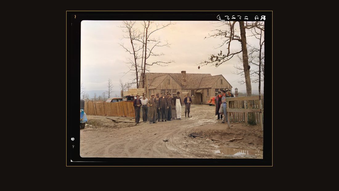
R15 Trading post at Cumberland Homesteads. Crossville, Tennessee
Carl Mydans · March 1936 · Library of Congress · FSA/OWI · AI-colorized. View the original.
The trading post, by the spring of thirty-six.
Saturday in town
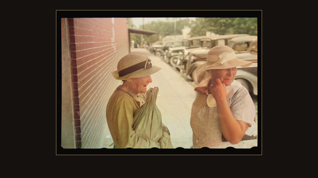
R17 Woman in Crossville, Tennessee
Ben Shahn · 1937 · Library of Congress · FSA/OWI · AI-colorized. View the original.
Two years later, Shahn came back through Crossville on a Saturday.
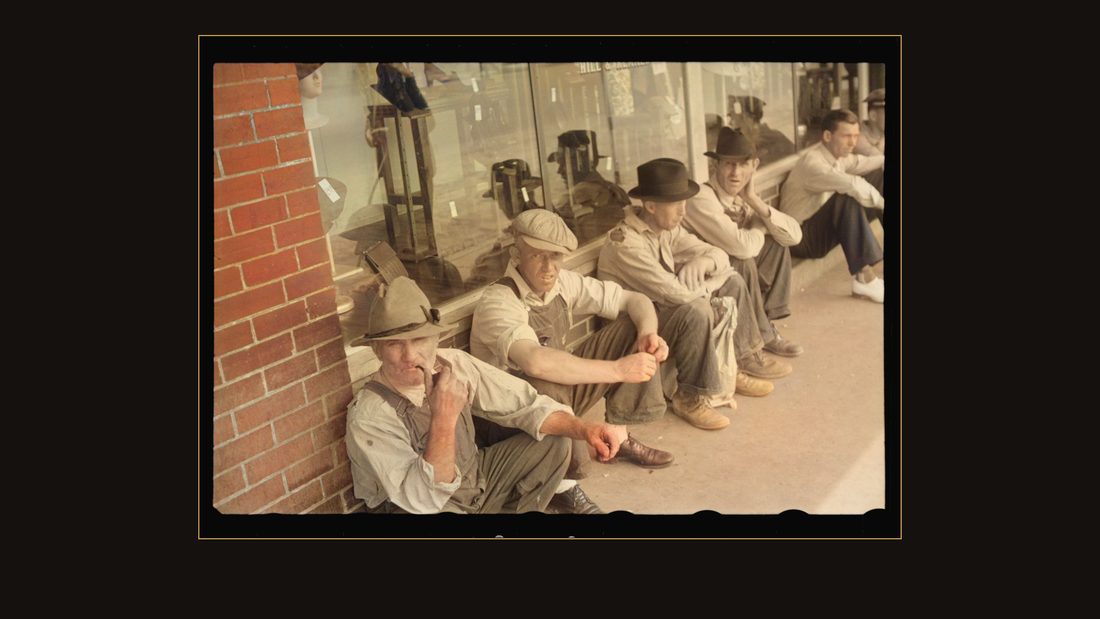
R18 Men loafing in Crossville, Tennessee
Ben Shahn · 1937 · Library of Congress · FSA/OWI · AI-colorized. View the original.
Men loafing, his caption says. Nineteen thirty-seven.
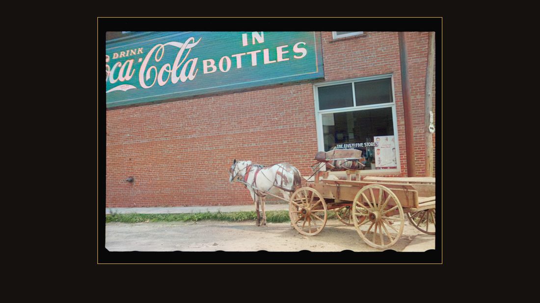
R19 Horse and wagon, Crossville, Tennessee
Ben Shahn · 1937 · Library of Congress · FSA/OWI · AI-colorized. View the original.
A horse and wagon, parked under a Coca-Cola wall.
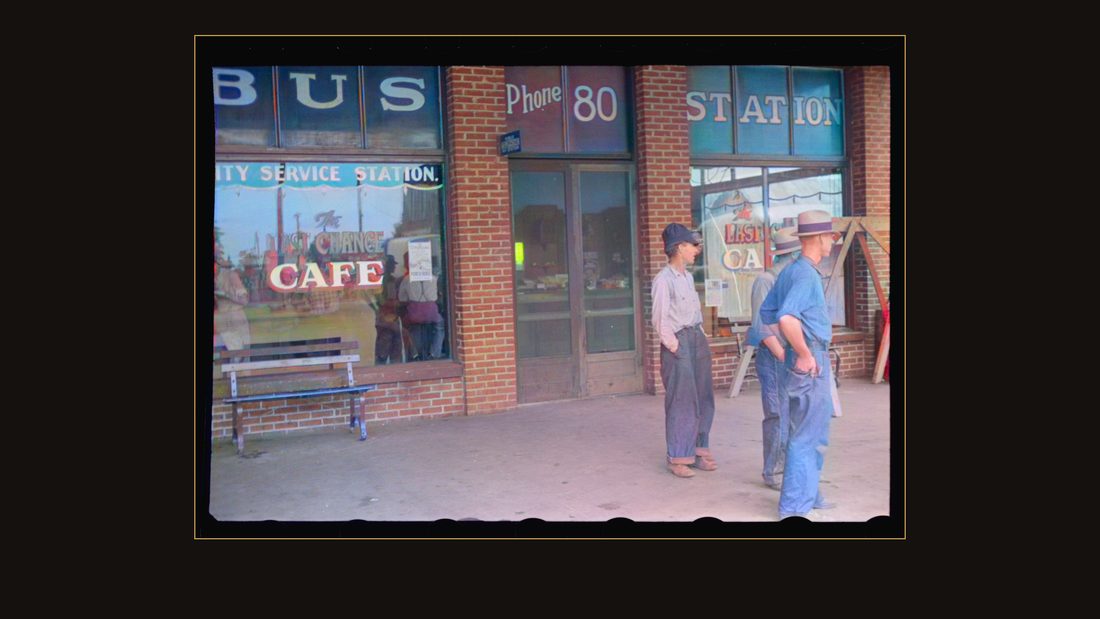
R20 Bus station, Crossville, Tennessee
Ben Shahn · 1937 · Library of Congress · FSA/OWI · AI-colorized. View the original.
The bus station. Phone eighty.

R21 Furniture store window, Crossville, Tennessee
Ben Shahn · 1937 · Library of Congress · FSA/OWI · AI-colorized. View the original.
The furniture store window.
R22 Dancers taught by Leonard Kirk, Cumberland Homesteads, Crossville, Tennessee
Ben Shahn · 1937 · Library of Congress · FSA/OWI · AI-colorized. View the original.
Out at the Homesteads, he found the settlement dancing. His caption names the caller: dancers taught by Leonard Kirk.
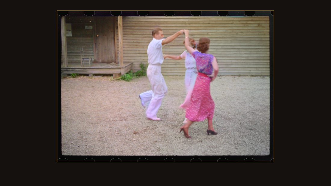
R23 Dancers at Cumberland Homesteads, Crossville, Tennessee
Ben Shahn · 1937 · Library of Congress · FSA/OWI · AI-colorized. View the original.
Square dance figures on the grass.
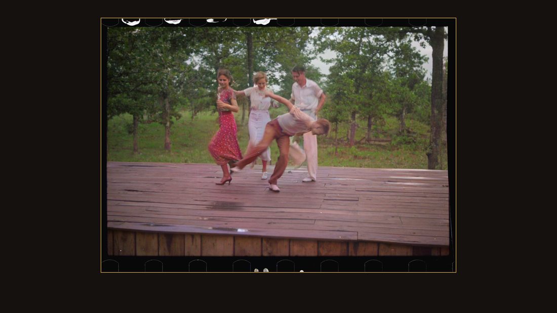
R24 Dance team, Cumberland Homesteads, Crossville, Tennessee
Ben Shahn · 1937 · Library of Congress · FSA/OWI · AI-colorized. View the original.
The dance team, mid-turn.
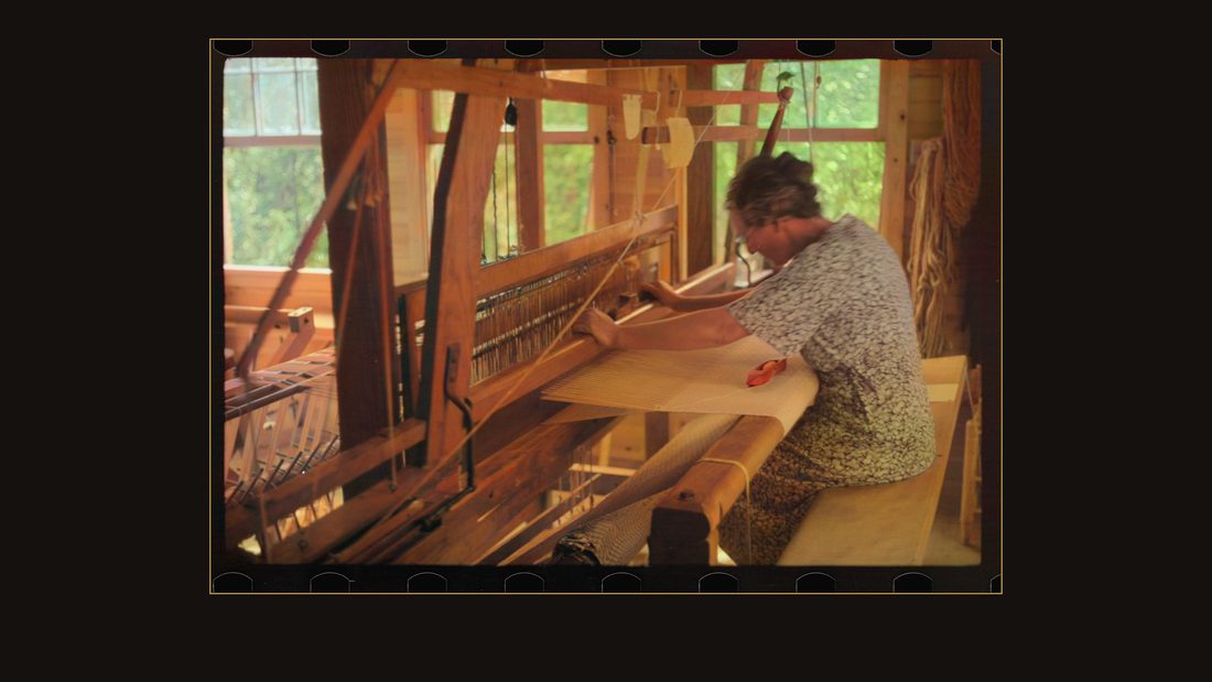
R25 Weaving at Cumberland Homesteads, Crossville, Tennessee
Ben Shahn · 1937 · Library of Congress · FSA/OWI · AI-colorized. View the original.
A weaver at her loom.
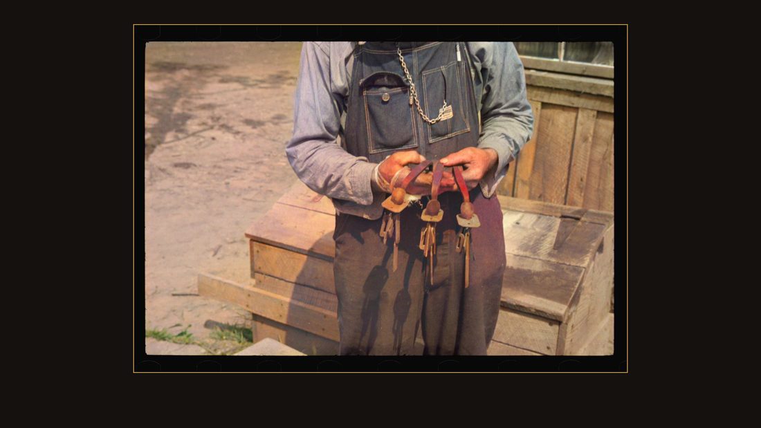
R26 Iron worker with his work, Cumberland Farms, Tennessee
Ben Shahn · 1937 · Library of Congress · FSA/OWI · AI-colorized. View the original.
And an iron worker with his work — hand-forged birds on a bench.
The dead land
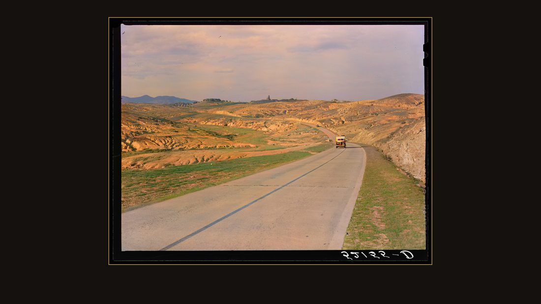
R29 Copper mining section between Ducktown and Copper Hill, Tennessee. Fumes from smelting copper for sulphuric acid have destroyed all vegetation and eroded the land
Marion Post Wolcott · September 1939 · Library of Congress · FSA/OWI · AI-colorized. View the original.
September, nineteen thirty-nine. Marion Post drove into the far southeastern corner of the state, where copper had been smelted for ninety years. Her caption for this basin: fumes from smelting copper for sulphuric acid have destroyed all vegetation and eroded the land.
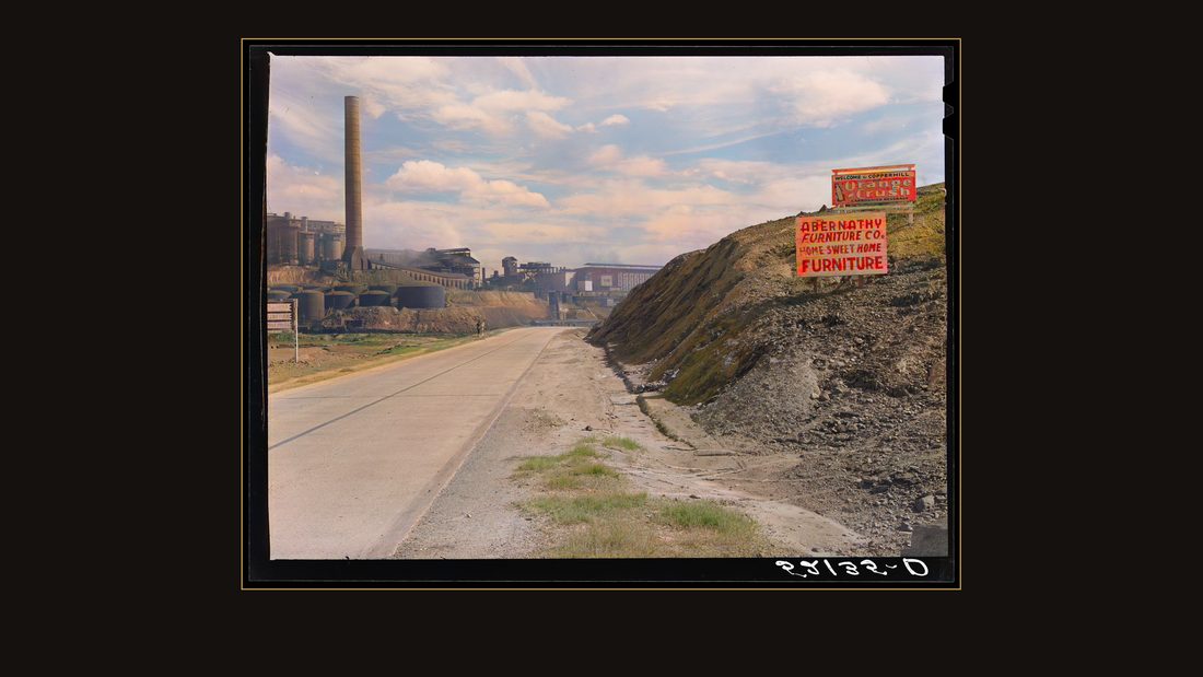
R27 Copper mining and sulfuric acid plant. Copperhill, Tennessee
Marion Post Wolcott · September 1939 · Library of Congress · FSA/OWI · AI-colorized. View the original.
The smelter and acid plant at Copperhill.
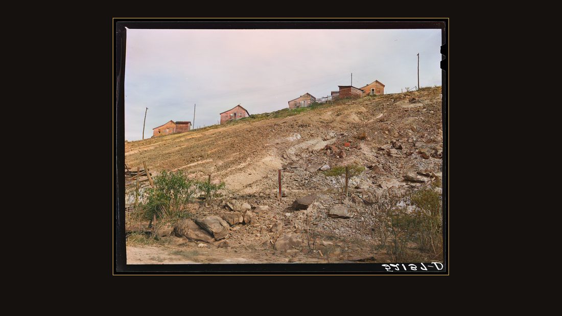
R28 The homes of copper miners. Copperhill, Tennessee
Marion Post Wolcott · September 1939 · Library of Congress · FSA/OWI · AI-colorized. View the original.
The miners' homes, on hills with no grass.
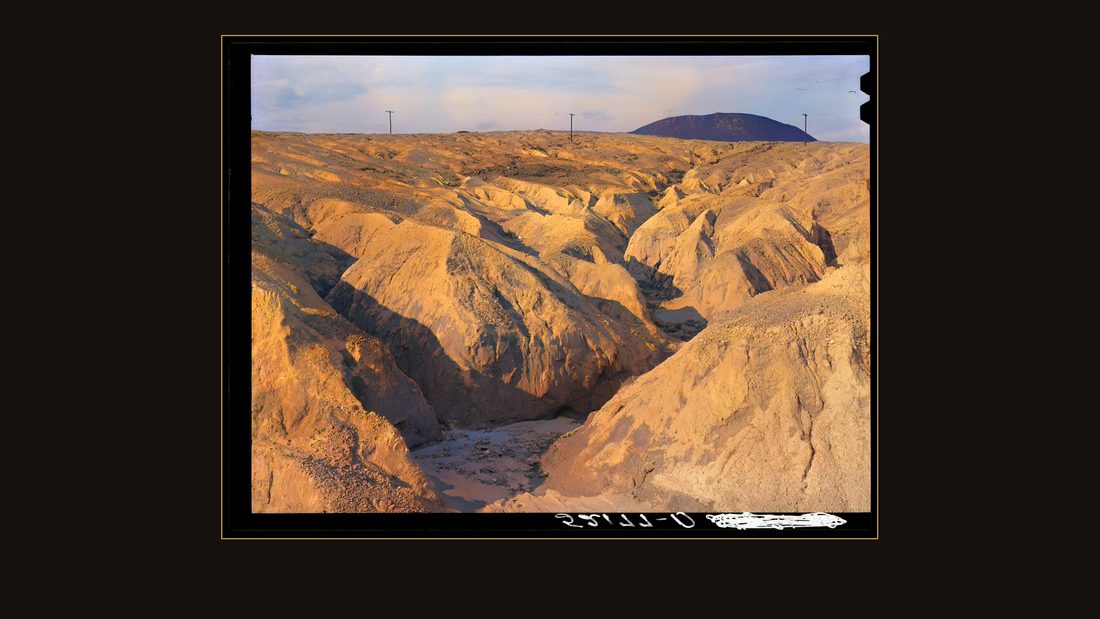
R30 Copper mining section between Ducktown and Copperhill, Tennessee. Fumes from smelting copper for sulfuric acid have destroyed all vegetation and eroded land
Marion Post Wolcott · September 1939 · Library of Congress · FSA/OWI · AI-colorized. View the original.
Square mile after square mile of the Copper Basin looked like this — red, gullied, bare to the rock. And people lived in the middle of it.
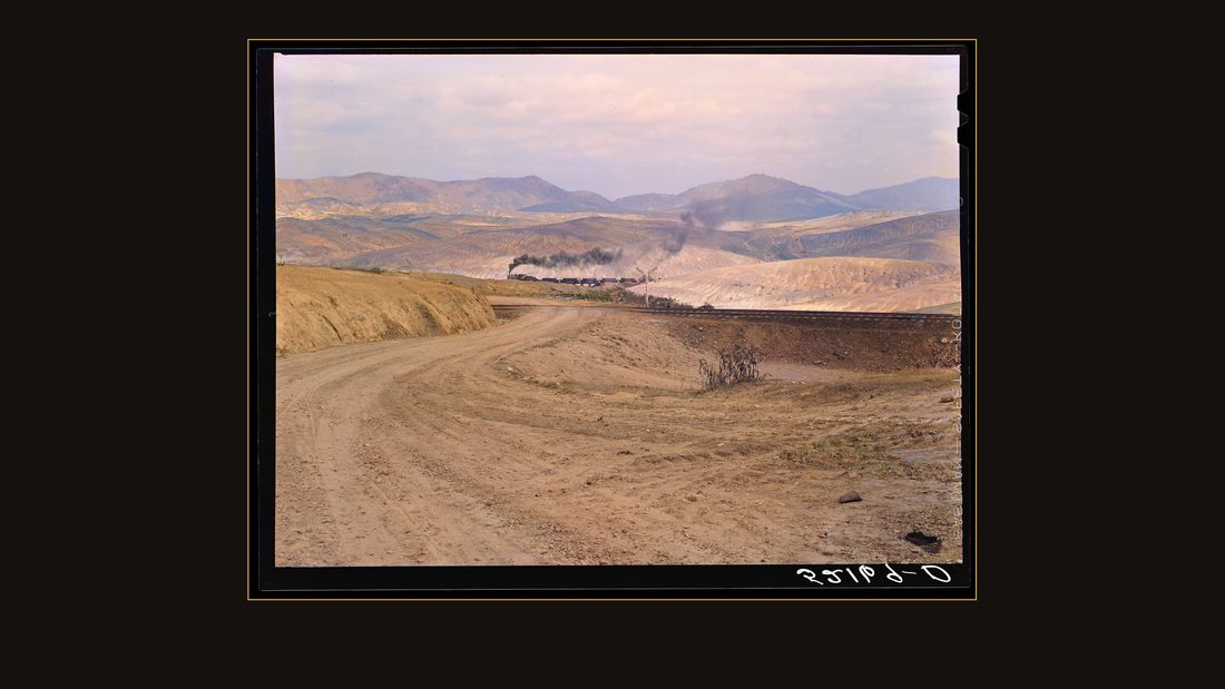
R31 Train bringing copper ore out of mine. Ducktown, Tennessee. Fumes from smelting copper for sulfuric acid have destroyed all vegetation and eroded the land
Marion Post Wolcott · September 1939 · Library of Congress · FSA/OWI · AI-colorized. View the original.
A train hauling ore out of the mine.
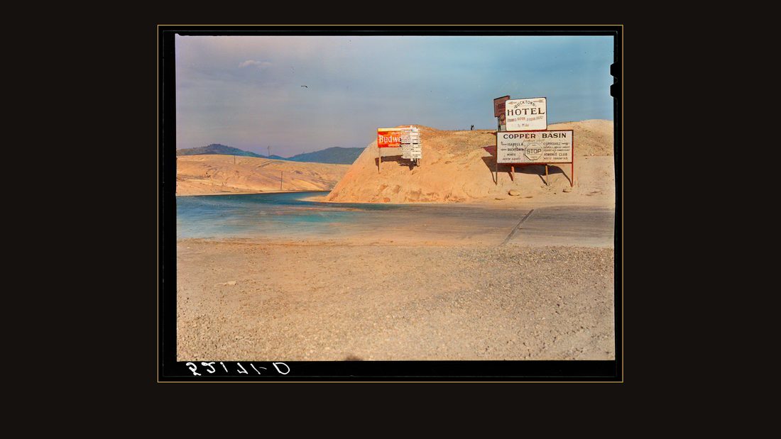
R32 Highway signs and billboards. Ducktown, Tennessee
Marion Post Wolcott · September 1939 · Library of Congress · FSA/OWI · AI-colorized. View the original.
The Ducktown Hotel, and the highway signboard pointing to Atlanta, Chattanooga, Cleveland, Murphy, Copperhill.
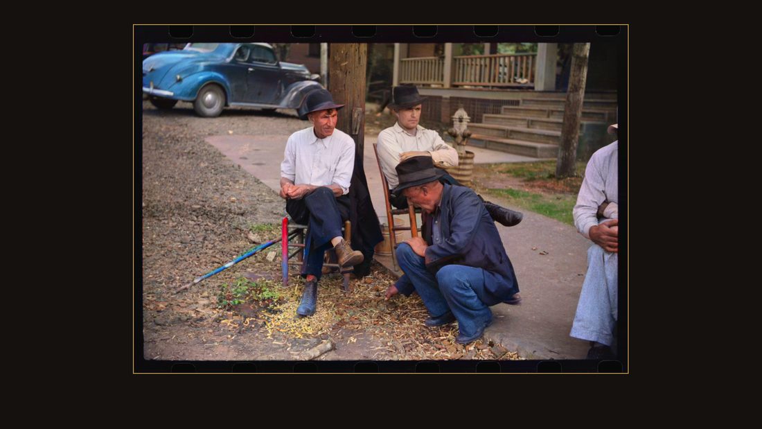
R33 Picketing. Copper miners on strike waiting for scabs to come out of mines. Ducktown, Tennessee
Marion Post Wolcott · October 1939 · Library of Congress · FSA/OWI · AI-colorized. View the original.
And when she was there, the mines were struck. Her caption, plainly: copper miners on strike, waiting for scabs to come out of mines. Ducktown, Tennessee.
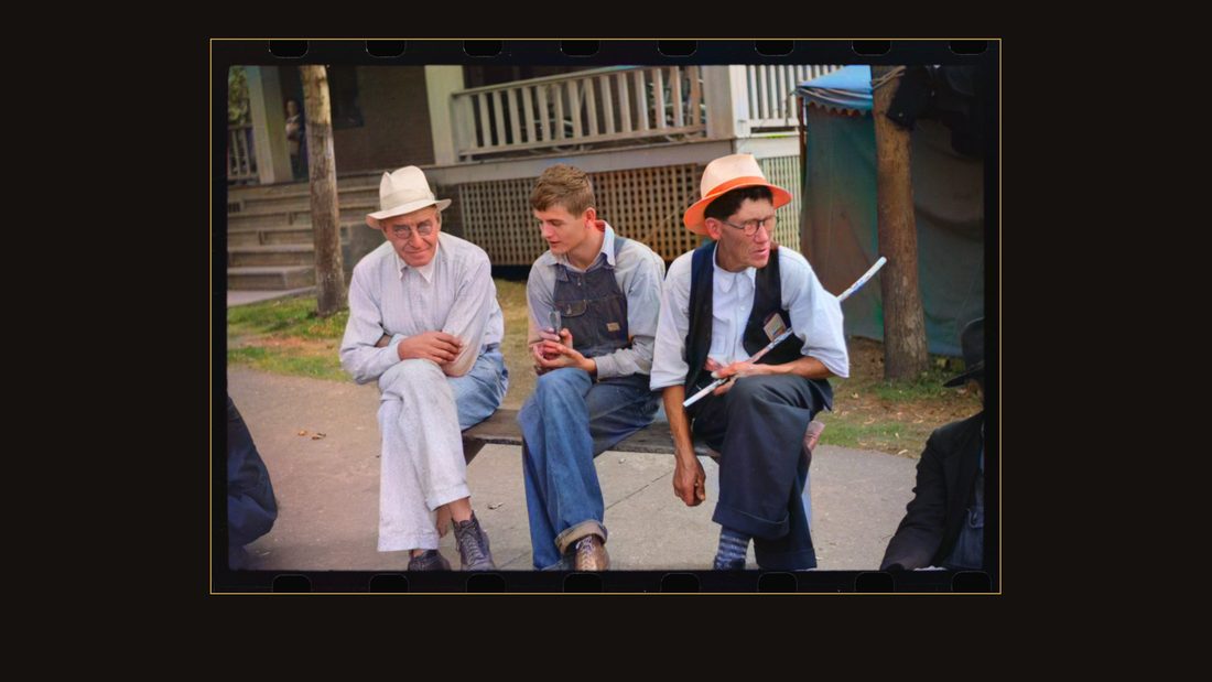
R34 Picket's sign outside copper mine during strike. Ducktown, Tennessee
Marion Post Wolcott · October 1939 · Library of Congress · FSA/OWI · AI-colorized. View the original.
The picket's sign, outside the mine.
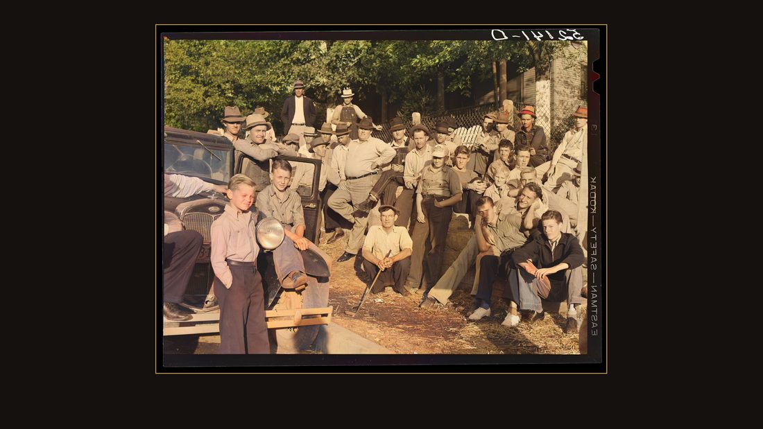
R35 Copper miners on strike waiting for scabs to come out of mines. Ducktown, Tennessee
Marion Post Wolcott · September 1939 · Library of Congress · FSA/OWI · AI-colorized. View the original.
Strikers, waiting.
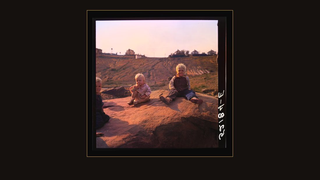
R36 Copper miner's children. Copperhill, Tennessee
Marion Post Wolcott · September 1939 · Library of Congress · FSA/OWI · AI-colorized. View the original.
And a copper miner's children, on bare rock above the works. Whatever the strike won or lost, this is where they lived.
What the power did
R37 Norris Dam, Tennessee (Tennessee Valley Authority (TVA)). Norris Dam pushes back the Tennessee River seventy-two miles to form Norris Lake
Arthur Rothstein · June 1942 · Library of Congress · FSA/OWI · AI-colorized. View the original.
Then the war came, and the valley's water turned into a weapon. In June of nineteen forty-two, Arthur Rothstein photographed Norris Dam — the first dam, the one that had taken Loyston — six years into its work.
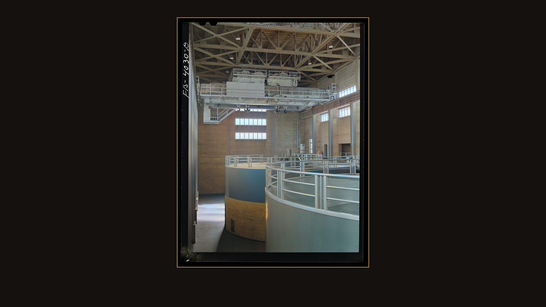
R38 Norris Dam, Tennessee (Tennessee Valley Authority (TVA)). Generators
Arthur Rothstein · June 1942 · Library of Congress · FSA/OWI · AI-colorized. View the original.
The generator hall.

R39 Norris Dam, Tennessee (Tennessee Valley Authority (TVA)). Fishing at the base of Norris Dam
Arthur Rothstein · June 1942 · Library of Congress · FSA/OWI · AI-colorized. View the original.
A man fishing at the base of the dam, in the water that used to be a river.
R40 Knox County, Tennessee (Tennessee Valley Authority (TVA)). Girls are shown how to operate an electric refrigerator at the Farragut Agricultural School
Arthur Rothstein · June 1942 · Library of Congress · FSA/OWI · AI-colorized. View the original.
In the farm kitchens of Knox County, Rothstein photographed what the dam had actually delivered. His caption: girls are shown how to operate an electric range.
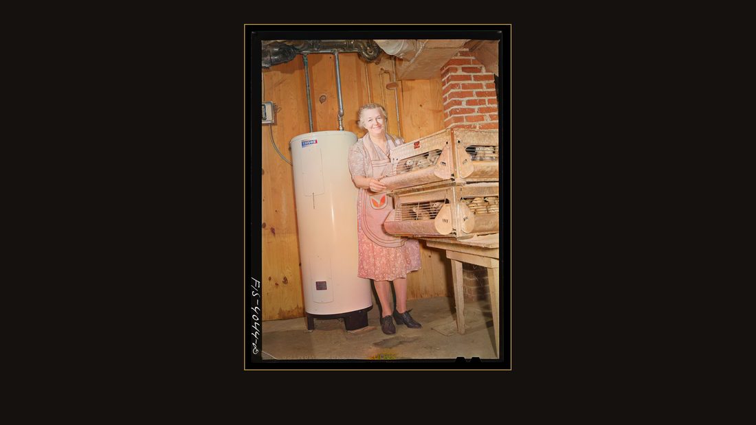
R41 Knox County, Tennessee (Tennessee Valley Authority (TVA)). Mrs. Wiegel, farm wife, with electric brooder and hot water heater
Arthur Rothstein · June 1942 · Library of Congress · FSA/OWI · AI-colorized. View the original.
Mrs. Wiegel, farm wife, with an electric brooder for her chicks.

R42 Knox County, Tennessee (Tennessee Valley Authority (TVA)). Mrs. Wiegel uses electric vacuum cleaner
Arthur Rothstein · June 1942 · Library of Congress · FSA/OWI · AI-colorized. View the original.
And with her vacuum cleaner. Ten years earlier, almost no farm in these counties had a wire to its door.

R43 Knox County, Tennessee (Tennessee Valley Authority (TVA)). Elmer Butter, farmer
Arthur Rothstein · June 1942 · Library of Congress · FSA/OWI · AI-colorized. View the original.
Elmer Butter, farmer, Knox County.
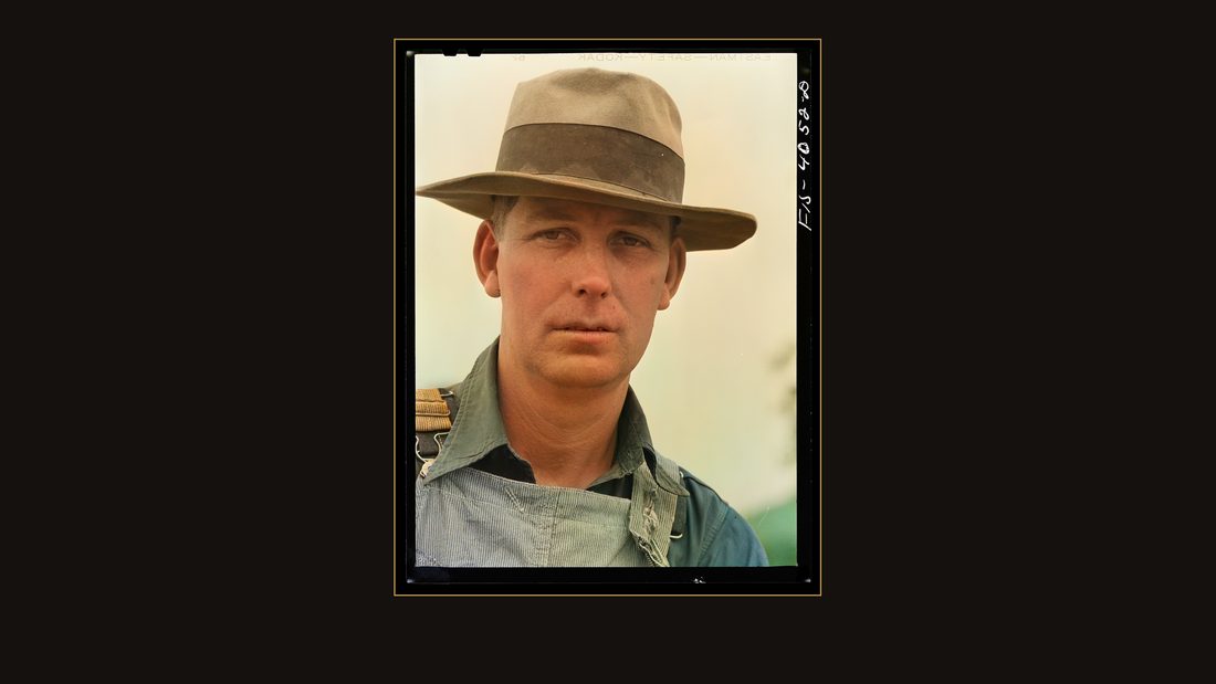
R44 Knox County, Tennessee (Tennessee Valley Authority (TVA)). Haywood Aycock, farmer
Arthur Rothstein · June 1942 · Library of Congress · FSA/OWI · AI-colorized. View the original.
Haywood Aycock, farmer. The captions give the names and nothing else.
Thirteen months
S4
TVA · The Douglas Project · Tech. Report No. 10 (1949) · p. 8.
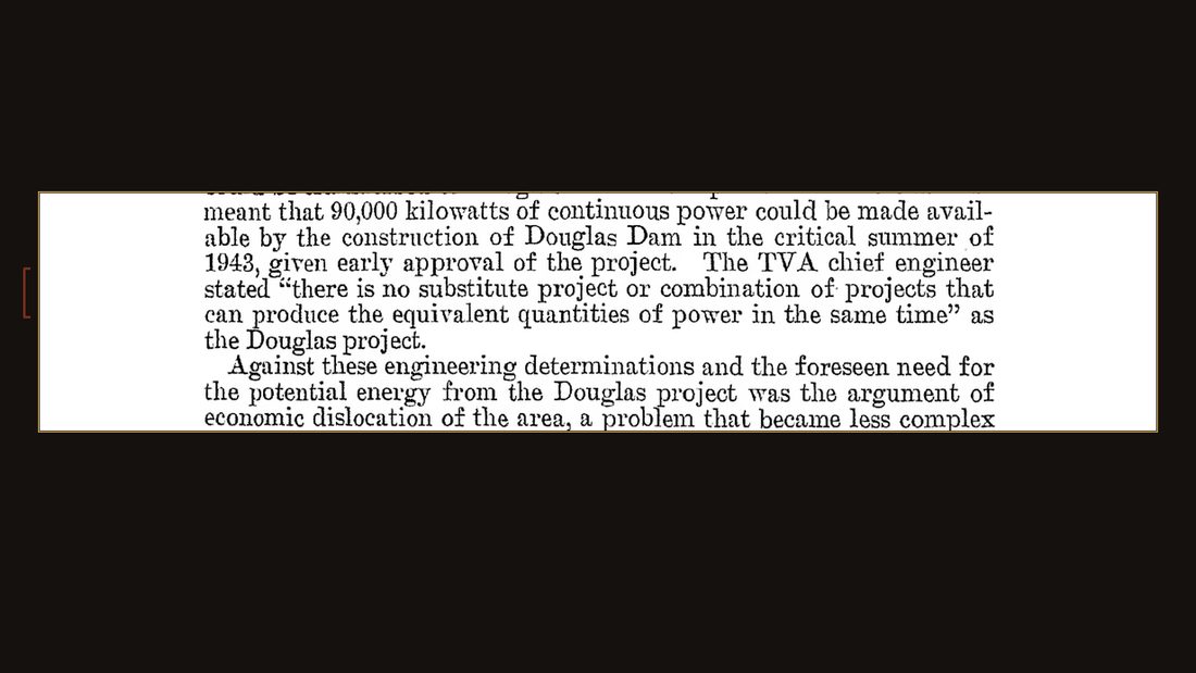
By then the government needed far more than farm kitchens could use. Aluminum for aircraft is made of electricity, and the war ran on aluminum. TVA's chief engineer told Congress there was no substitute project that could produce the power in the time required.

R45 Douglas Dam, Tennessee. Tennessee Valley Authority (TVA). Welder
Arthur Rothstein · June 1942 · Library of Congress · FSA/OWI · AI-colorized. View the original.
Congress authorized Douglas Dam on January thirtieth, nineteen forty-two — seven weeks after Pearl Harbor. Construction started February second. Three days later.
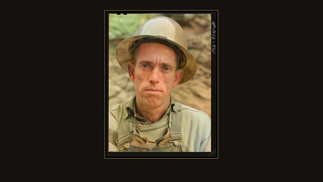
R46 Douglas Dam, Tennessee. Tennessee Valley Authority (TVA). Workman
Arthur Rothstein · June 1942 · Library of Congress · FSA/OWI · AI-colorized. View the original.
The target: ninety thousand kilowatts, continuous, in time for the critical summer of nineteen forty-three. Rothstein and Alfred Palmer photographed the sprint.
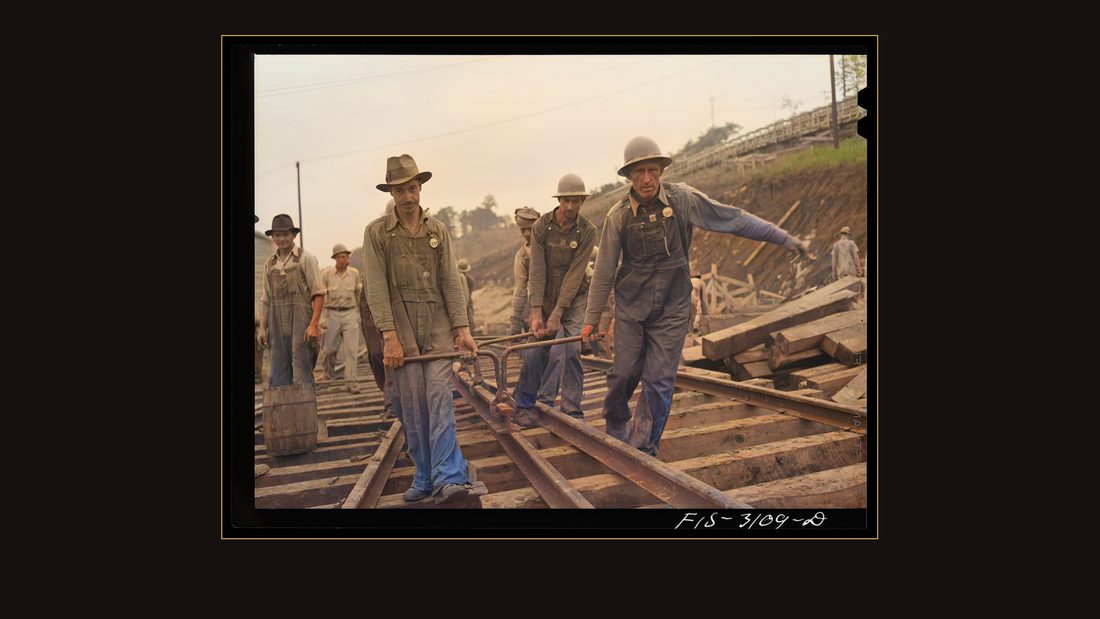
R47 Douglas Dam, Tennessee. Tennessee Valley Authority (TVA). Laying track
Arthur Rothstein · June 1942 · Library of Congress · FSA/OWI · AI-colorized. View the original.
Laying track.
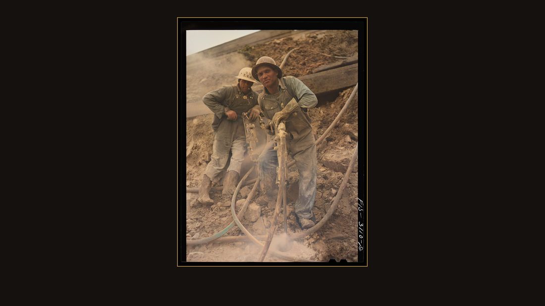
R48 Douglas Dam, Tennessee. Tennessee Valley Authority (TVA). Jackhammer operator
Arthur Rothstein · June 1942 · Library of Congress · FSA/OWI · AI-colorized. View the original.
A jackhammer operator in the rock cut.
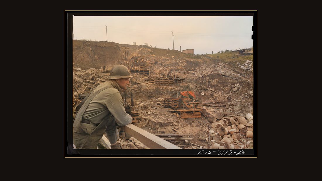
R49 Douglas Dam, Tennessee. Tennessee Valley Authority (TVA). Construction
Arthur Rothstein · June 1942 · Library of Congress · FSA/OWI · AI-colorized. View the original.
The dam wall climbing.
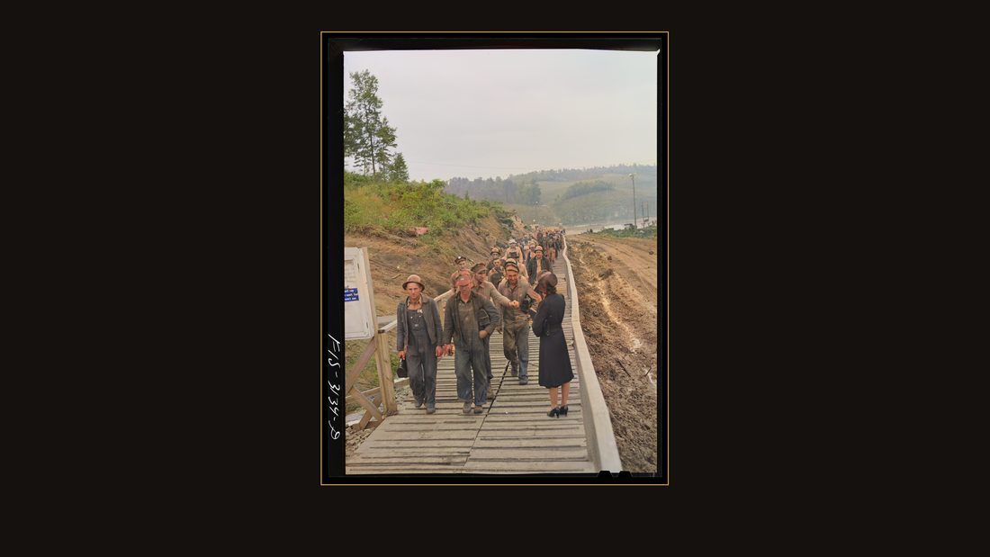
R50 Douglas Dam, Tennessee. Tennessee Valley Authority (TVA). Workers leaving the job
Arthur Rothstein · June 1942 · Library of Congress · FSA/OWI · AI-colorized. View the original.
Workers leaving the job at the whistle.
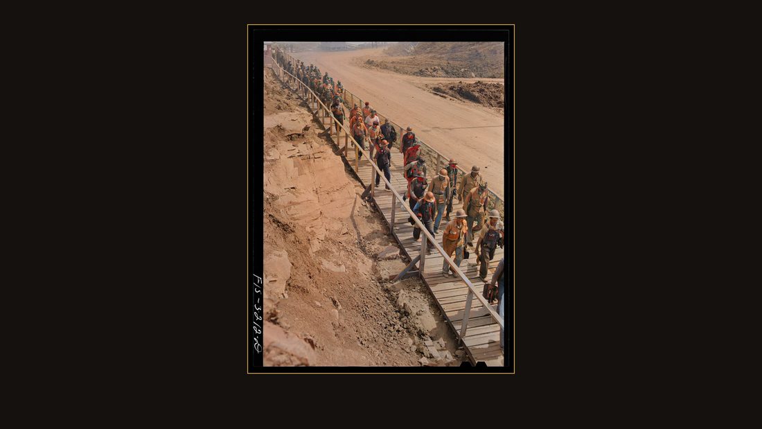
R51 Douglas Dam, Tennessee. Tennessee Valley Authority (TVA). Change of shift
Arthur Rothstein · June 1942 · Library of Congress · FSA/OWI · AI-colorized. View the original.
Change of shift. The job ran around the clock.
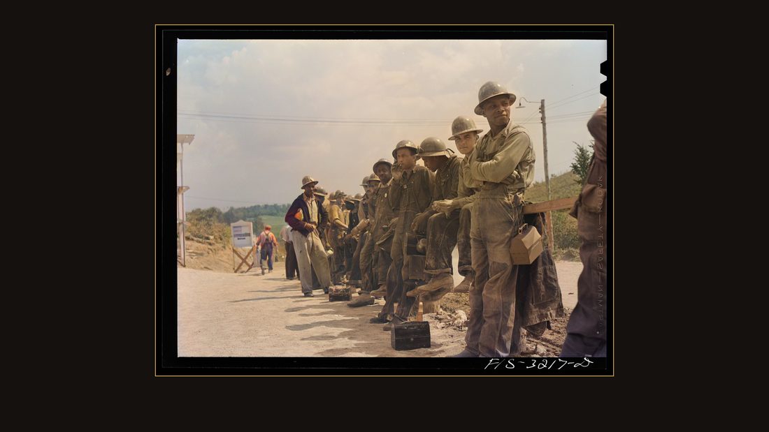
R53 Douglas Dam, Tennessee. Tennessee Valley Authority (TVA). Workers at the timekeeper's office
Arthur Rothstein · June 1942 · Library of Congress · FSA/OWI · AI-colorized. View the original.
The line at the timekeeper's office.
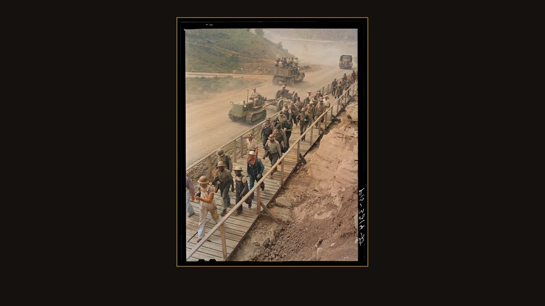
R52 Douglas Dam, Tennessee. Tennessee Valley Authority (TVA). Change of shift
Arthur Rothstein · June 1942 · Library of Congress · FSA/OWI · AI-colorized. View the original.
Another shift crossing.
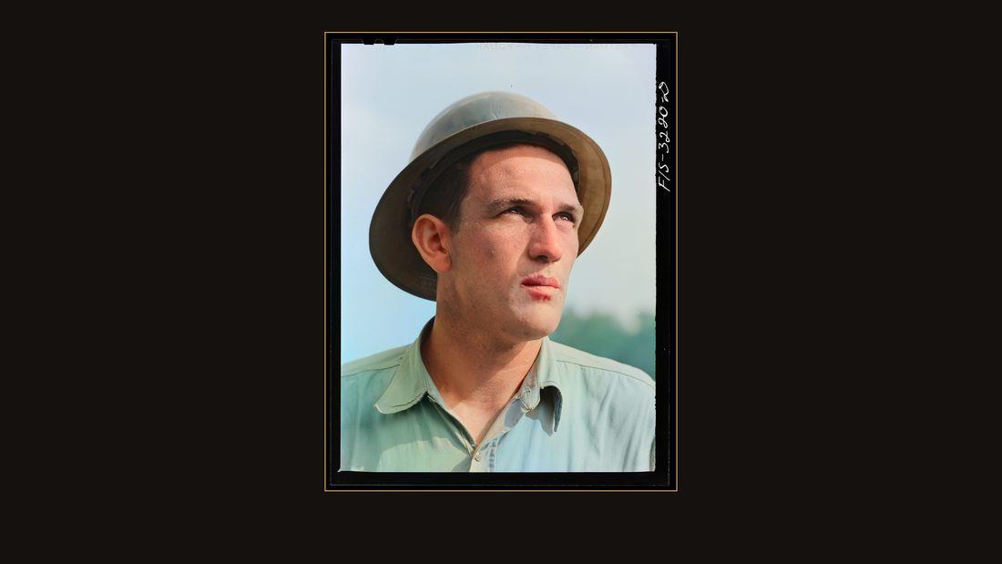
R54 Douglas Dam, Tennessee. Tennessee Valley Authority (TVA). Foreman
Arthur Rothstein · June 1942 · Library of Congress · FSA/OWI · AI-colorized. View the original.
The foreman.
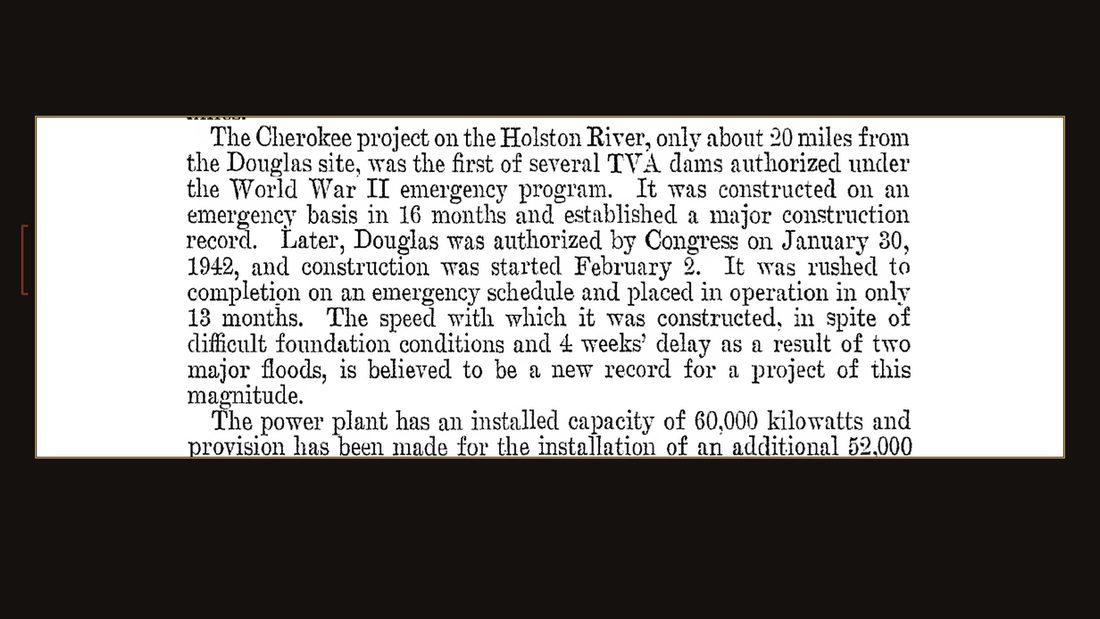
S6
TVA · The Douglas Project · Tech. Report No. 10 (1949) · p. 1.
It worked. Despite the foundation, and despite two floods that cost four weeks, Douglas Dam went from first concrete to operation in thirteen months — a record, the project report says, for a job of its size.
![Fort Loudon [i.e., Loudoun] Dam, Tennessee (Tennessee Valley Authority (TVA)). Drillers at work](img/R55.jpg)
R55 Fort Loudon [i.e., Loudoun] Dam, Tennessee (Tennessee Valley Authority (TVA)). Drillers at work
Jack Delano · August 1942 · Library of Congress · FSA/OWI · AI-colorized. View the original.
The sprint wasn't one dam. At Fort Loudoun, downstream, Jack Delano photographed the drillers.
![Fort Loudon [i.e., Loudoun] Dam, Tennessee (Tennessee Valley Authority (TVA)). Workman munching a sandwich while operating a drilling machine](img/R56.jpg)
R56 Fort Loudon [i.e., Loudoun] Dam, Tennessee (Tennessee Valley Authority (TVA)). Workman munching a sandwich while operating a drilling machine
Jack Delano · August 1942 · Library of Congress · FSA/OWI · AI-colorized. View the original.
A workman with his sandwich.
![Fort Loudon [i.e., Loudoun] Dam, Tennessee. Tennessee Valley Authority (TVA). Construction at night](img/R57.jpg)
R57 Fort Loudon [i.e., Loudoun] Dam, Tennessee. Tennessee Valley Authority (TVA). Construction at night
Arthur Rothstein · June 1942 · Library of Congress · FSA/OWI · AI-colorized. View the original.
Rothstein shot Fort Loudoun after dark — his caption: construction at night.
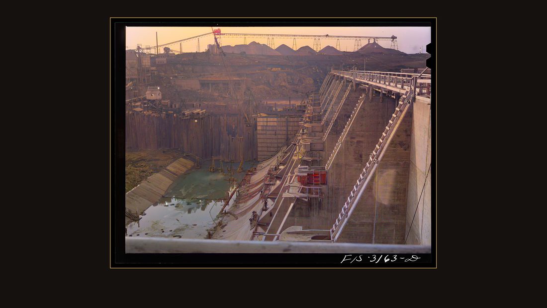
R58 Fort Loudoun Dam, Tennessee. Tennessee Valley Authority (TVA). Construction at night
Arthur Rothstein · June 1942 · Library of Congress · FSA/OWI · AI-colorized. View the original.
The cranes against the dark.
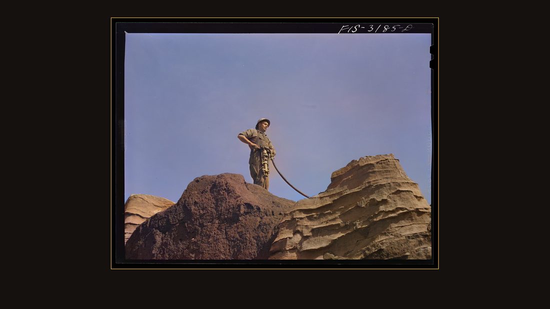
R59 Fort Loudoun Dam, Tennessee. Tennessee Valley Authority (TVA). Jackhammer operator
Arthur Rothstein · June 1942 · Library of Congress · FSA/OWI · AI-colorized. View the original.
A jackhammer man, up on the rock.
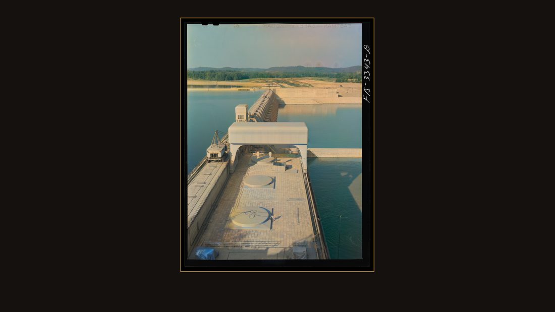
R60 Watts Bar Dam, Tennessee. Tennessee Valley Authority (TVA)
Arthur Rothstein · June 1942 · Library of Congress · FSA/OWI · AI-colorized. View the original.
Watts Bar, on the river between Knoxville and Chattanooga.
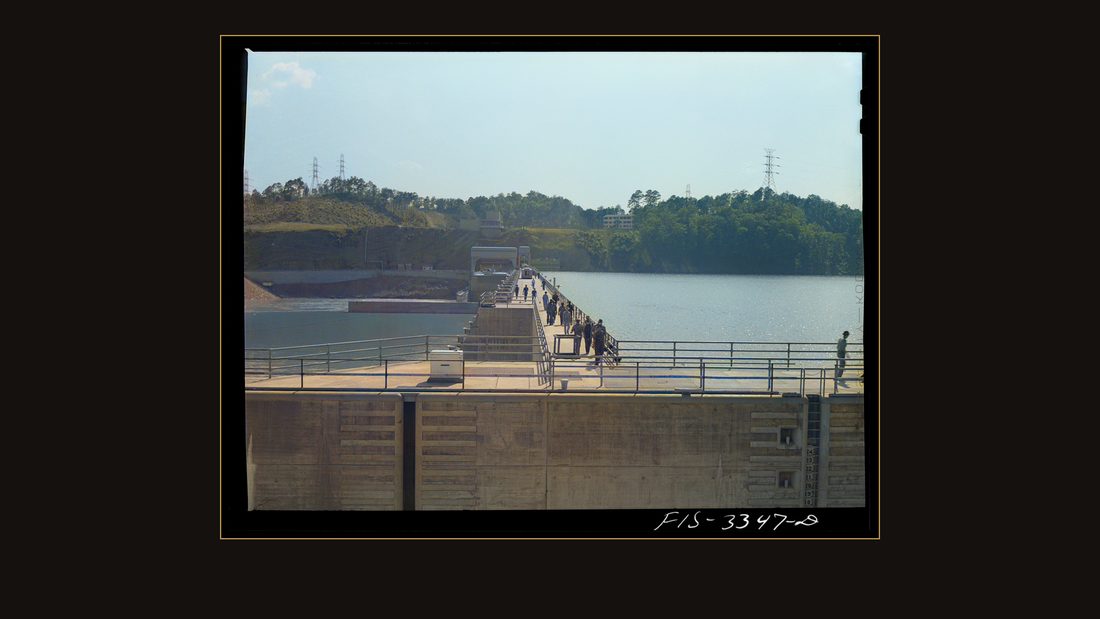
R61 Watts Bar Dam, Tennessee. Tennessee Valley Authority (TVA). Workers crossing the dam
Arthur Rothstein · June 1942 · Library of Congress · FSA/OWI · AI-colorized. View the original.
Workers crossing the dam.
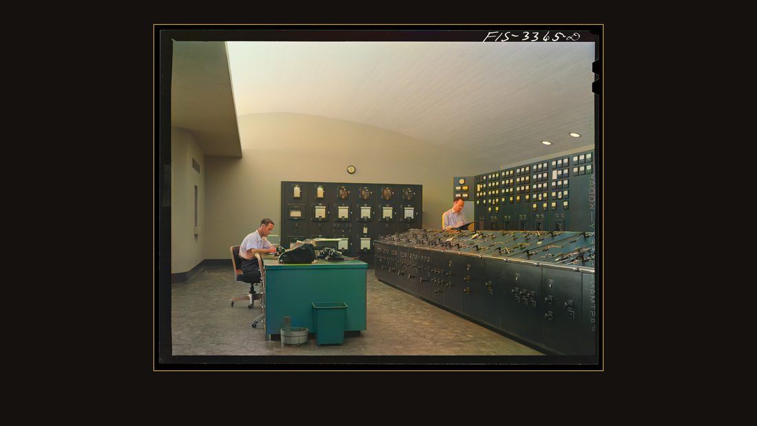
R62 Watts Bar Dam, Tennessee. Tennessee Valley Authority (TVA). Control room
Arthur Rothstein · June 1942 · Library of Congress · FSA/OWI · AI-colorized. View the original.
And the control room — one woman, one wall of dials.
The lit valley
R63 The city of Chattanooga, Tennessee on the Tennessee River
Jack Delano · August 1942 · Library of Congress · FSA/OWI · AI-colorized. View the original.
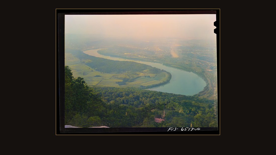
August, nineteen forty-two. Jack Delano climbed Lookout Mountain and photographed Chattanooga on its river bend.
R64 Chattanooga, Tennessee (vicinity). The suburbs seen at night from the "incline railway" on Lookout Mountain
Jack Delano · August 1942 · Library of Congress · FSA/OWI · AI-colorized. View the original.
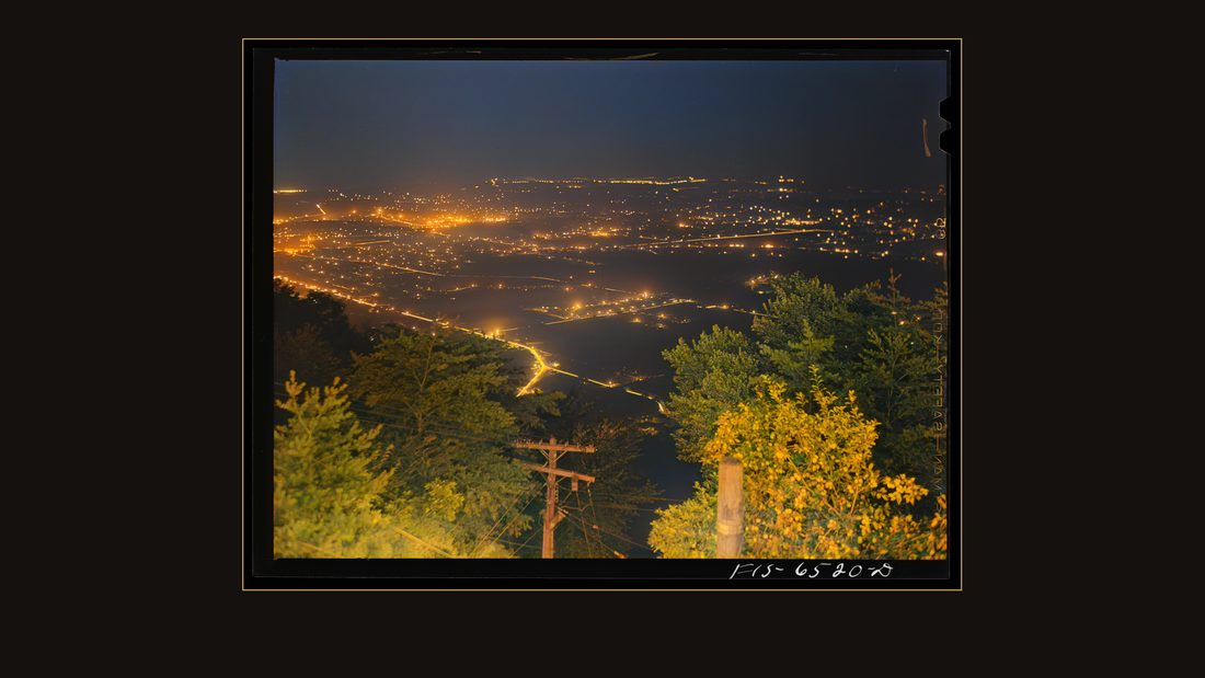
And after dark, from the incline railway, he shot the suburbs burning electric below — a valley that had been kerosene lamps a decade before.
R65 Chattanooga, Tennessee (vicinity). The suburbs seen at night from the "incline railway" on Lookout Mountain
Jack Delano · August 1942 · Library of Congress · FSA/OWI · AI-colorized. View the original.
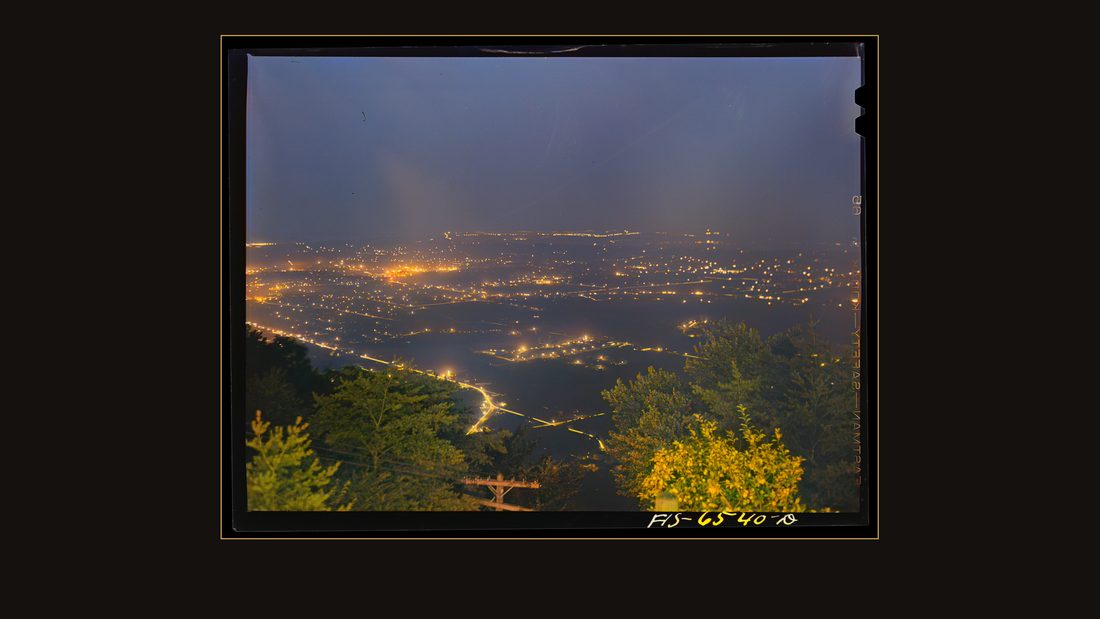
The same view, wider. Every light is the dams.

R66 Chickamauga Dam, Tennessee (Tennessee Valley Authority (TVA)). Control room
Jack Delano · August 1942 · Library of Congress · FSA/OWI · AI-colorized. View the original.
The control room at Chickamauga Dam.
R67 Chickamauga Dam, Tennessee (Tennessee Valley Authority (TVA)). Generators
Jack Delano · August 1942 · Library of Congress · FSA/OWI · AI-colorized. View the original.
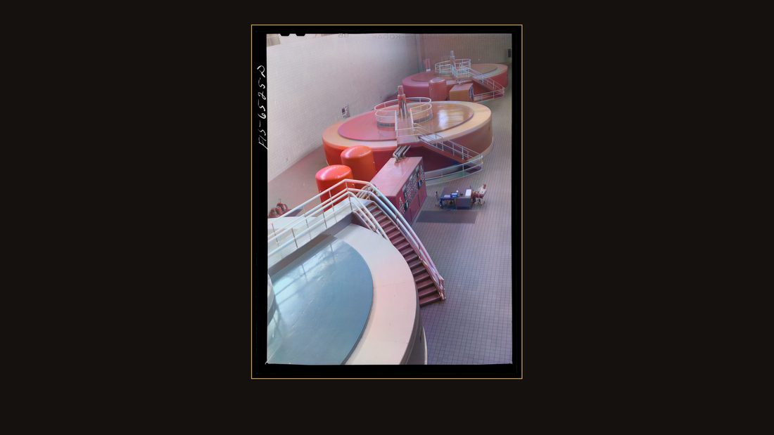
The generators.
The overnight run
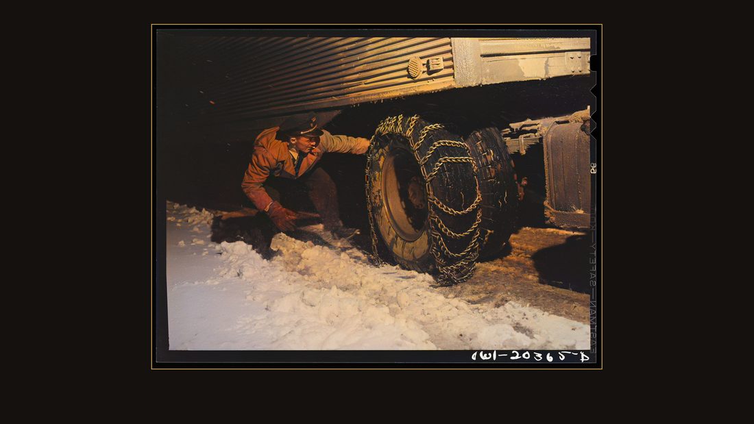
R68 Jim Fletcher putting on chains in order to get the truck across the Blue Ridge Mountains of eastern Tennessee during a snow storm
John Vachon · March 1943 · Library of Congress · FSA/OWI · AI-colorized. View the original.
March, nineteen forty-three. A snowstorm in the mountains near Elizabethton. John Vachon rode the overnight freight run and photographed the driver — Jim Fletcher. If that name sounds familiar, you may have met him on this channel already, gassing up in Boone, North Carolina, on the same route, in the same snow.
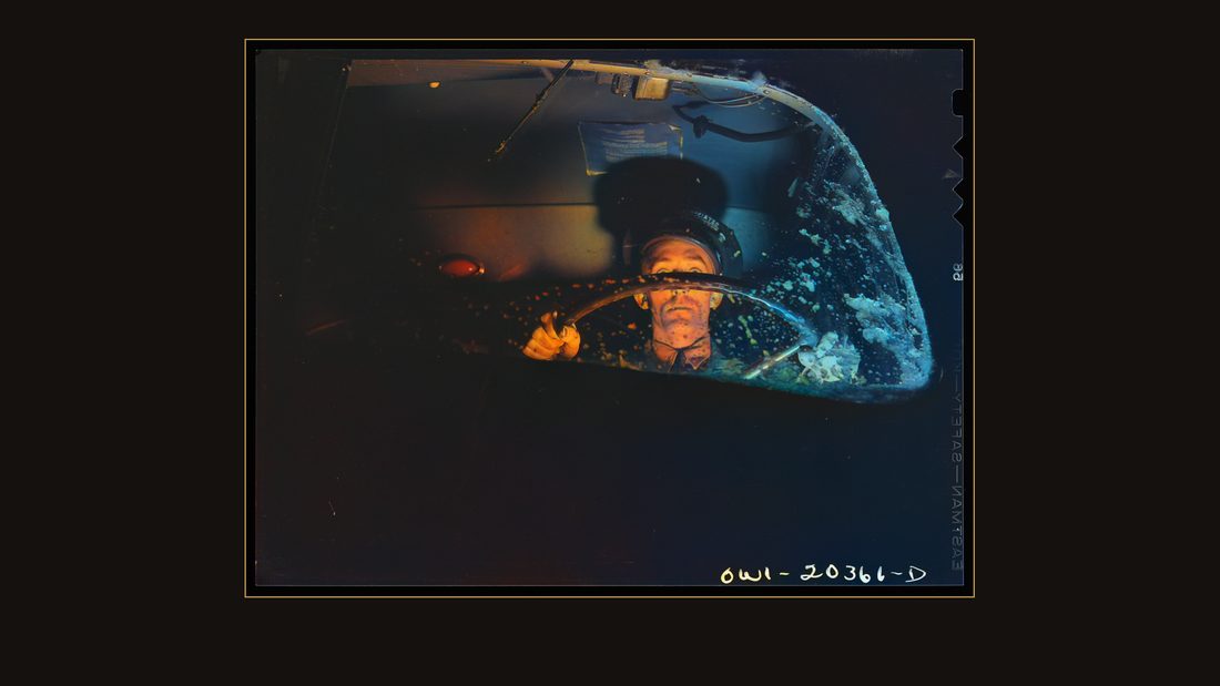
R69 Jim Fletcher driving through eastern Tennessee mountains during a snow storm
John Vachon · March 1943 · Library of Congress · FSA/OWI · AI-colorized. View the original.
Fletcher, driving through eastern Tennessee.
![[Untitled photo, possibly related to: Jim Fletcher stopping to put on chains while crossing the Blue Ridge Mountains in Tennessee during a snow storm]](img/R70.jpg)
R70 [Untitled photo, possibly related to: Jim Fletcher stopping to put on chains while crossing the Blue Ridge Mountains in Tennessee during a snow storm]
John Vachon · March 1943 · Library of Congress · FSA/OWI · AI-colorized. View the original.
Stopping to chain up.
![[Untitled photo, possibly related to: Jim Fletcher driving through eastern Tennessee mountains during a snow storm]](img/R71.jpg)
R71 [Untitled photo, possibly related to: Jim Fletcher driving through eastern Tennessee mountains during a snow storm]
John Vachon · March 1943 · Library of Congress · FSA/OWI · AI-colorized. View the original.
The road ahead, in the headlights, through the wipers.
The bus out
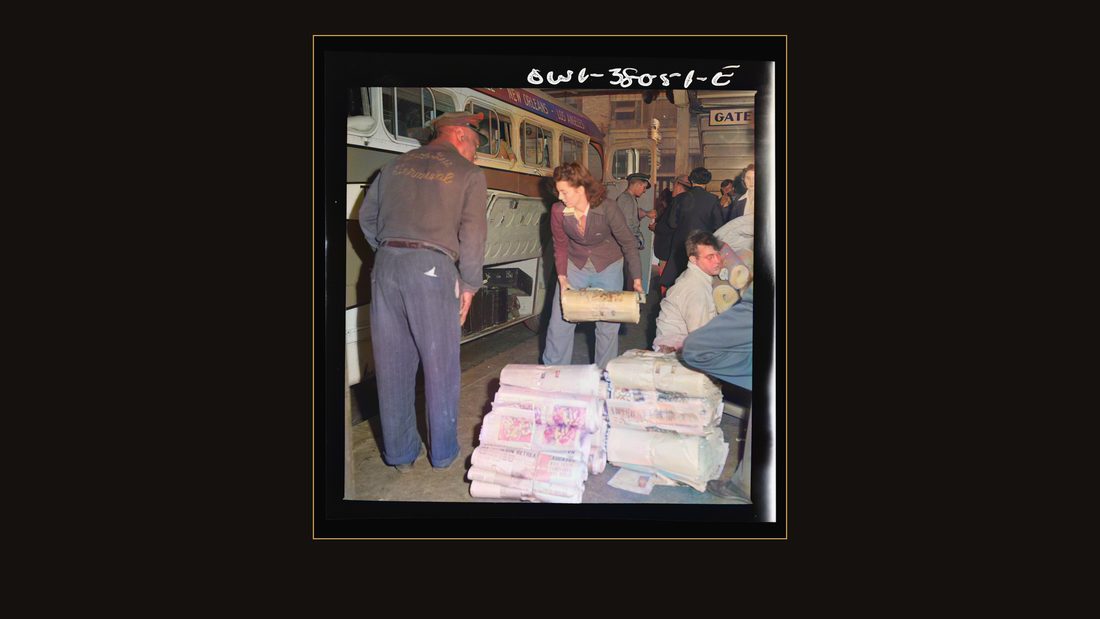
R72 Bus trip from Knoxville, Tennessee to Washington, D.C. Girl baggage clerk loading newspapers onto a bus at Knoxville, Tennessee. These will be left at small towns along the way
Esther Bubley · September 1943 · Library of Congress · FSA/OWI · AI-colorized. View the original.
September, nineteen forty-three. The last photographer through was Esther Bubley, riding the buses. At the Knoxville depot, a girl baggage clerk loaded newspapers — her caption says they'd be left at small towns along the way.
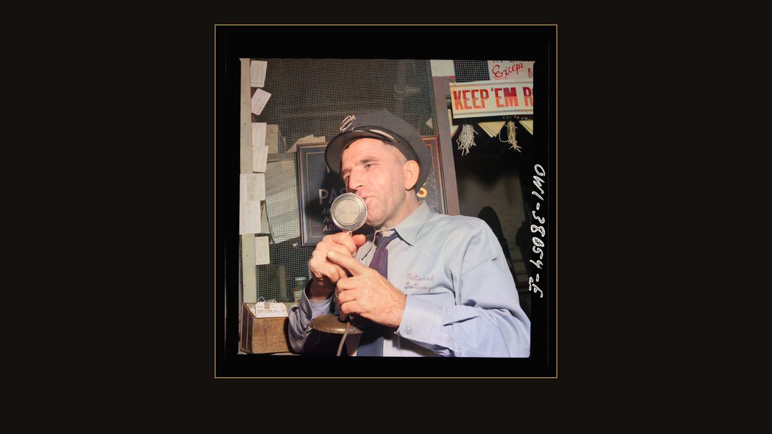
R73 Bus trip from Knoxville, Tennessee to Washington, D.C. A Trailway bus driver calling his own bus. There is no official starter at Knoxville to do this
Esther Bubley · September 1943 · Library of Congress · FSA/OWI · AI-colorized. View the original.
A Trailway driver calling his own bus. There was no official starter at Knoxville to do it for him.
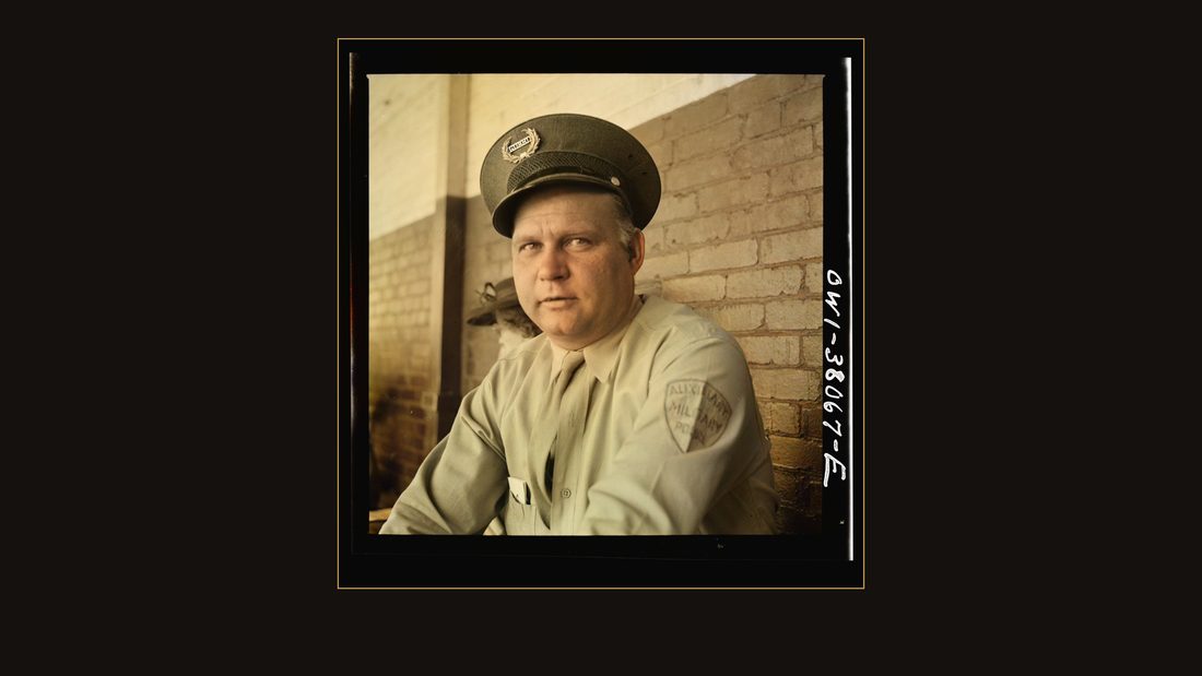
R74 Bus trip from Knoxville, Tennessee to Washington, D.C. Auxiliary MP (Military Police) waiting for bus at Chattanooga, Tennessee
Esther Bubley · September 1943 · Library of Congress · FSA/OWI · AI-colorized. View the original.
A military policeman, waiting at Chattanooga.
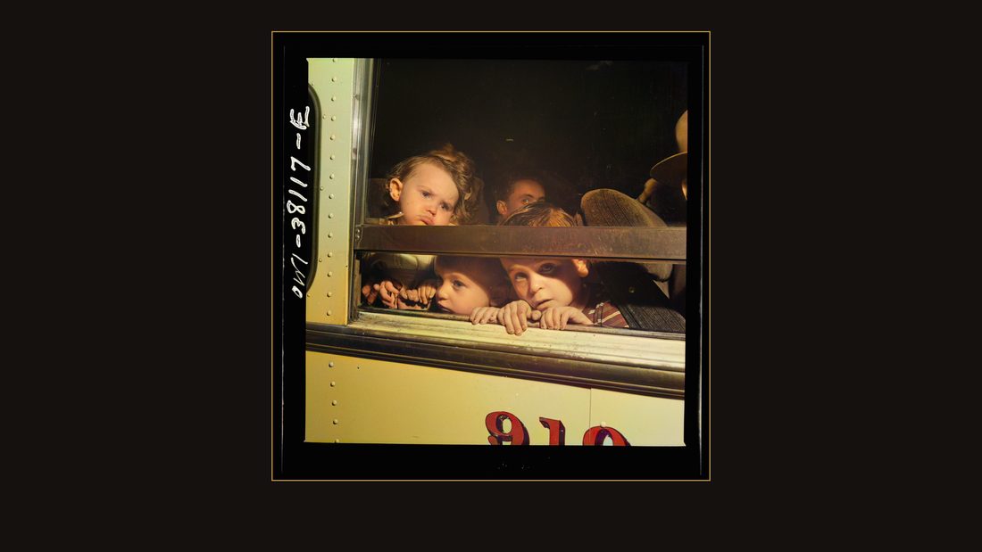
R75 Bus trip from Knoxville, Tennessee, to Washington, D.C. Bus passengers at Knoxville, Tennessee
Esther Bubley · September 1943 · Library of Congress · FSA/OWI · AI-colorized. View the original.
Passengers at the window, Knoxville.
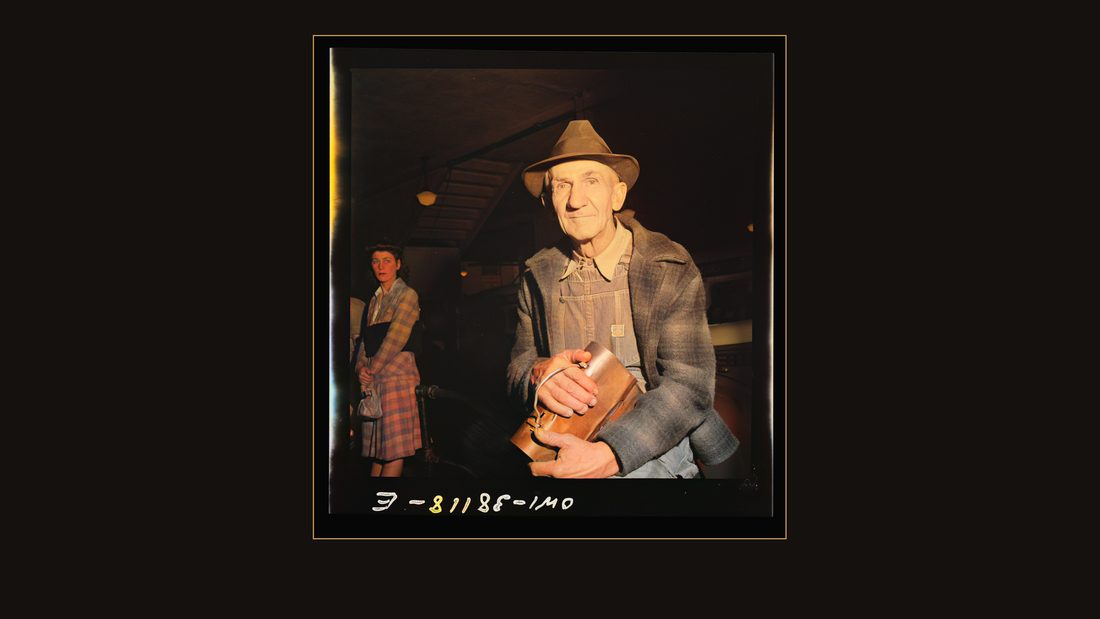
R76 Bus trip from Knoxville, Tennessee, to Washington, D.C. Workman waiting for bus at Knoxville, Tennessee
Esther Bubley · September 1943 · Library of Congress · FSA/OWI · AI-colorized. View the original.
A workman waiting for the bus.
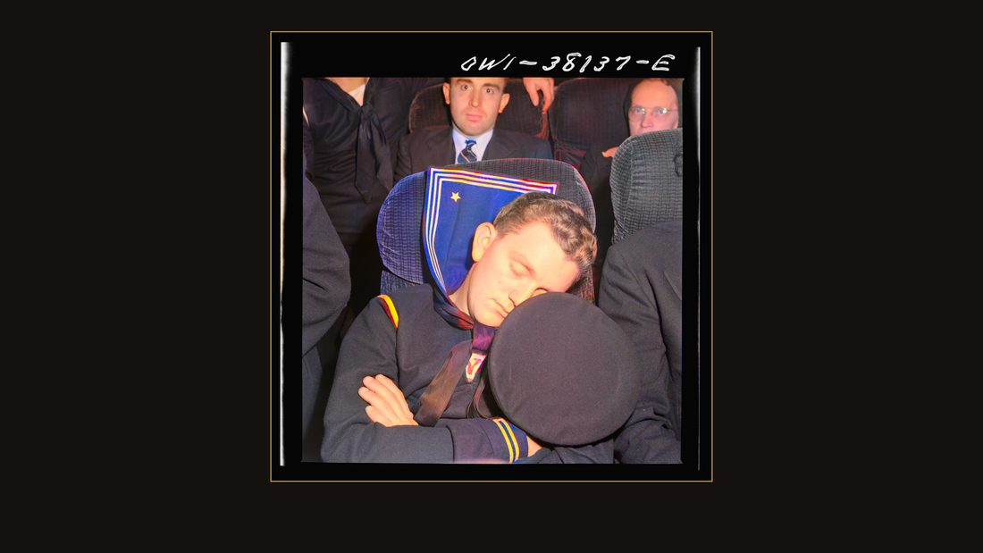
R77 Bus trip from Knoxville, Tennessee, to Washington, D.C. Sailor on bus enroute to Washington from Roanoke
Esther Bubley · September 1943 · Library of Congress · FSA/OWI · AI-colorized. View the original.
A sailor asleep on the run to Washington.
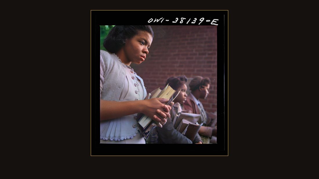
R78 Bus trip from Knoxville, Tennessee, to Washington, D.C. Schoolgirl waiting to get on bus at small town in Tennessee
Esther Bubley · September 1943 · Library of Congress · FSA/OWI · AI-colorized. View the original.
And a schoolgirl, waiting at a small town stop. The next year, the whole file — printed and killed alike — went to the Library of Congress, where it has waited in black and white ever since.
R64 Chattanooga, Tennessee (vicinity). The suburbs seen at night from the "incline railway" on Lookout Mountain
Jack Delano · August 1942 · Library of Congress · FSA/OWI · AI-colorized. View the original.
The negatives are yours — they always were. Every frame is linked below, in the original black and white. The lake never gave Loyston back. But the pictures kept the five months before the water, and now you've seen them. If you want the other side of these mountains — the fiddlers and the flood over in North Carolina — that film is already on this channel.
R65 Chattanooga, Tennessee (vicinity). The suburbs seen at night from the "incline railway" on Lookout Mountain
Jack Delano · August 1942 · Library of Congress · FSA/OWI · AI-colorized. View the original.
Sources
- Library of Congress, Prints & Photographs Division, FSA/OWI Collection — all photographs (Ben Shahn, Carl Mydans, Marion Post Wolcott, Arthur Rothstein, Alfred T. Palmer, Jack Delano, John Vachon, Esther Bubley, 1935–1943). Every frame is linked from its on-screen credit; originals are free at loc.gov/pictures. All quoted captions are the photographers' own caption-card texts as catalogued by the Library.
- Tennessee Valley Authority, *The Norris Project: A Comprehensive Report on the Planning, Design, Construction, and Initial Operations of the TVA's First Water Control Project*, Technical Report No. 1 (Washington: GPO, 1940) — reservoir totals (150,000 acres; 3,000 families; 5,000 graves; 326 cemeteries surveyed, 12,005 graves), construction dates (Oct. 1, 1933; gates closed March 4, 1936), and the Loyston and Caryville passages (pp. 485, 487, 531–532).
- Tennessee Valley Authority, *The Douglas Project*, Technical Report No. 10 (Washington: GPO, 1949) — authorization Jan. 30, 1942; construction start Feb. 2, 1942; 13-month emergency schedule; 90,000 kW for the "critical summer of 1943"; the chief engineer's "no substitute project" statement (pp. 1, 8).
- National Park Service, National Register of Historic Places nomination, "Cumberland Homesteads Historic District" (ref. 88001593, listed 1988) — acreage and purchase price, the self-help building program, the family barns, 251 of 350 planned units, Crab Orchard sandstone, architect William Macy Stanton.
- Tennessee Valley Authority Act, Pub. L. 73-17, 48 Stat. 58 (May 18, 1933).
- Colorization: DDColor (open-source model), run locally on 2,600-px copies of the Library's master scans. The colors are machine estimates, not restorations. Narration is synthetic (TTS). The research is not.